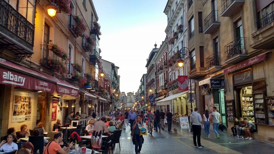
The road leading to Leon’s Cathedral, Calle Mariano Dominguez Berrueta
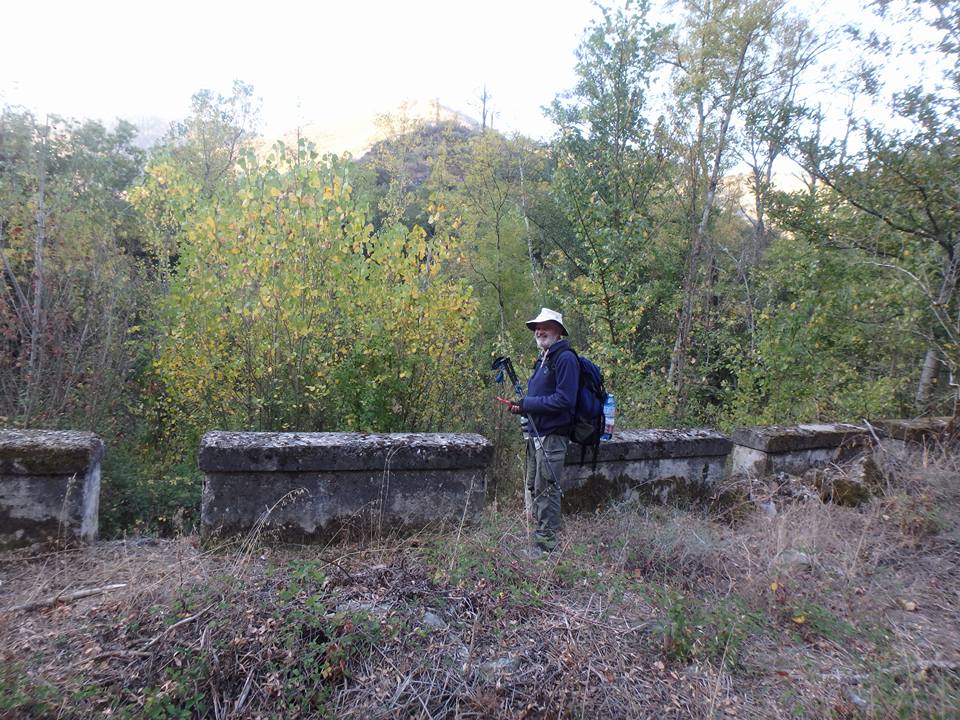
October 6 Puente Villarente Day 22. 26 Kms. El Burgo Ranero – Reliegos – Mansilla de las Mulas – Puente Villarente. Another 0630 start with a beautiful full moon to guide us till daybreak at about 0800. Sunrise didn’t happen till 0830. Then it was a bit of a hot, mind numbing trudge beside the N – 601 to here at 1330. This town is the typical outer reach of a major city: two bars and a funeral home. 😂 The municipal albergue was lovely. A beautiful lawned courtyard with washing and drying facilities plus lounge chairs to enjoy cevezas. Leo, Ria, Kirsty, Jane and I made new friends during the wonderful pilgrims’ meal that night.
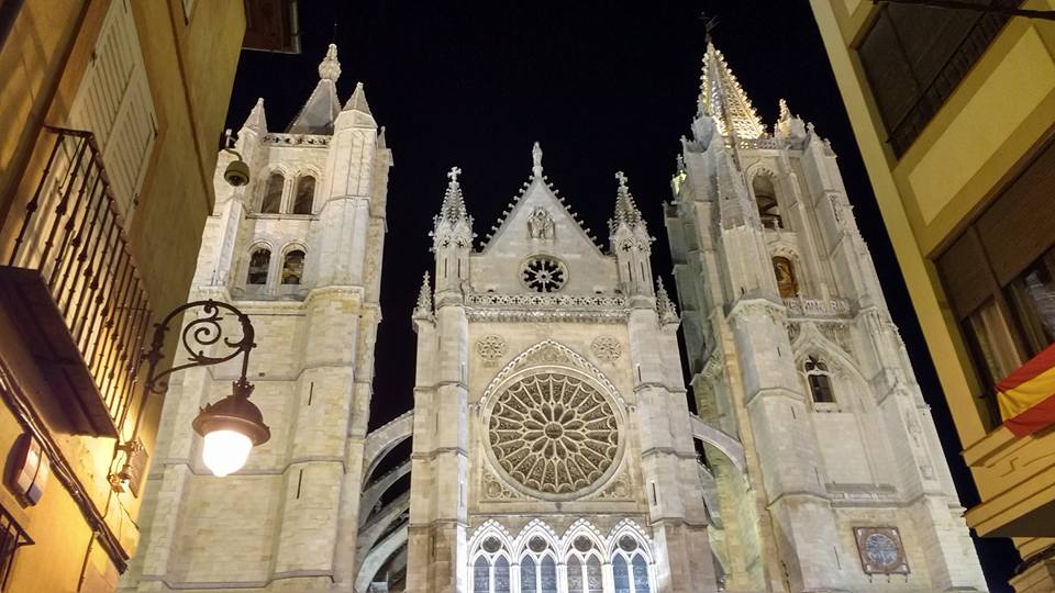
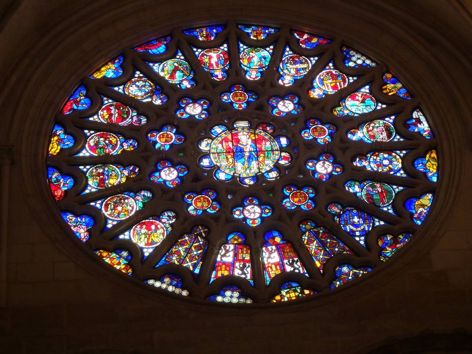
Santa María de León Catedral
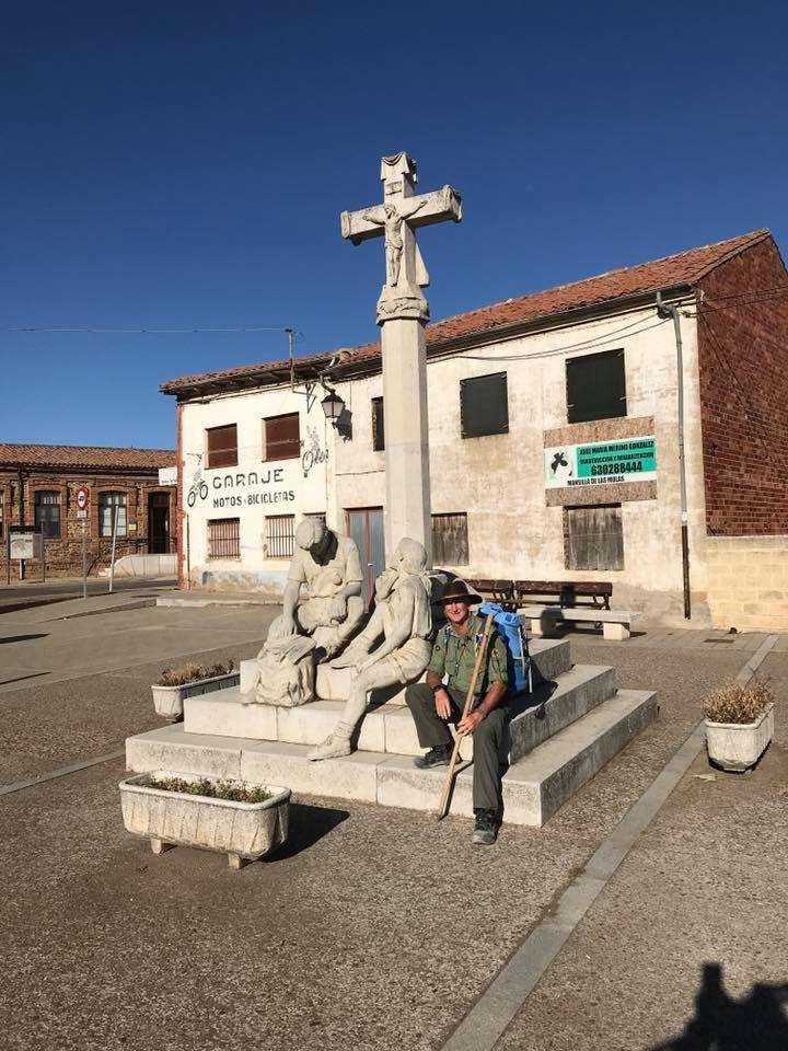
October 7 Leon Day 23. 16 Kms. Puente Villarente – Leon. We had this idea that we would pass through Leon and check it out on the way through but we decided to stay and checked in to an albergue just off the Plaza de Regla next to the cathedral. We did the touristy things then, that night, the town exploded in a fiesta. Jane and Kirsty decided to spend an extra day here. We left the fiesta at about 2200 but it was still going strong @ 0400 the next morning. Conveniently located albergues are not always the best choice.
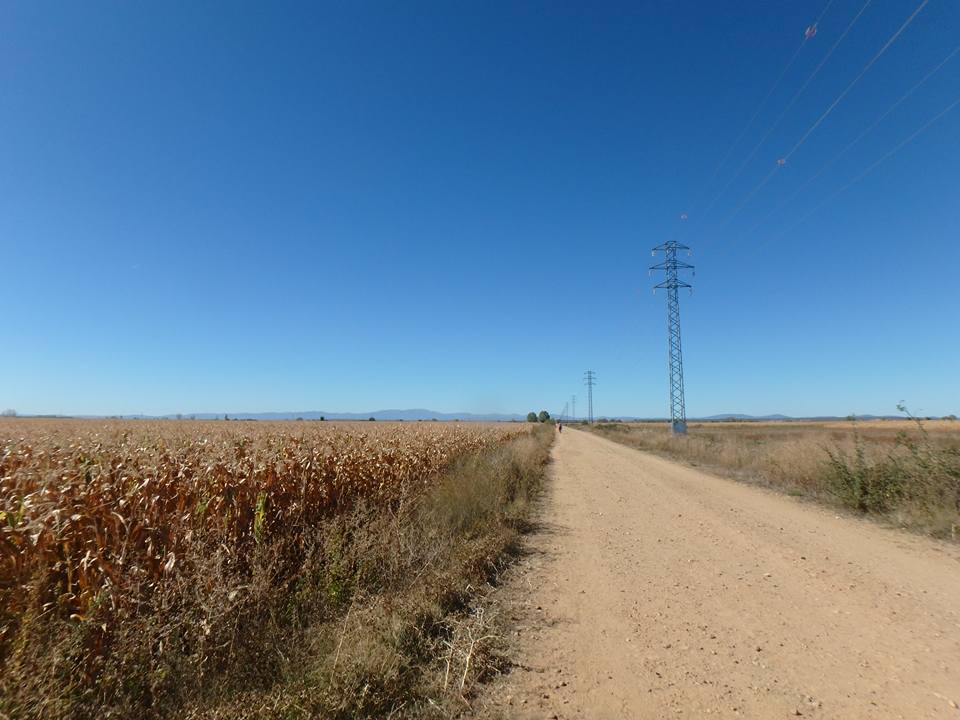
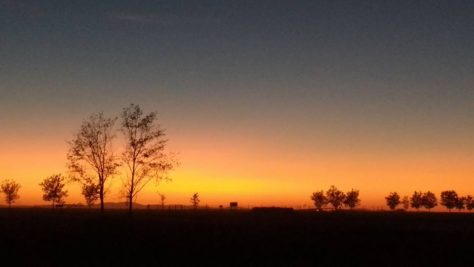
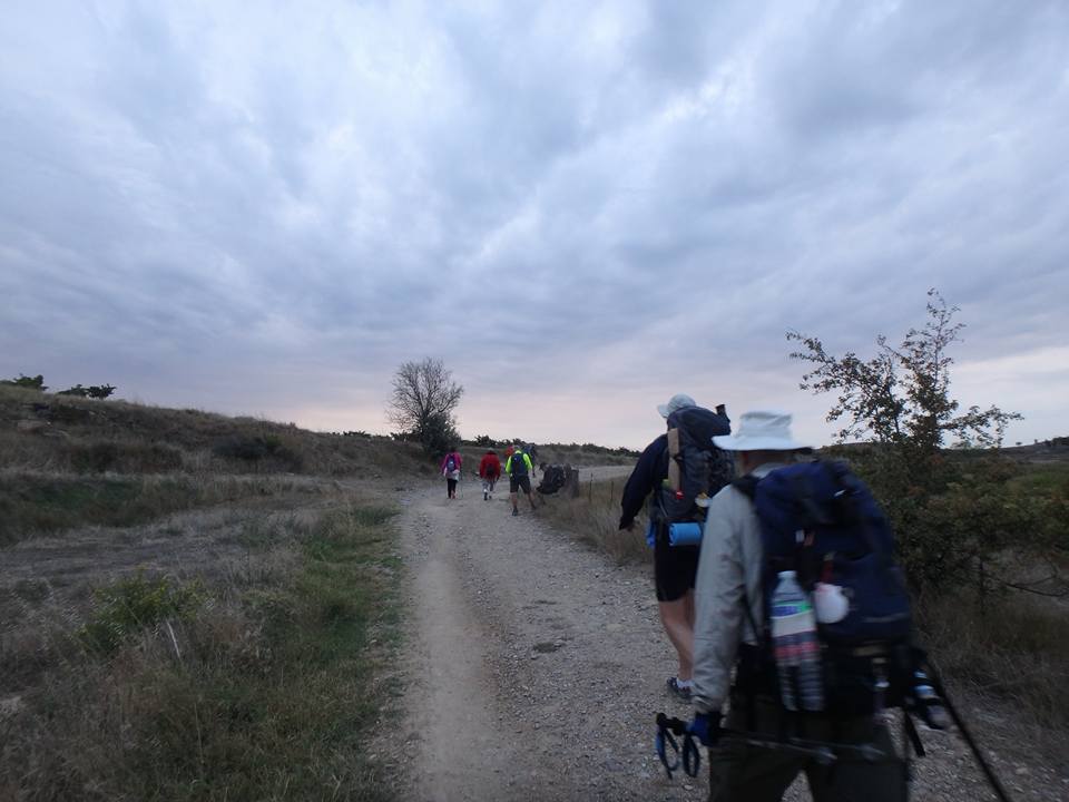
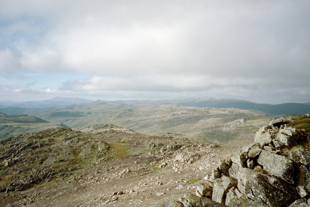
Mesita Central, great interior mesita (plateau) of the Iberian Peninsula, central Spain heading to Villavante
October 8 Villavante Day 24. 32 Kms. Leon – La Virgen del Camino – Fresno del Camino – Villar de Mazarife – Villavante. We left @ 0630 while the cleaners were fire hosing out the plazas from the night before in preparation for the night to come and had a very hot walk across the Paramos to here passing numerous canals and rios. We arrived at 1430 ready for a shower. p.s. the Sierra de Ancares are getting closer. We start climbing after Astorga tomorrow.
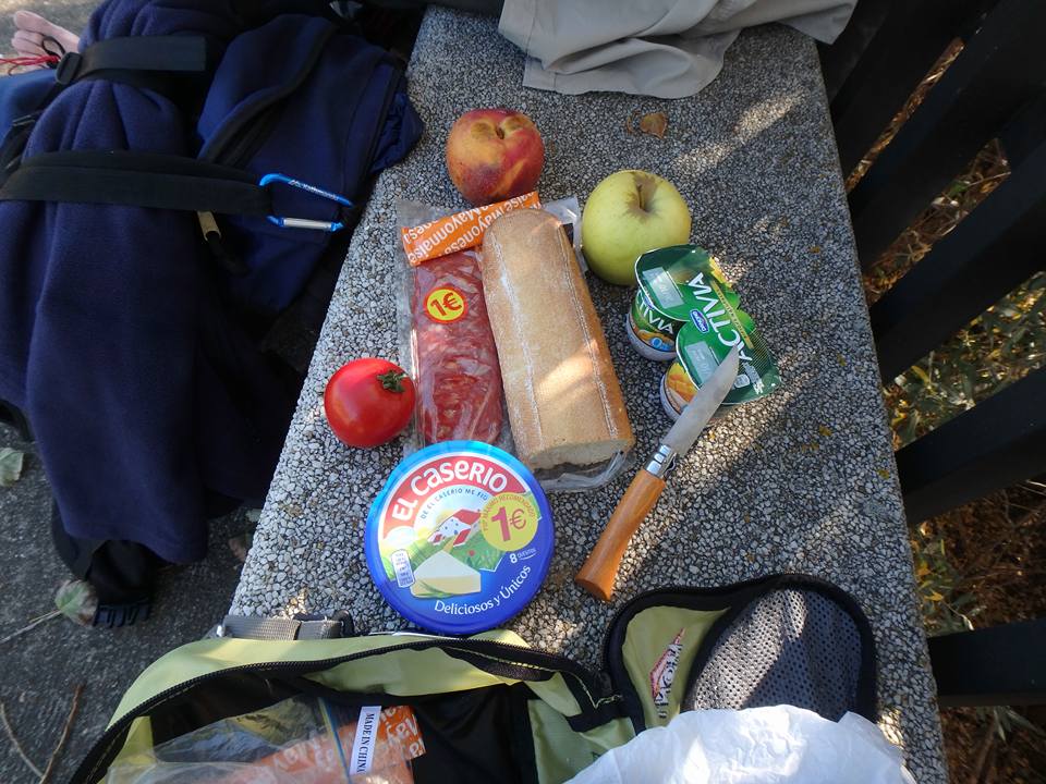
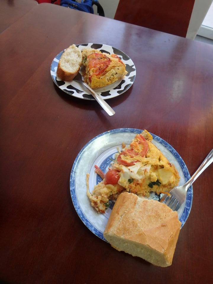
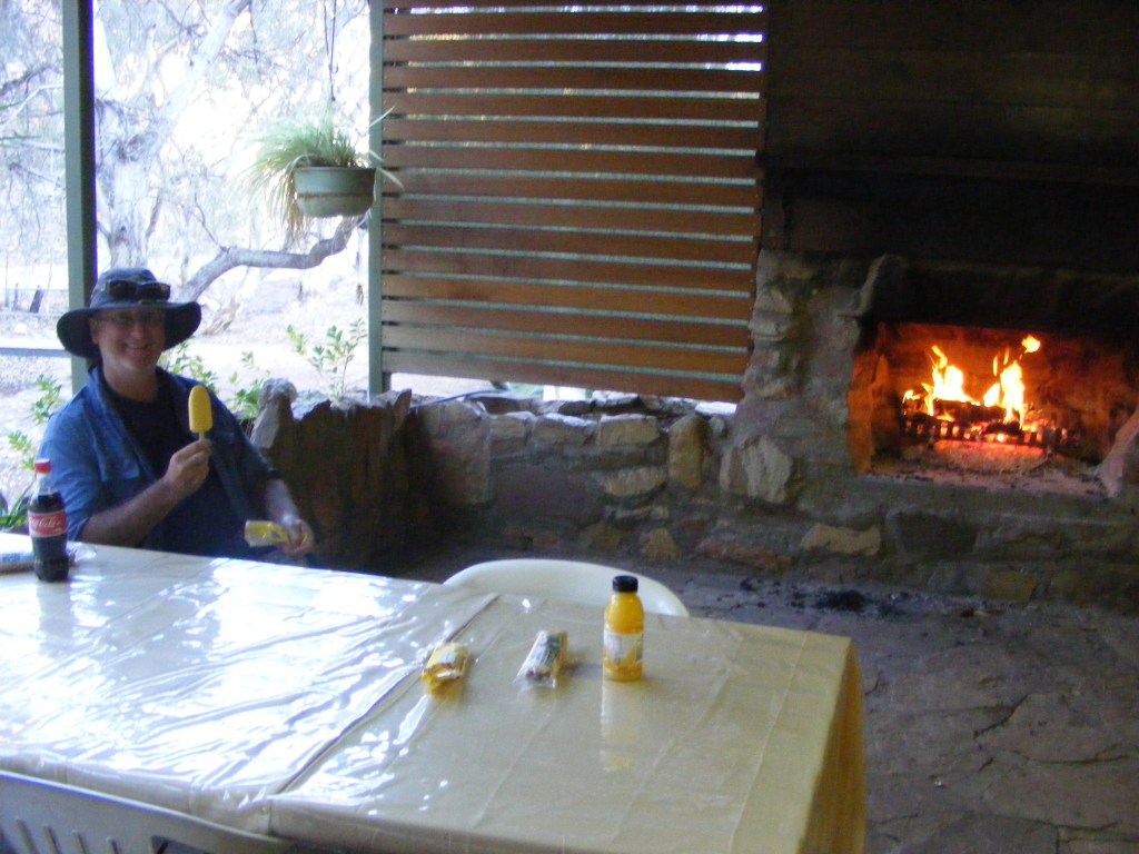
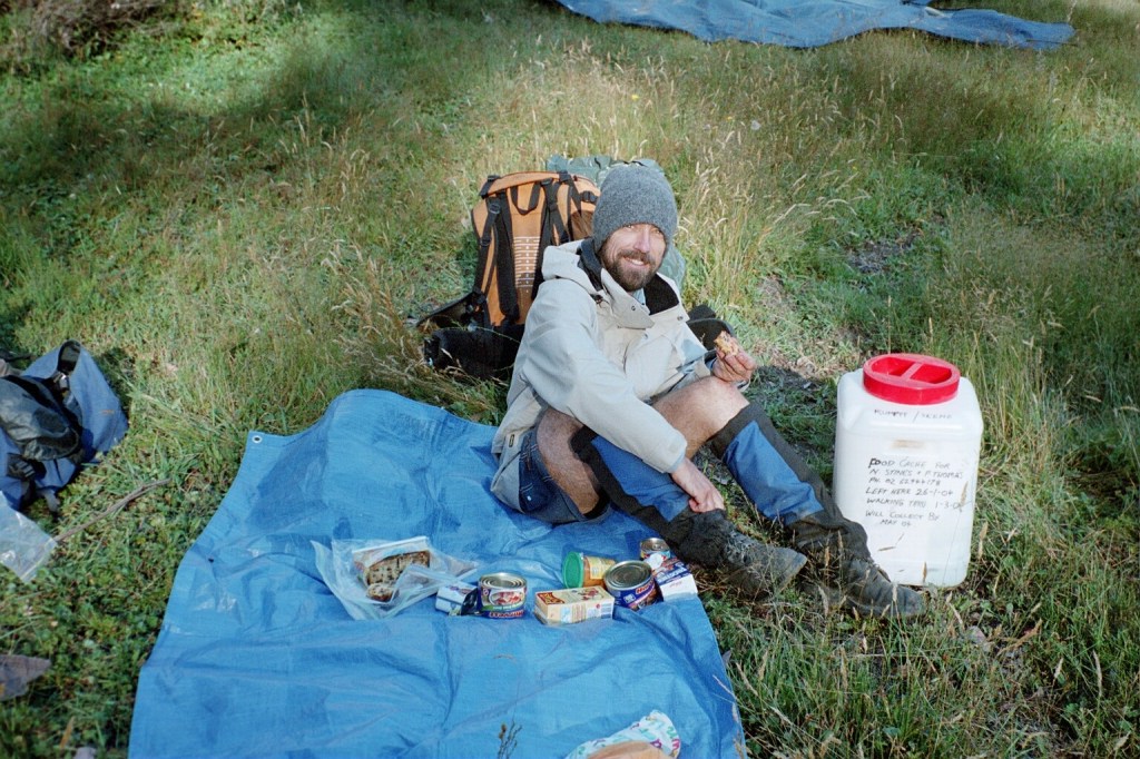
Lunch
October 9 Murias de Rechivaldo Day 25. 29 Kms. Villavante – Hospital de Orbigo – Villares de Orbigo- Astorga – Murias de Rechivaldo. We wandered in to Hospital de Orbigo just on daybreak. The bridge in to the town overlooks a jousting field. Seriously. Knights, armour, horses and lances. It’s still a “sport” here. We crossed the bridge to a cafe and had cafe americano y croissants for breakfast. As we were leaving an American lady stopped us and asked us if we were the two Australian scouts she had heard about. We admitted guilt and she said that she was an American Girl Scout Leader (read Guides) and said that Sonny said to say hello. Sonny we walked with about a week ago. Now, Sonny was about twenty kilometres ahead of us and this lady had just caught up with us to pass on Sonny’s greeting. Go figure. Anyway, a lovely stroll through the countryside. Astorga is a wonderful town but it was the weekend and overrun. This is getting to be our standard lunch (pictured) which costs about €1.75 each a day.
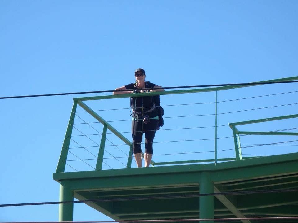
Erica Bruen. One of nuestr familia de senderos (our trails family). On our way to Astorga
October 10 Foncebadon Day 26. 21 Kms. Murias de Rechivaldo – Santa Catalina de Somoza – Rabanal del Camino – Foncebadon. A long steady climb up the Sierra de Acares to one of the best albergues we’ve stayed in. It was a real new age/tree huggin’ place with an awesome paella for dinner. Only €7 with breakfast. It’s October and autumn’s here. We have a real international trail family now who all are travelling at the same pace and whom we’ve grown very attached to. We are travelling with Canadians (Elaine, Edith & Lorry), Americans (Charlie, Cody & Meredith), Dutch (Ria), Germans (Claudia), Irish (Jane) and Australians (Kirsty & Erica)
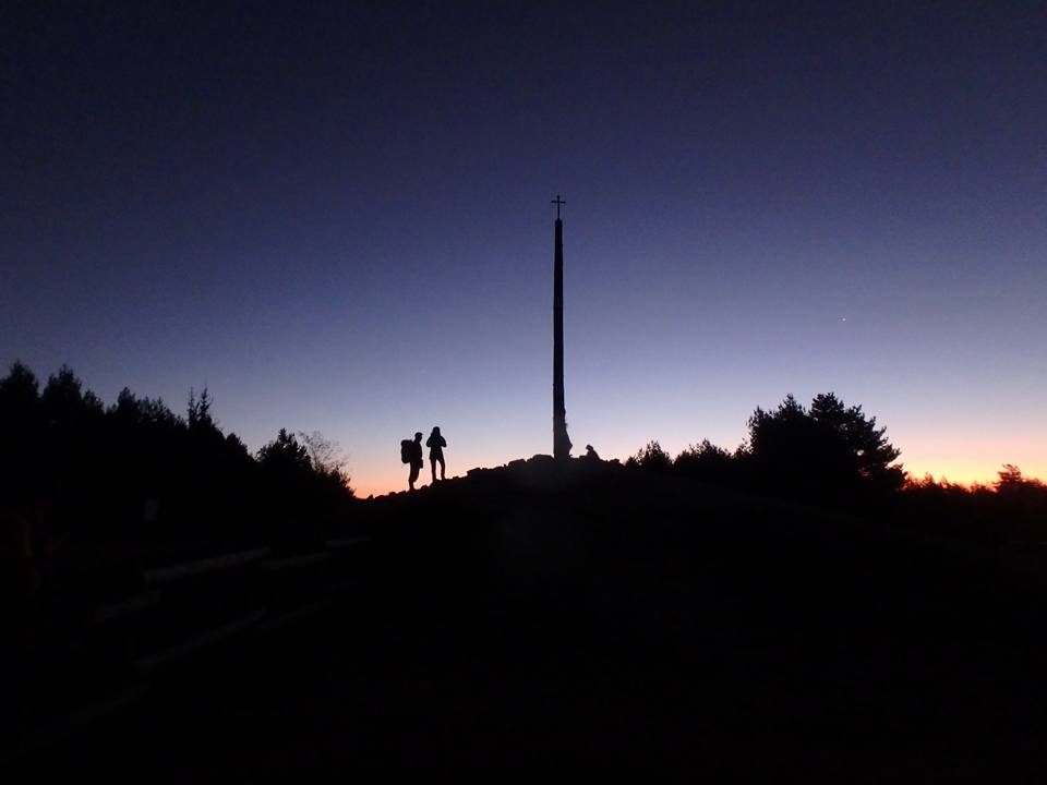
Dawn @ El Cruz de Ferro
October 11 Molinaseca Day 27. 22 Kms. Foncebadon – La Cruz de Ferro – Acebo – Molinaseca. Just for something different (not), we left in the dark and climbed up the sierra to watch dawn at el Cruz de Ferro (the Iron Cross). It really was a spectacular sunrise and definitely worth it. It was, however, a long slow descent down to Molinaseca from 1500 metres to 600 metres.
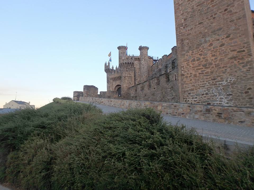
Castillo de los Templarios (Castle of the Templars), Ponferrada, Province of Leon, Spain
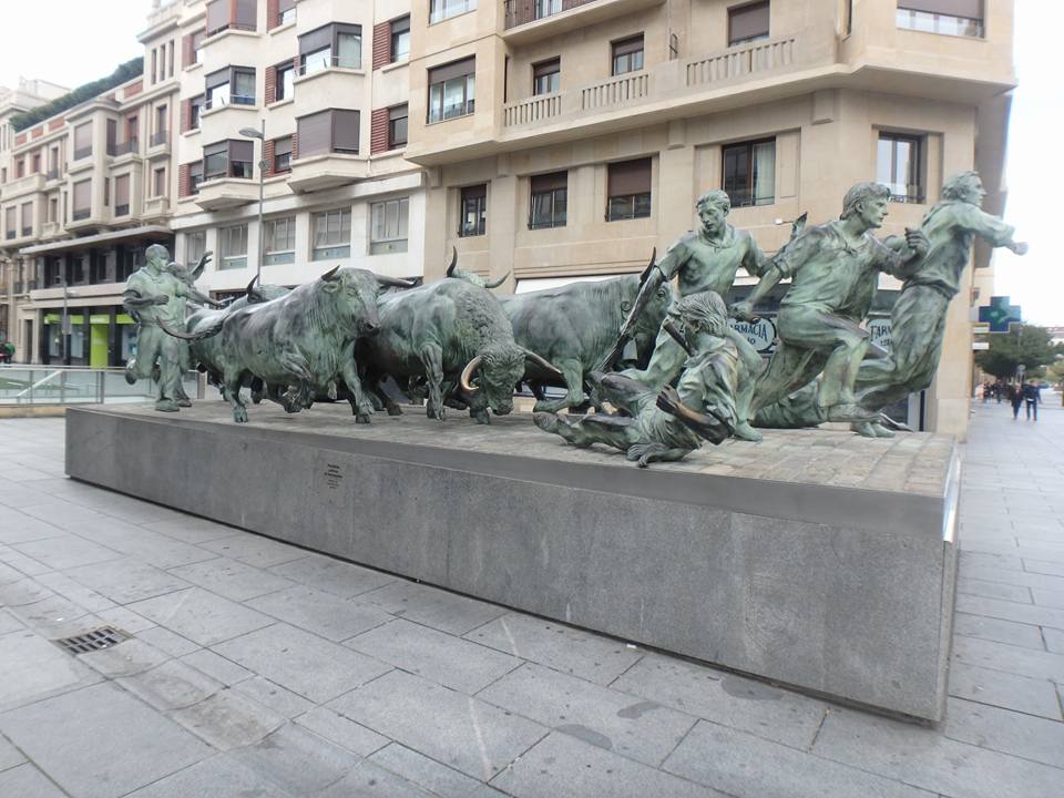
October 12 Cacabelos Day 28. 25 kms. Molinaseca – Ponferrada – Cacabelos. A lovely walk in to Ponferrada for breakfast and then on to Cacabelos. Ponferrada is one of the homes of los Caballeros Templarios (the Knights Templar) and it has the vibe.
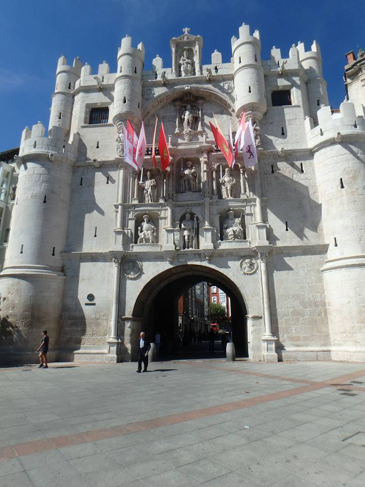
September 29 Burgos Day 15. 0 kms. Burgos. A very lazy day off. We checked out the Museum of Evolution which was fascinating and even had an entire display devoted to Mungo. (http://ia.anu.edu.au/biography/mungo-man-27704) Then we visited Santa Iglesia Catedral Basílica Metropolitana de Santa María de Burgos. It is without a doubt the most spectacular cathedral I have ever seen. However, business hours are 1000 -1400 then 1700 – 2200. There were two framed revolvers in the hostel we stayed at. They are Le Mat pistols (https://en.wikipedia.org/wiki/LeMat_Revolver). Designed in and used by the Confederate rebel states in the American civil war. I’m sure there’s a story behind them.
Kirsty & Leo. Burgos.
September 30. Hontanas Day 16. 34 Kms. Burgos – Tardajos- Hornillos del Camino – Hontanas. Camino Rumours abound. Peregrinos were getting robbed on their way out of Burgos by a balaclava wearing mugger during the morning darkness but when we stopped for cafe Americanos, 10 Ks out, no one had seen anything odd. Rumours run up and down el Caminos grapevine. We met the local neighbourhood watch in Rabe de las Calzadas. They patrol this section of the Camino and get considerable more funding than our guys do. We’re starting to do big Ks. 12 Ks before breakfast and another 10.5 Ks before lunch then 12 Ks here. Welcome to the Spanish Mesitas (plateaus). A long exposed walk across them today and more tomorrow. A dangerous place because, apparently, this is where you stop thinking extrinsically and start thinking intrinsically. It’s where the dark places are. Regrets? I’ve got thousands and, hopefully, I’m going to work my way through them by the end. I’ve always got Vivaldi, Steinman, Heywood and the Eagles to help me if needs be. Hontanas was a surprise as it is in a concealed valley on el Mesitas and we were in the town before we realised it. It was extremely welcomed. Albergue, shower, washing and cervezas. Leo went to the pilgrim’s mass while I was doing the washing and came back with a lovely Dutch woman, Ria. We all had a lovely evening, drank too much vino tinto and Ria instantly became part of our trail family.
El Mesitas
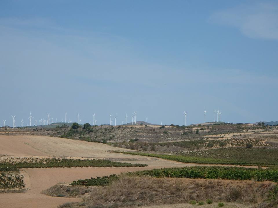
September 30. Itero de la Vega Day 17. 21 Kms. Hontanas – San Anton – Castrojeriz – Itero de la Vega. A lovely stroll up and across more mesitas with some interesting diversions to some medieval churches. Castrojeriz is a lovely town and, oh, look, more wind turbines. A lazy afternoon ahead with some washing and hanging out at the plazas. (Us not the washing) 😂
Hontanas
October 1. Villalcazar de Sirga Day 18. 30 Kms. Itero de la Vega – Fromista – Villovieco – Villacazar de Sirga. We left our digs at 0700 this morning and wandered through the dark for a while until it got light near Poblacion de Campos. Then a very lovely meander along country lanes and followed the Canal de Castilla in to Fromista for mornos and on to here. I found a pair of sunglasses besides the canal on the way to Villovieco and carried them to the town. By the weirdest coincidence in the first group of peregrinas we met was an American woman who had lost them. She was quite vivacious in her thanks and, when we met up again in Villacazar over a couple of vino tintos, quite forward. One thing we have discovered on el Camino is that there is a huge difference between the stated distances on the maps, the guide books, the road signs and the gps. In the great scheme of things, it doesn’t matter. 🤗
El Mesetas on our way to Villalcazar de Sirga
October 2. Ledigos Day 19. 30 Kms. Villalcazar de Sirga – Carrion de los Condes – Ledigos. We had another 0700 start to Carrion then a long, hot haul across the Royal Valley of East Leon to here.
Castrojirez
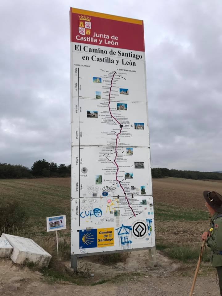
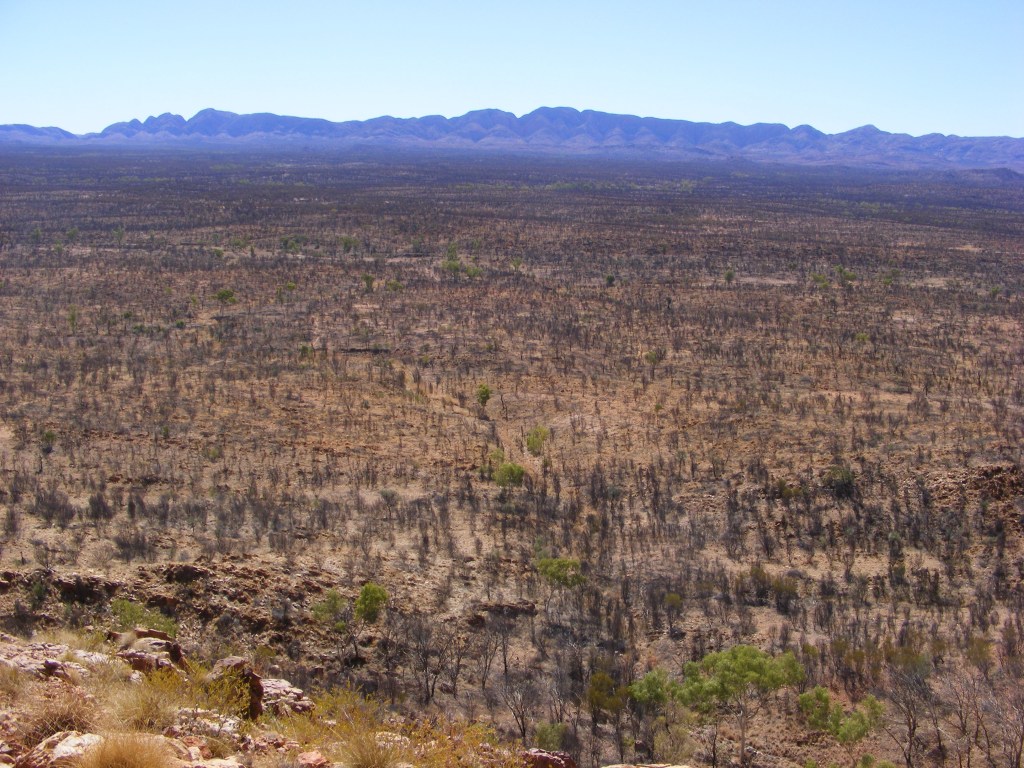
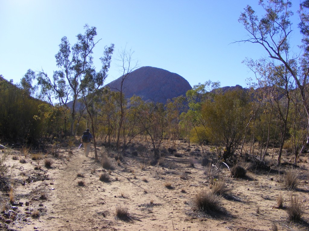
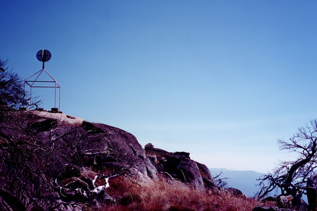
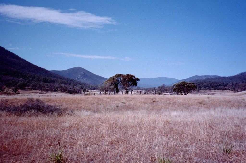
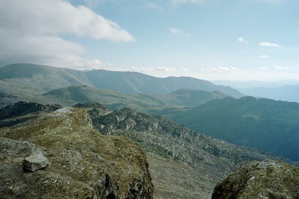
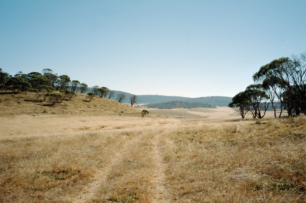
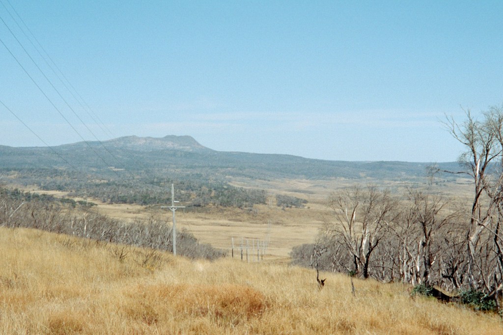
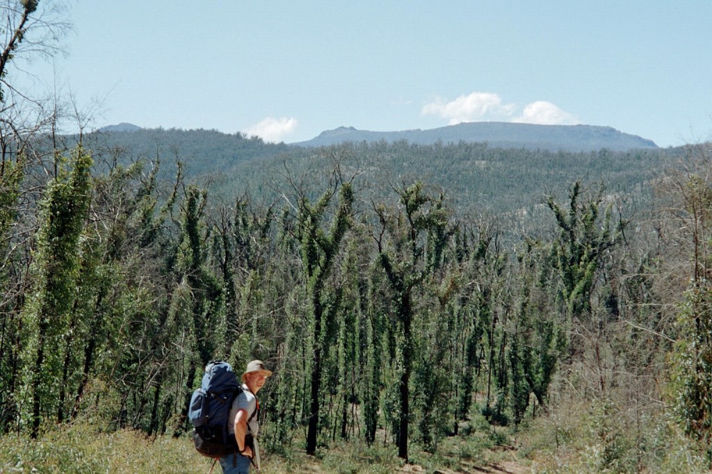
October 3. Sahagun Day 20. 17 Kms. Ledigos – Moratinos – Sahagun. A short day today so we could explore Sahagun. We got here at 1030 after a 0645 start. If you look closely at the main picture you’ll see a mountain range on the horizon. It’s quite a few days away but we’ll have to cross them. Sierra de Acares.
On our way to Sahagun. The half way point on el Camino Frances
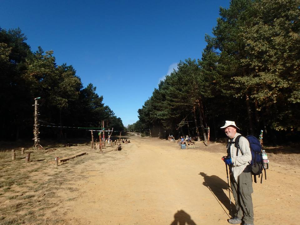
October 5. El Burgo Ranero Day 21. 21 Kms. Sahagun – Calzadilla de los Hermanillos – El Burgo Ranero. We left @ 0630 this morning and left the Camino to follow el Via Romana through forests before rejoining it at El Burgo Ranero. We identified the two Ursers and the North Star before it got light but we had to walk 14 Kms before we could get coffee. We caught up with most of the usual suspects (Cameron, Jane, Kirsty, et al) at our albergue @ 1300.
September 22 Viana Day 8. 18 Kms. Los Arcos – Torres del Rio (no bull & no river) – Viana. We arrived in Viana @ 1230 and decided to take the afternoon off. Another lovely walk, a few Camino pilgrim memorials and enough wind turbines to give Don Quijote a breakdown. Cameron Cossart, a long time friend from Canberra who now lives in Melbourne, wandered in to the albergue while we were having lunch and introduced us to Jane who is walking with Marcus (?), a Serbian so our trail family is starting to form. It’s going to be an afternoon of touristy stuff and catching up. Plus a load of washing.
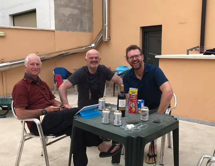
(l – r) Peter Thomas, Leo Farrelly & Cameron Cossart. Albergue Izar, Viana
September 23 Navarrete, La Rioja, Spain Day 9. 27 Km. Viana – Logrono – Navarrete. The endless procession. Apparently there are about 40K pilgrims walking the Camino this month. Cameron decided to stay in Logrono as a wine festival is on this weekend. And, yes, the altar at the Iglesia Santiago Real (16th century) is ALL gold.
Heading for Iglesia Santiago Real, Navarette
September 24 Azofra Day 10. 26Kms. Navarette- Ventosa (b/f – coffee, OJ and ham and omlette roll 😋) – Najera – Azofra. It takes a bit of getting used to setting out @ 0730 when it’s still dark but the walking is really just strolling along a Spanish rural footpath. We do some big Ks but we’re finished by early afternoon which leaves time for other pursuits. Speaking of which, there are hundreds of square kilometres of grape vines here which explains why quite good vino tinto is 3€ a bottle unless you really want to splurge and pay 4€. We had an interesting encounter when we walked in to Azofra. Azofra is a small village with a single road in and out, a plaza mayor, several bars, a mercado and a municipal albergue. As we walked in to town we stopped to say hello to a couple sitting on a doorstep. The woman said, “Oh, thank God, Australians. I haven’t heard an Australian accent for days.” Her name was Kirsty from Melbourne and her American friend was Mike. We introduced ourselves and Kirsty asked where we had walked from. It had been a long hot day and the heat was affecting us so Leo and I were both very foggy. I said that we weren’t sure and she asked us where we had had lunch. Leo said that we weren’t sure about that either. I think Kirsty thought we were having her on as she heatedly said, “You don’t know where you started from and you don’t know where you’ve been?” All I wanted was a shower, a bed somewhere and several cervezas so I said, “We don’t live in the past.” That cracked the ice. She became one of nuestra familia sendero muy querido, our much loved trail family.
Albergue @ AzofraThe courtyard @ Albergue Azofra
September 25 Granon Day 11. 24 Kms. Azofra – Ciruena – Santo Domingo de la Calzada – Granon. We left our albergue in the dark at about 0700 and wandered through dark country lanes making it up as we went along. We still had some serious NFI on how the Caminos worked. We just blindly followed the yellow arrows. Sunrises are marked by criss crossing contrails glowing. Ciruena was quite surreal. We stopped at the golf course for café americanos con tortillas in a very up market dining room. Afterwards we followed the yellow arrows through the town. It was very modern with quite new houses but they all had “se verde” signs (For Sale) and nobody around. It turns out the town was built as a golf resort then the GFC hit and nothing happened. It’s a very modern ghost town. We’re just going to cross in to Castille after meandering through La Riorja.
Crossing in to Castille y Leon @ Tosantos
September 26 Villambistia, Castilla y Leon Day 12. 24 Kms. Granon – Belorado – Villambistia. We had another day of rolling Spanish countryside and we find we’re averaging 4 – 5 km/h now so our 20 km+/day schedule is done just after lunch. The downside is sore feet but a shower and a lazy afternoon fix them.
Leo crossing el Alto Pedrada
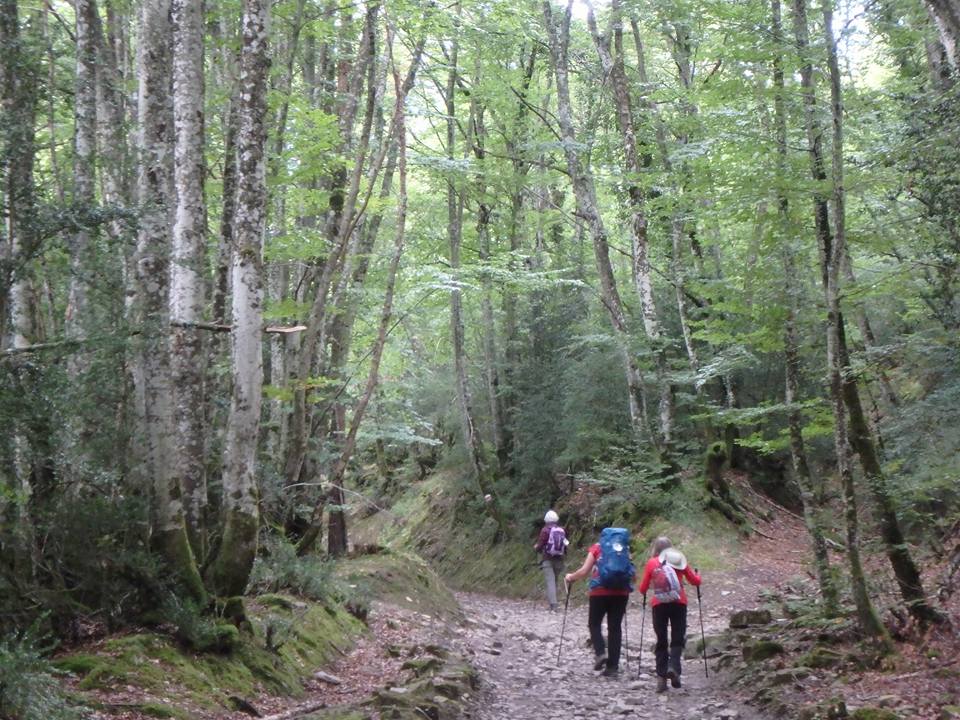
September 26 Atapuerca, Province of Burgos Day 13. 25 Kms. Villambistia – San Juan de Ortega – Atapuerca. We climbed up and across the Alto Pedraja (1120 m.) through gorgeous oak, spruce and pine forests before descending down. We seem to have become part of a very friendly multicultural group which is travelling much the same distances each day. Australians, Americans, Canadians, Irish and Germans. It’s nice to stop at a café and be welcomed by lots of hellos. 🙄
Burgos
September 28 Burgos Day 14. 20 Kms. Atapuerca – Villaval – Castanares – Burgos. We left our albergue @ 0715 and climbed the Alto to 1050 m. in the dark to a spectacular sunrise with silhouetted wind turbines. When it got light we discovered we had bordered a military training area. Spanish omelettes for breakfast then on to Burgos for two nights. And to celebrate Leo’s birthday with a dinner with the current usual suspects. Kirsty, Jane and Cameron.
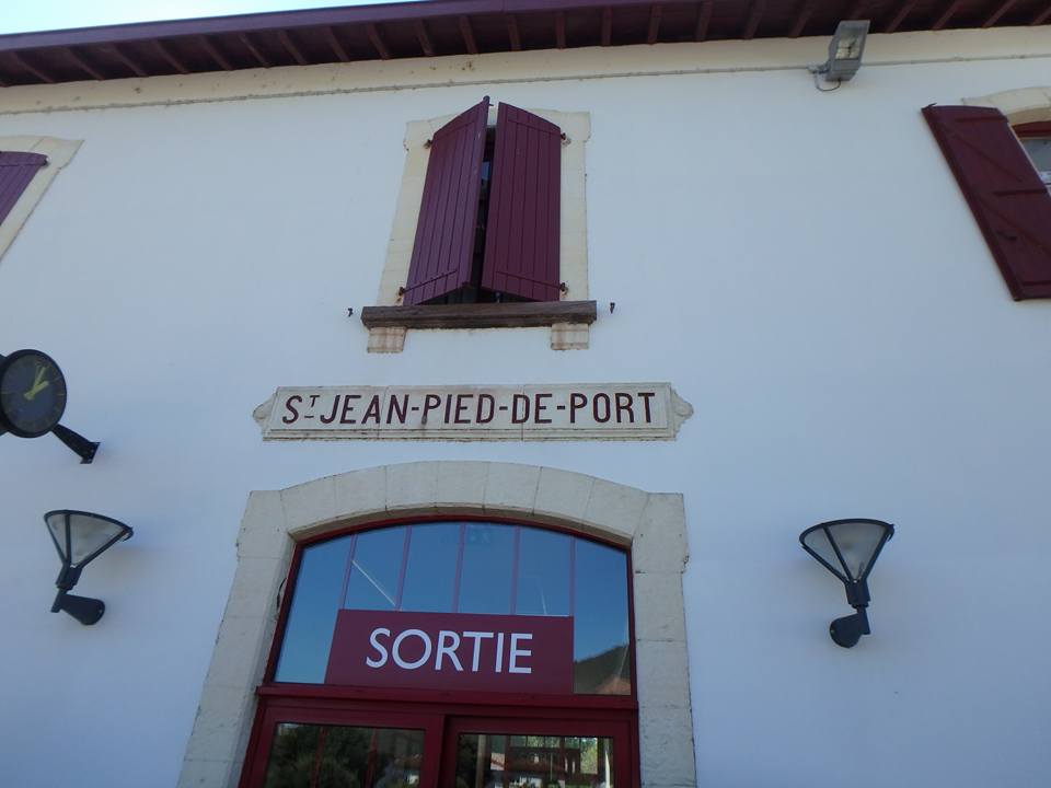
September 14. St. Jean Pied de Port, France …and so it begins. After a fantastic trip on the TGV from Paris, we registered and got our peregrinos’ passports stamped at the pilgrims’ office. Then we booked in to a very interesting albergue. (Red Cross packages on Thursdays, escape committee meets @ 2130). It was a private one and had we known better, we should have looked around the town for an official one. We decided to head off for Roncesvalles the next day (27Ks) as the albergue at Orrisson is booked out.
Leo on our crossing of the Pyrenees 15th September 2017
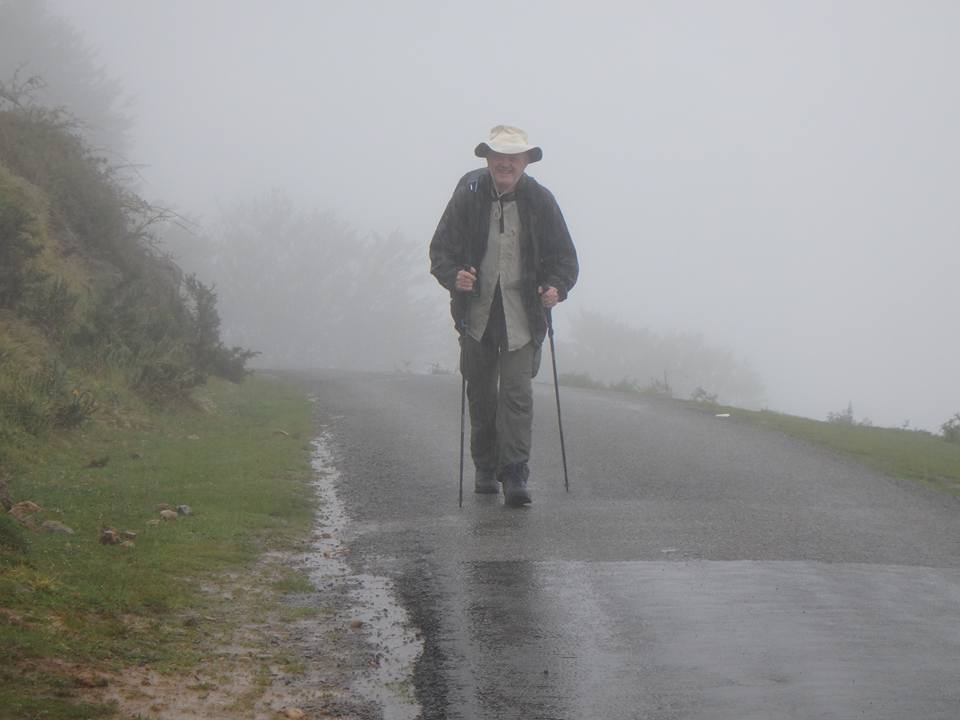
September 15. St. Jean Pied de Port – Orrison – Roncesvalles, Navarre, Spain Day 2. Definitely our hardest day yet. (Yes, I know. 🙏 ) It was raining, windy, freezing cold and the visibility was down to 20 metres occasionally. We walked 27 km, climbed 1200 metres and descended 425 metres. On the plus side, Leo and I crossed the Pyrenees from France to Spain in one day on foot so we’re feeling pretty chuffed. Exhausted and sore but chuffed. Leo took a bad tumble on the way down from the border and we just wanted some rest. The hospitaleros in Roncevalles are from a Dutch pilgrim’s association and were incredibly welcoming in to the huge monastery converted in to an Albergue (pilgrims hostel) . It was almost dark when we arrived and we were allocated bunks in the overflow in the basement. We laid out our beds, showered, washed our clothes, hung them out and chatted with our fellow walkers. This was the beginning of a routine which we would follow every day. Domestics first then socialising. Curfew was at 10 pm and we were allocated the 8 pm pilgrims meal at the nearby restaurant. There were a few too many vino tintos over dinner before we realised it was 10.30 so we rushed back and got some knowing winks from the hospitalero on the front desk.
On our way to Zubiri 16th September 2017
September 16 Zubiri, Navarre Day 3. A lovely 23 kms today through forests. It was a much easier day although somewhat challenging . Zubiri has a bridge known as el Puente de la Rabia (the Rabies Bridge) Legend has it that if you took any animal three times around the arch, it would be cured of rabies. We were booked in to the municipal albergue by a woman who definitely needed another vocation. She was rude, brusque and didn’t want anything to do with peregrinos. Definitely not the job for her. Our bunk room was full and a lot of siestas were in progress so we did our routine and went looking for a bar.
On our way to Pamplona 17th September 2017
September 17 Pamplona, Spain Day 4. We hiked about 28 Ks today. First following the rio Arga down the valley to Pamplona then through the suburbs and city to the old city. We couldn’t find a vacant albergue so we got a hotel across from the Plaza de Torros. Apparently, Jumanji was a bit of a hit in this town.
During our rest day in Pamplona we became touristas for the day. 18th September 2017
September 19 · Uterga Day 5. Pamplona – Uterga. 18kms. After a rest day in Pamplona, Leo & I had a lovely stroll through rural vistas and over the Alto del Perdon where there is a pilgrim’s monument (monumento peregrino). One of the more disconcerting things is the number of trailside memorials to pilgrims who have died doing this. Quite a lot across the Pyranees but more as we continue.
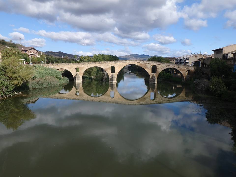
Puente la Reina
September 20 Lorca, Navarre, Spain Day 6. 25 km. Uterga – St Maria Eunate – Puente la Reina – Lorca. Another lovely stroll with some challenging climbs. Puente la Reina (Bridge of the Queen) has a rather ghastly legend attached. (Look it up. Typical medieval Europe) The church of St Maria Eunate was a 5 km detour but it’s part of the original Camino route and was protected by los caballeros templarios, the Knights Templar. The grail wasn’t there 😢. We checked.
Alto del Perdon
September 21 Los Arcos, Navarre, Spain Day 7. 30 Kms. Lorca – Estella – Villamayor de Monjardin – Los Arcos. A beautiful days walk if a tad long. A lot of medieval and Roman ruins, churches and forts. The towns are SO medieval. We stopped and had a wine from the Fuente de Vino (fountain) at the Monasterio Irache.
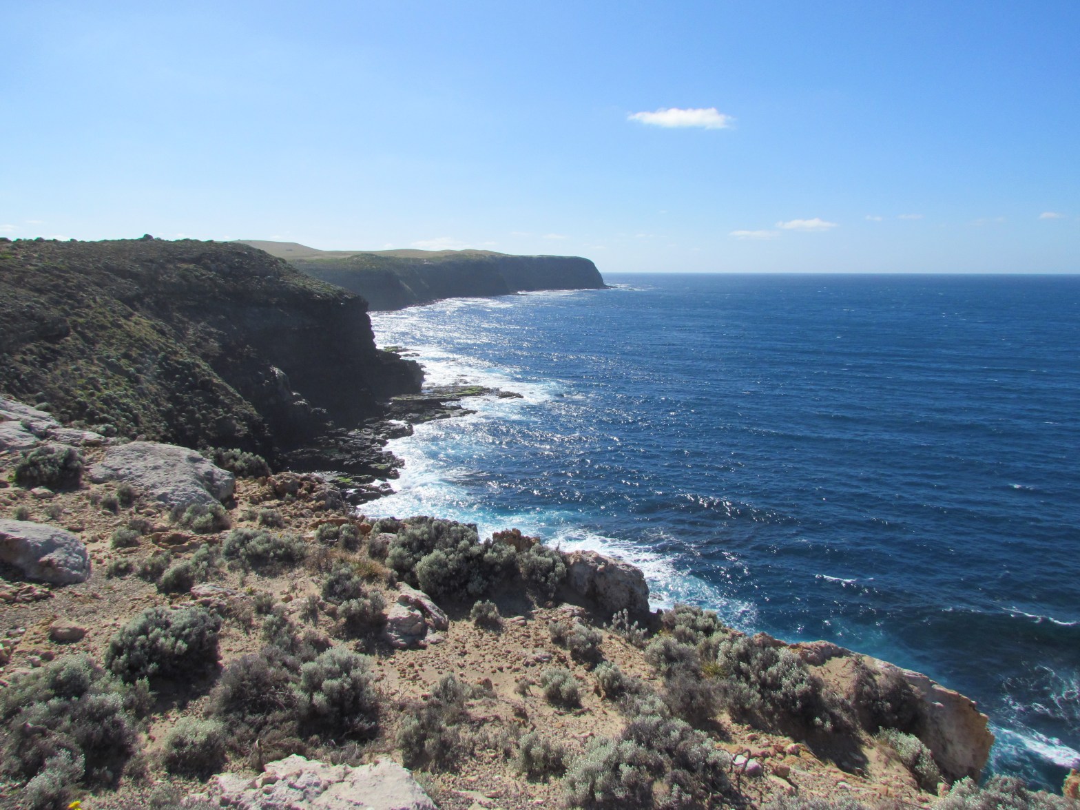
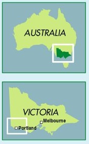
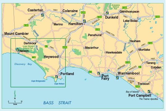
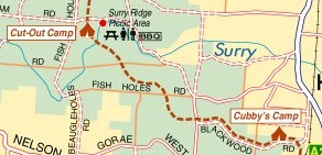
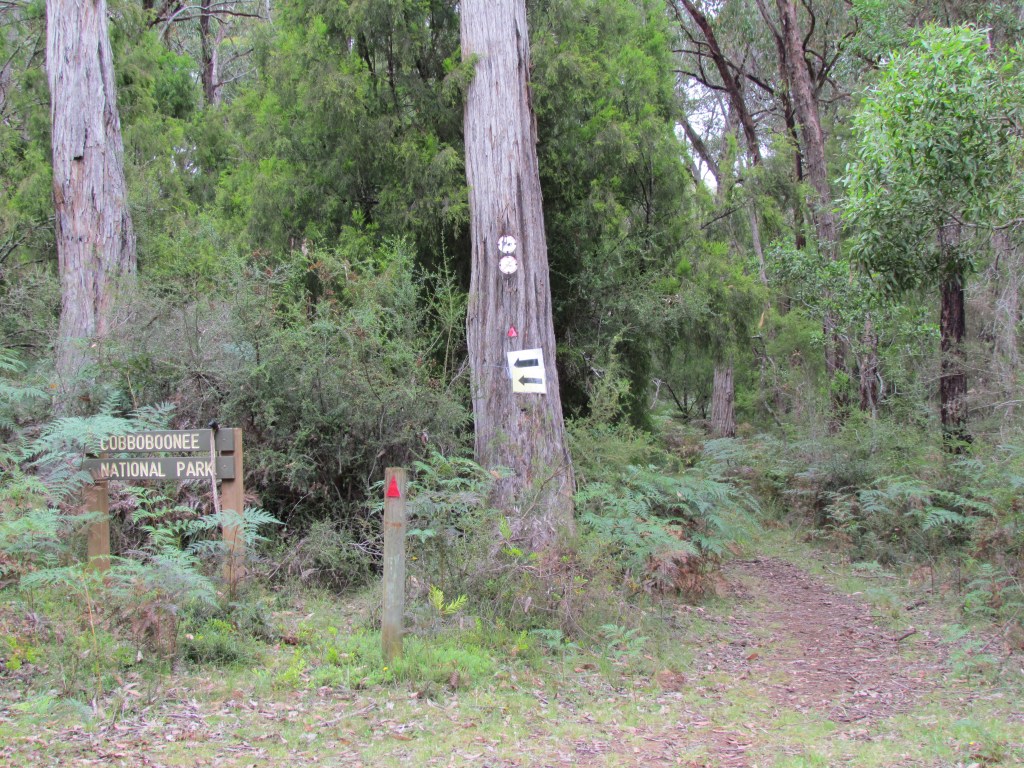
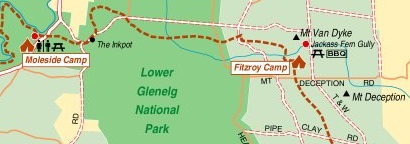
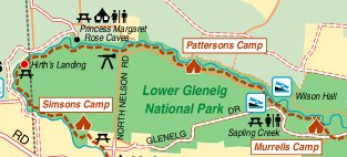
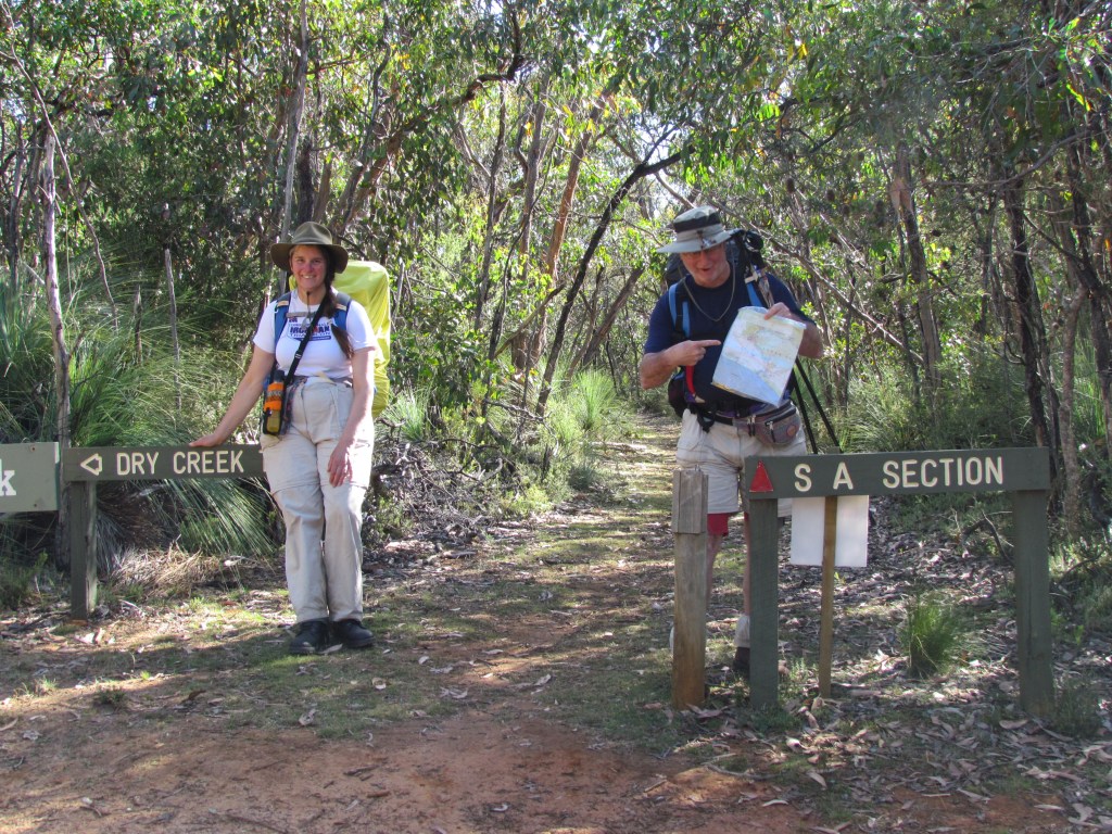
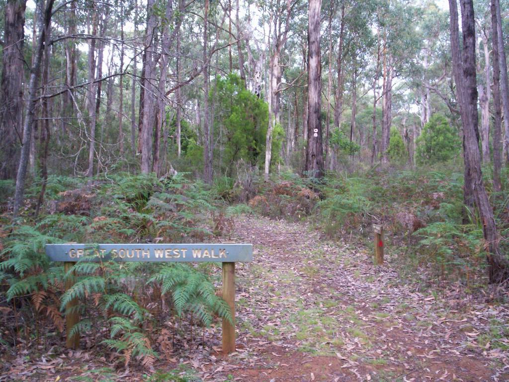
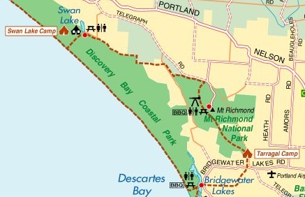
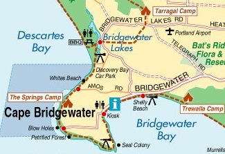
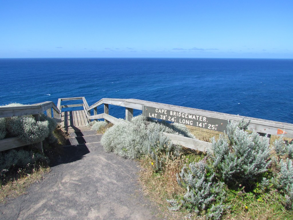
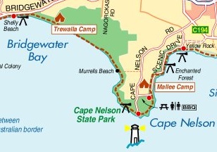
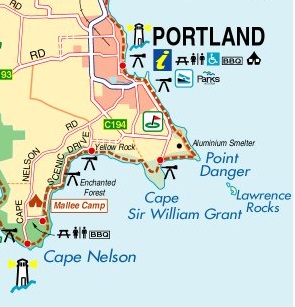
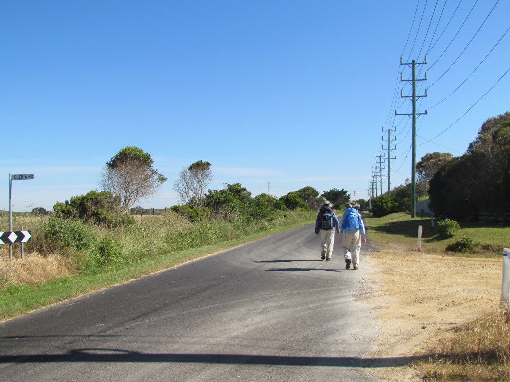
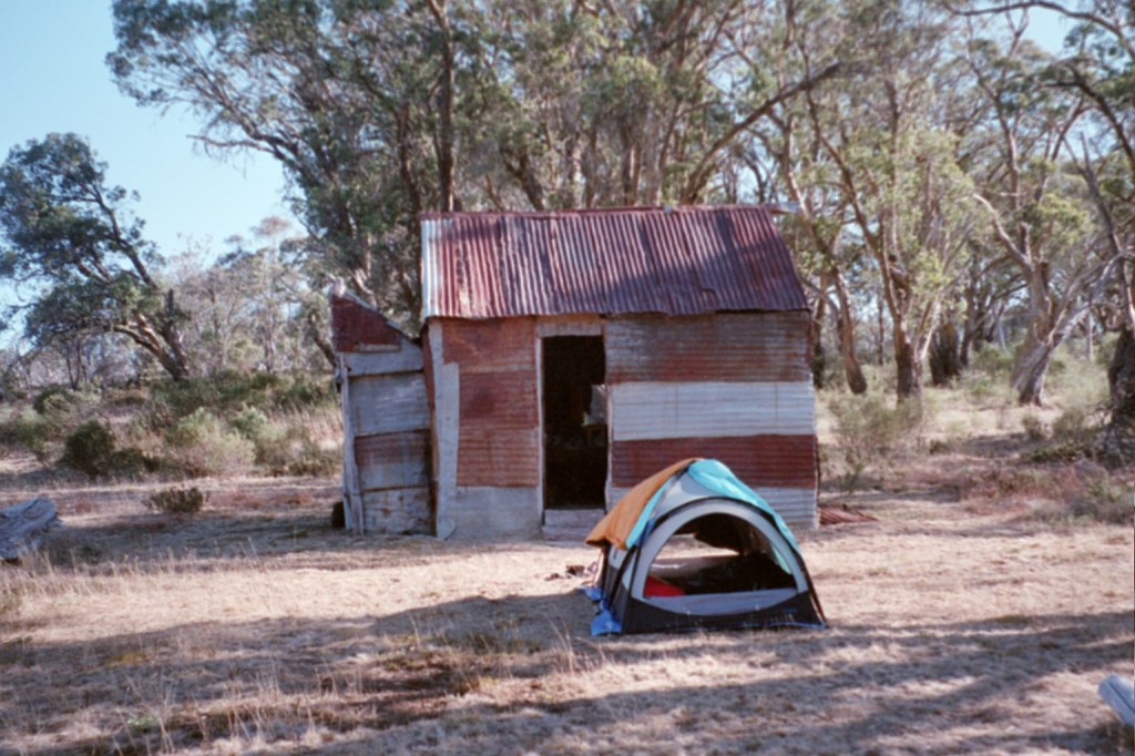
The Great South West Walk is on Victoria’s western coastline and actually crosses in to South Australia briefly. It is divided in to four sections: The Forest from Portland to the Glenelg River at Moleside Camp; The River along the Glenelg River to Nelson; The Beach from Nelson to Cape Bridgewater and; The Cliffs from Cape Bridgewater back to Portland.
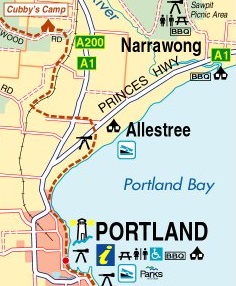
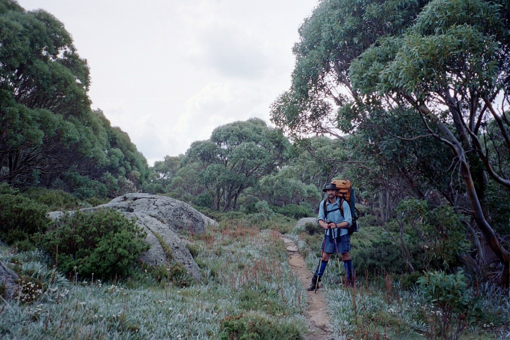
Day 1. Saturday, 26th November, 2011. Portland – Cubbys Camp
On the first day of all long hikes there’s a variety of emotions. There’s Elation because you’re on holidays, the great adventure is starting now and you’re sharing it with people you love. Then there’s Trepidation because all the day to day comforts of home are no longer present and you’re about to walk two-hundred and fifty kilometres through goodness-knows what conditions only protected by your own planning, knowledge and with just the equipment and food on your back. It’s a bit scary really. Probably the most trepidation is your own fear of yourself. Will I make it? Will I still be smiling at the end? Will I be able to be an encouragement or a disappointment when things get rough? And they will. Funnily enough, the next real emotion is a bit like Despair. About two kilometres in to the walk you start thinking things like, “What am I doing this for? I’ve done only two kilometres and there’s two-hundred and forty-eight to go. This is ridiculous!” But it wears off by lunch time and you realise that you’re actually enjoying yourself and having a fairly good time. You marvel that your body can still do this sort of stuff without too many discomforts and you get in to a rhythm so you’re back to elation.
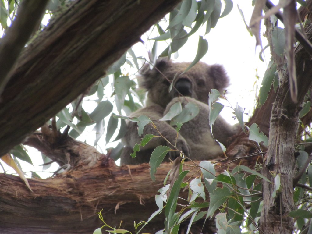
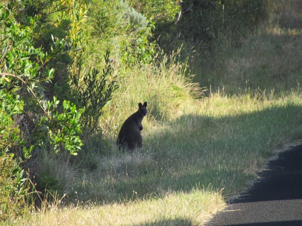
Koala
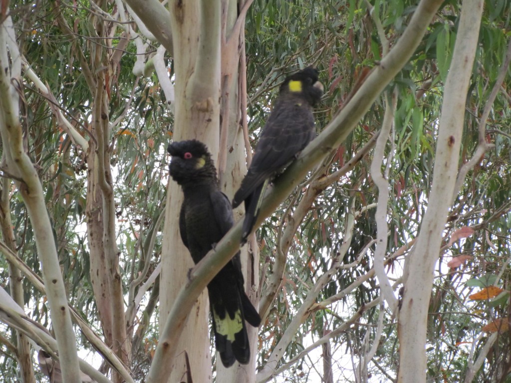
Yellow Tailed Black Cockatoos
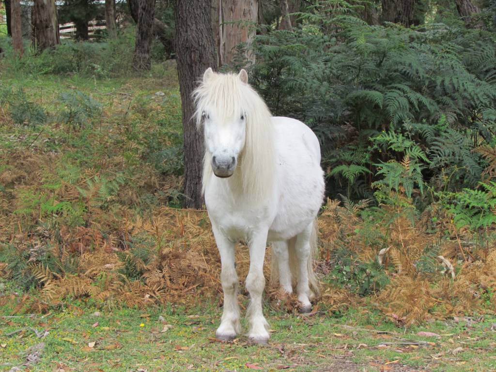
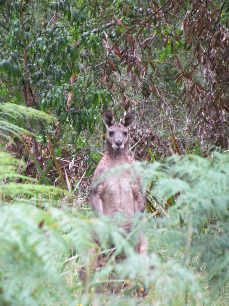
Not sure if it’s wild or not but it’s in the forest on its own.
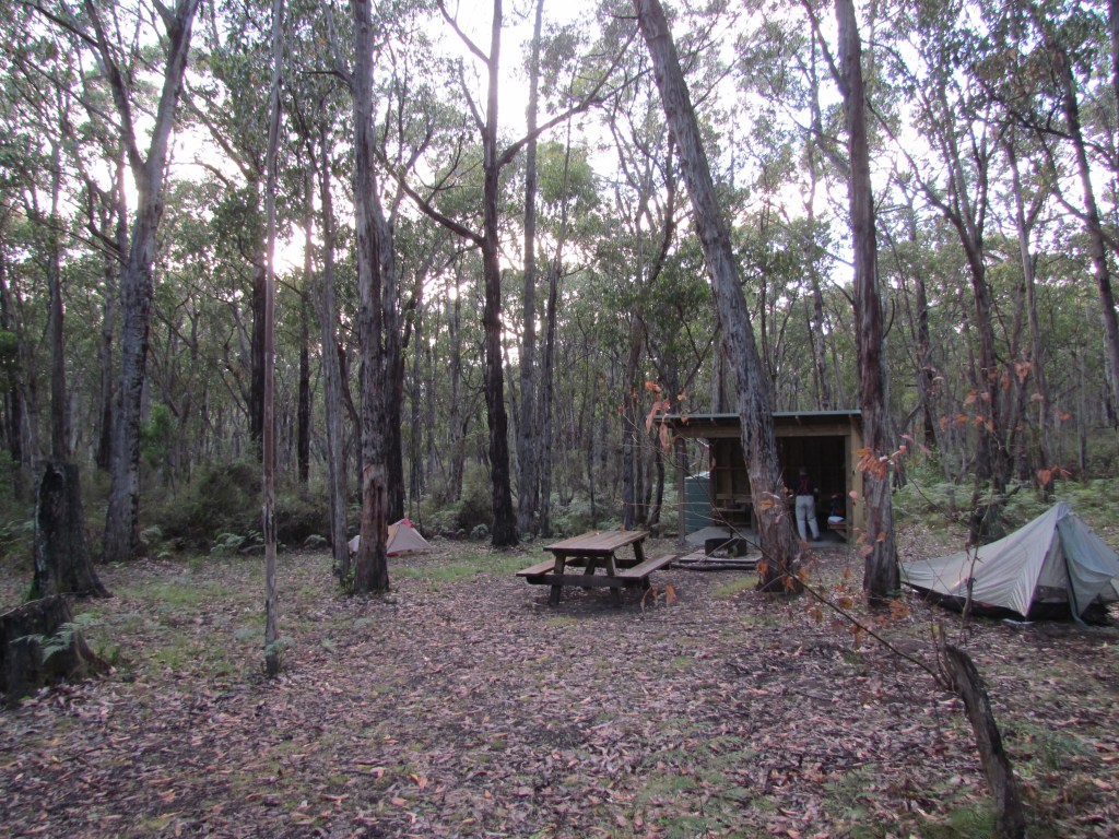
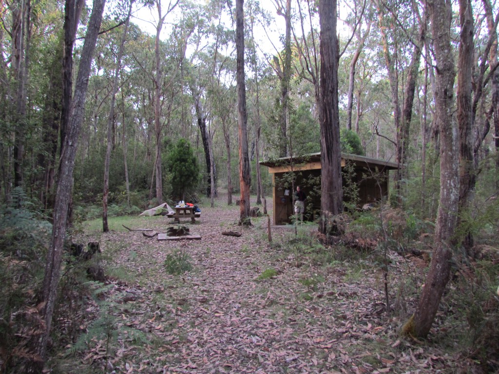
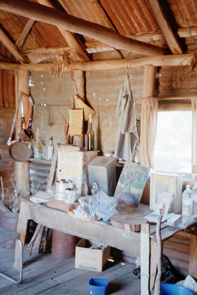
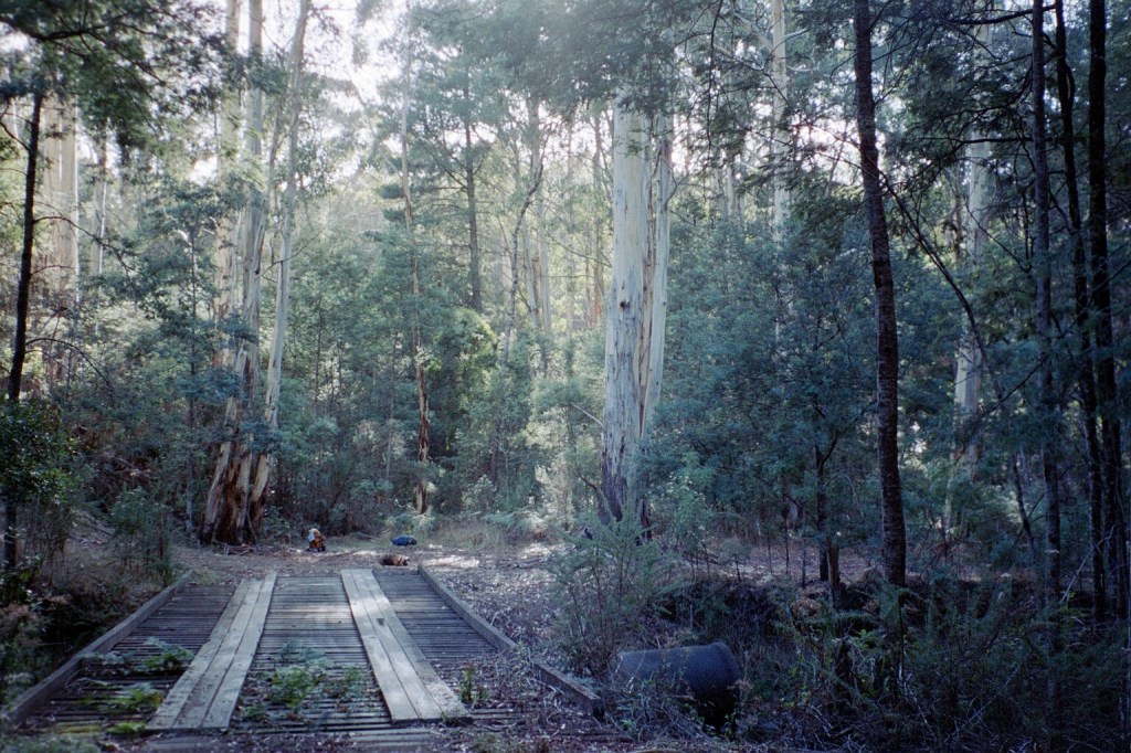
Cubbys Camp
0800 Very overcast day. Parked car at Police Station then walked down to Niv and Lis’ at the Info Centre. Short stroll along beach then climb to Portland suburbia. 1945 – 1995 Party Tower. > Cemetery > down to Breakwater > bitumen country lane. Inquisitive cows. I whistled up a phantom cattle dog which scattered them. Up to Princes Highway. BIGGEST HAZARD ON WALK. Through forest looking for koalas. Niv and Lis’ spotted one. Crossed Portland – Hamilton railroad. Niv and Lis’ again spotted a couple of Koalas before we got there. Humped bluey down the line for about 200 m. Followed track to lunch spot beside paddocks with sheep @ 1230.Sunshine. 1600 arrived Cubbys. Light rain, country road amble. 20 kms. Cups of tea and dinner in shelter.
Well, how was the first day? How did the walking, camping, cooking and clothing bear up? Depending on the weather, usually the excess clothing (leggings, long sleeve shirt, insect net, etc.) gets packed away until it’s actually needed. When do you put your waterproofs on? Well, actually not until there’s a real chance you’re going to get wet from either rain or wet shrubbery and then you think about it. The more stuff you have on, the less freedom of movement you have. And what else can you use what you have for? Waterproofs become a windproof dressing gown over your pyjamas in camp. How is your pack packed? Are the compression straps snug? Can you get to the things you really need quickly and is the really important stuff (sleeping gear) well protected? A reality rule of bushwalking is that not everything can be conveniently packed at the top of your pack. Some stuff just has to be under other stuff. By the time you’ve sorted all that out in your head you’re walking to camp two. It really seems like the first real day on the track because now you’re in to it.
Lisa & I
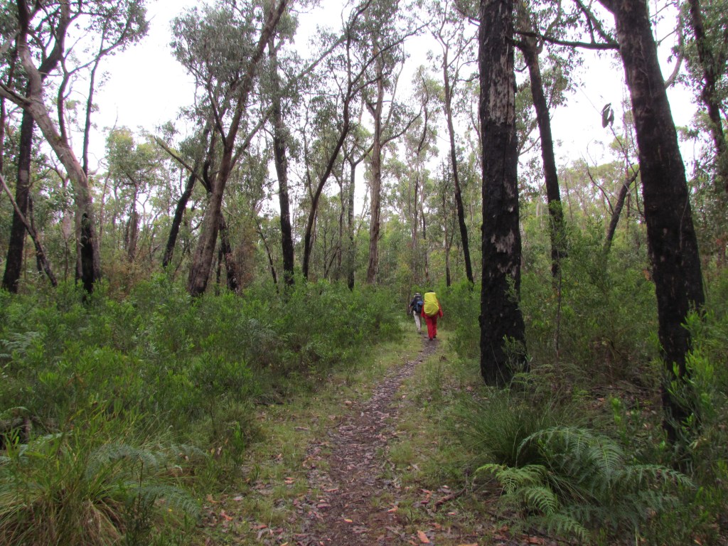
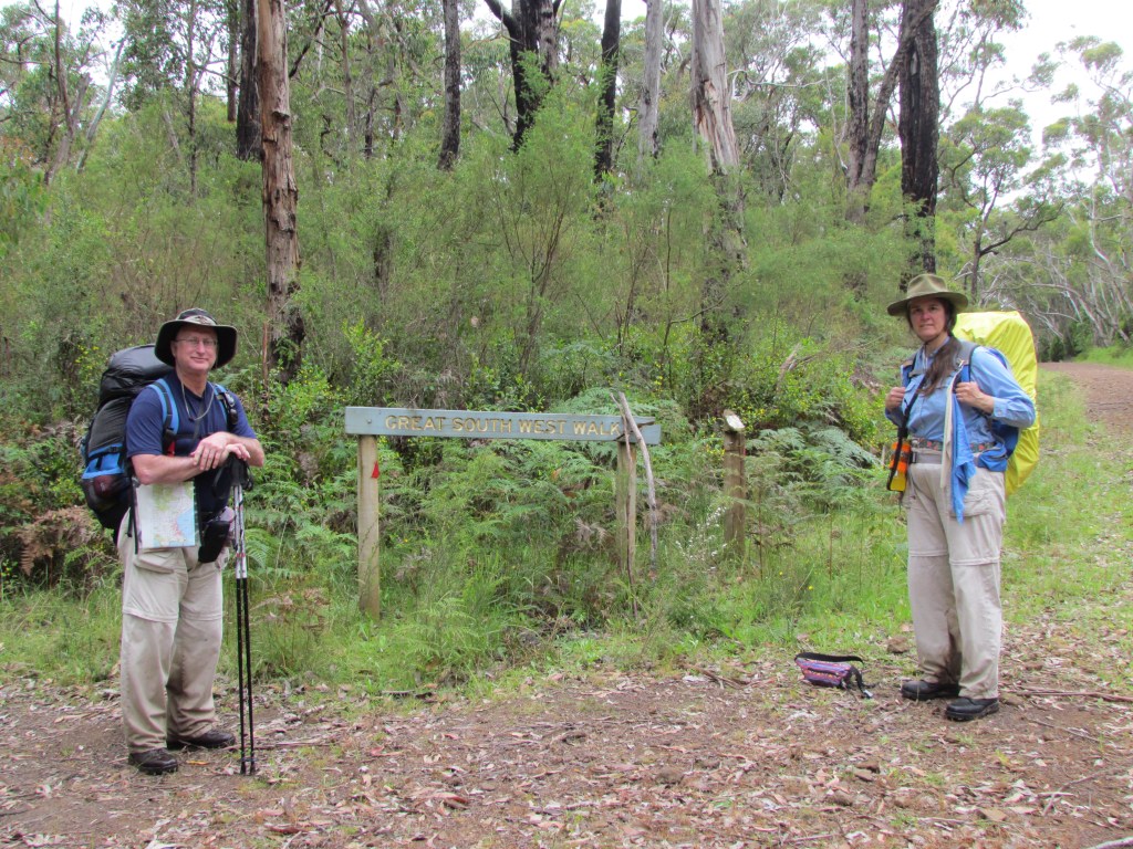
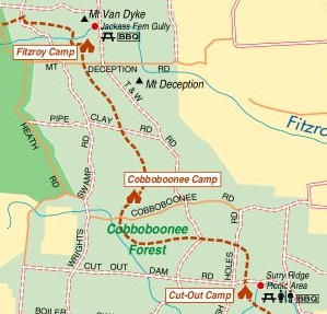
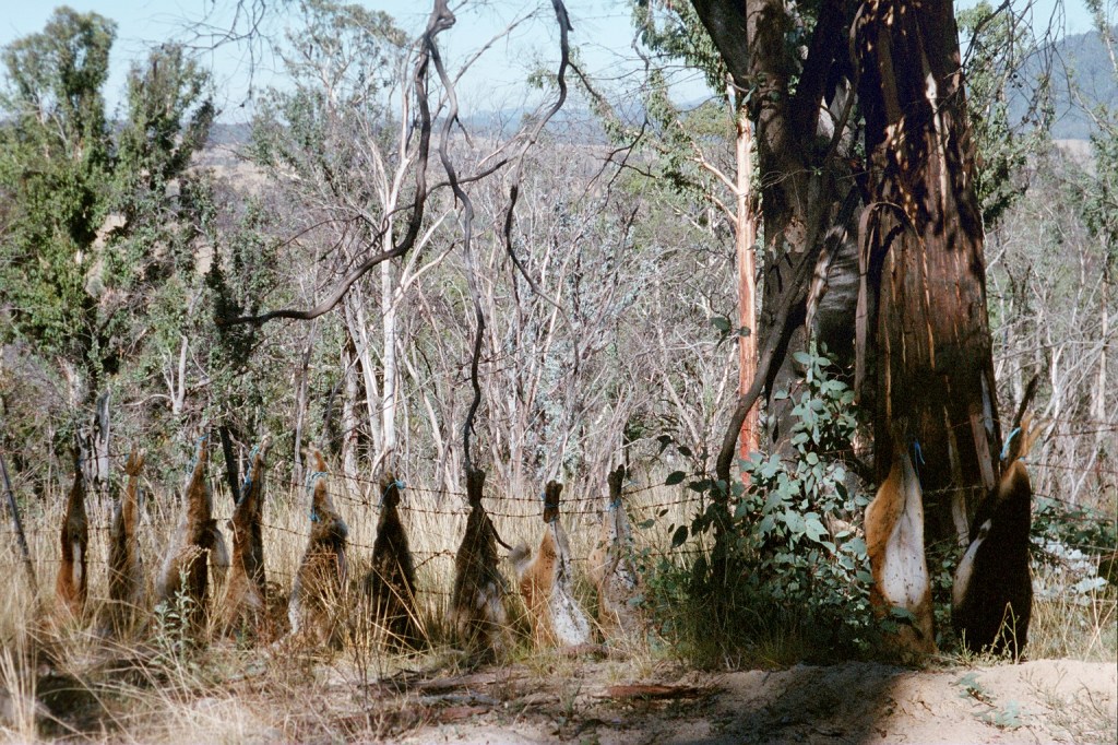
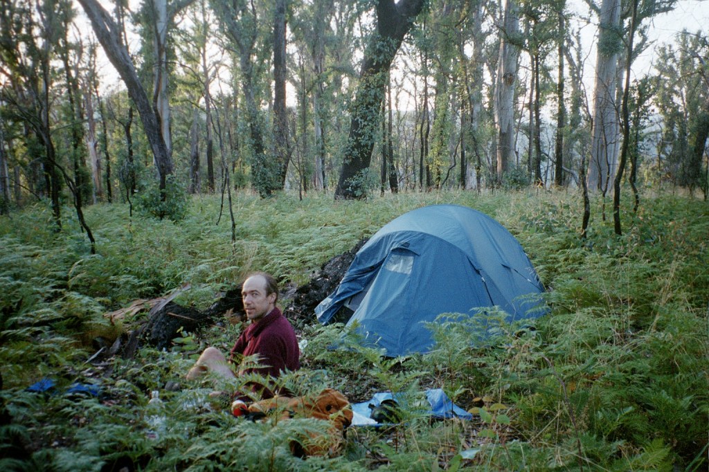
Up @@ 0615. Rained all night. Two shotgun blasts during the night. Tent held out beautifully during rain. I had blood on my pillow, bag, sheet, mat and pyjamas. Found dead leach and bite on neck. The sun shone briefly then overcast again. Hiked through Cobboboonee State Forest. Lunch beside track. Reached Cutout at 1415. Washed, shaved, dried gear. Sunny, relaxing afternoon.
Things hurt on Day Three. Feet, calves, thighs, back, shoulders and lots of things you didn’t realise you had until they started to hurt. It takes about a kilometre to warm up so getting up, packing up and eating breakfast tends to hurt a bit but once you’re in to the rhythm again the pain recedes especially with ibuprofen. Stopping for breaks and lunch also reminds you what’s hurting. By this stage you’ve done most of the damage to your body and it has to start repairing itself as well as building muscles your body realises should be bigger. Protein and sugars are good for this.
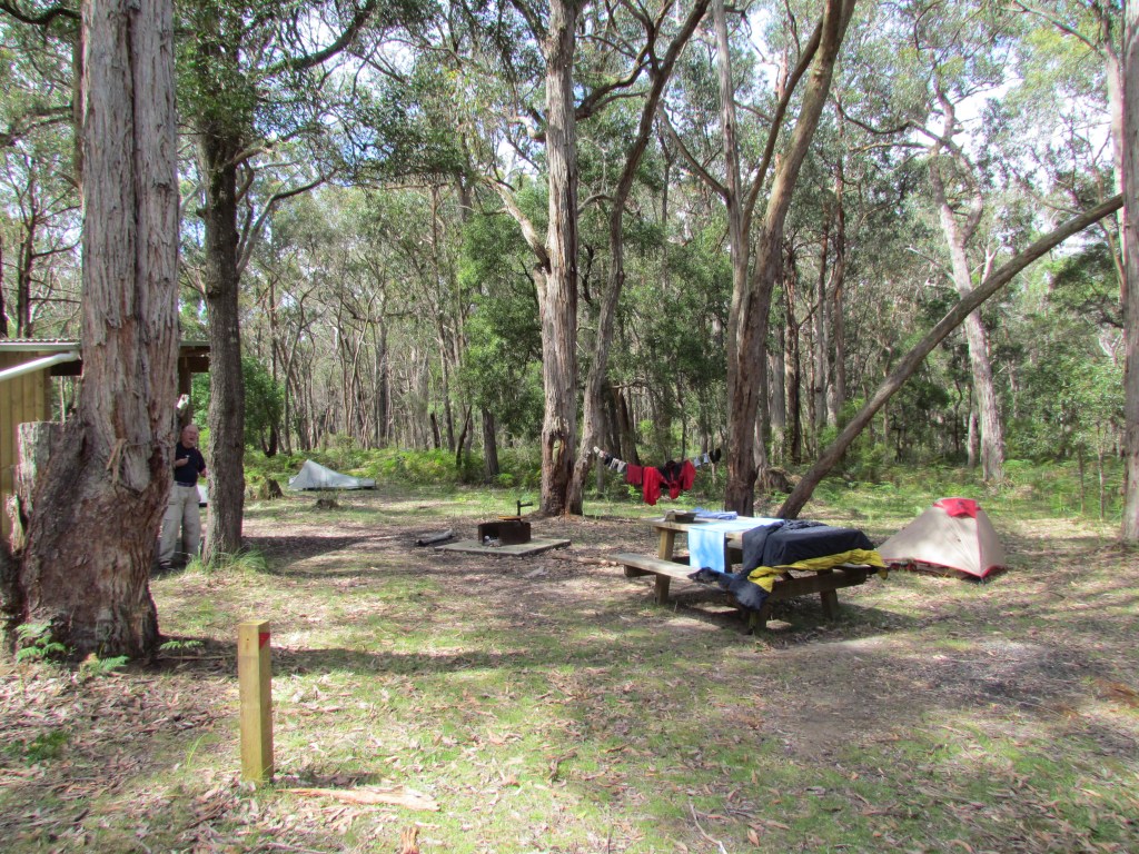
Drying and shaving. Fitzroy Camp
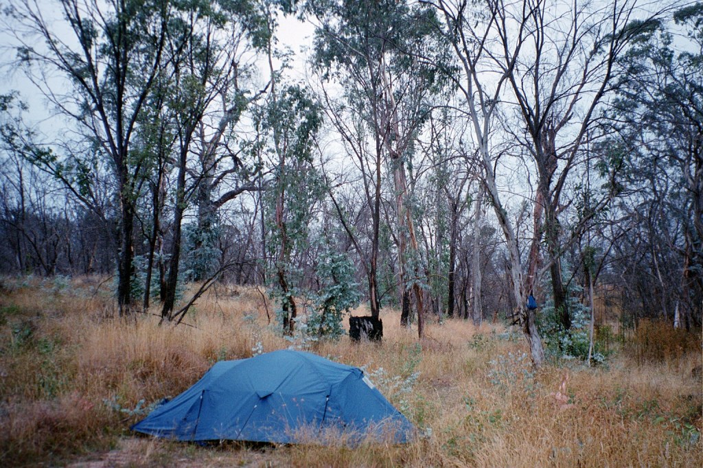
Cold night. Brief shower after we got up @ 0600. Packed and breakfasted and first step @ 0730. Wrecked Holden beside track. Rain and leaches. Reached Cobboboonee N.P. @ 1041. Briefly sunny. Forest and heathland. Potoroos on wet forestry road. Lis’ disturbed a Tiger snake sunning itself on the track. Sunny afternoon. Reached Fitzroy@ 1600.
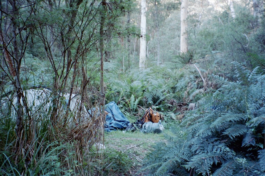
Day 4.Tuesday, 29th November, 2011. Fitzroy Camp – Moleside Camp.
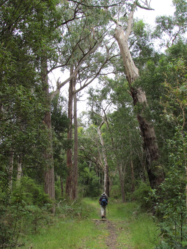
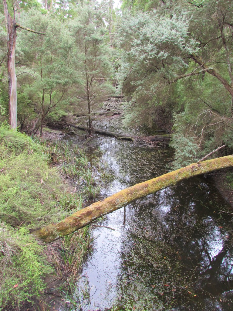
Warm night but stars out at one stage. Overcast day. Zen forest walk. Leaches. Lunch @ Inkpot after road stroll bypassing GSWW track. Reached Moleside @ 1400 after 20 km day. Sign at Moleside said Muller and Post and Rail camps closed. Canoeist and walkers camps. Beautiful river. Had swim in Moleside creek. Spent afternoon washing and drinking tea. Parks Victoria took away our picnic table. Tranquil evening on jetty. Ducks and wallabies in canoe camp.
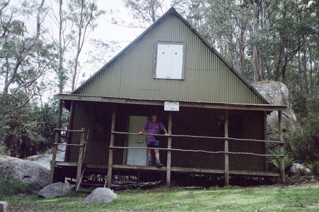
Moleside Camp
Lisa & I
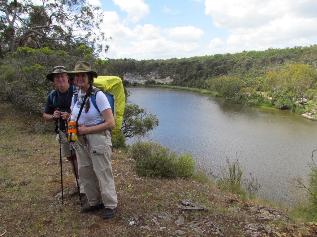
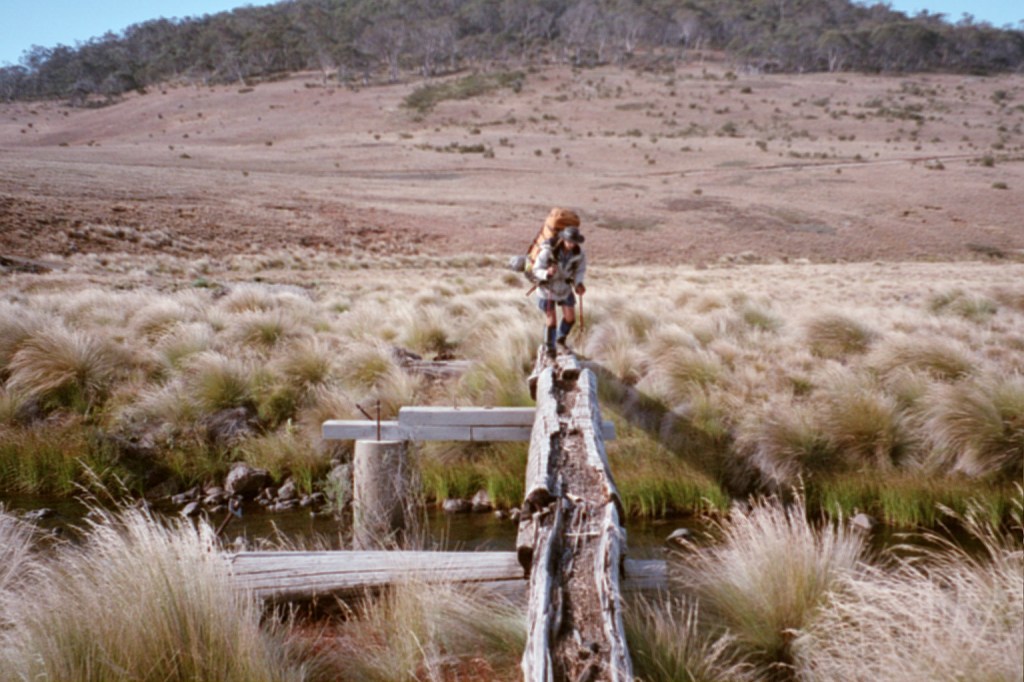
Day 6. Thursday, 1st December, 2011. Batersby – Simpsons Camp
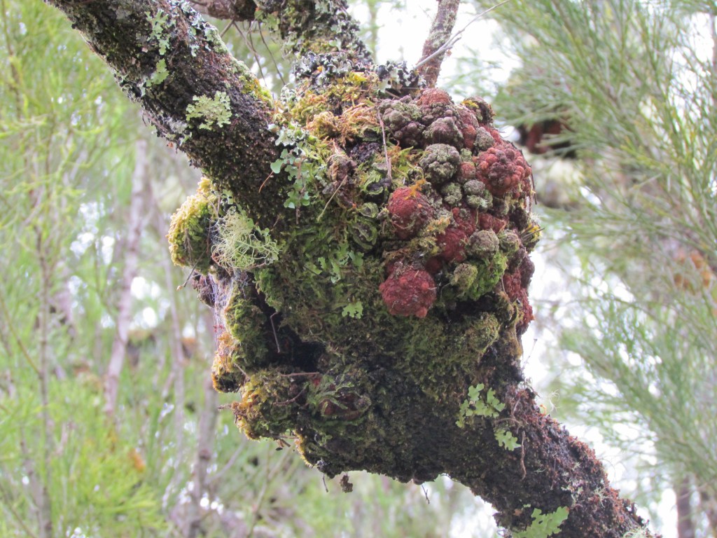
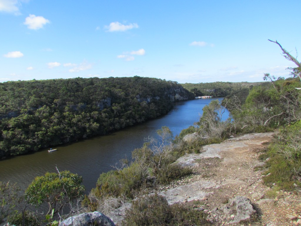
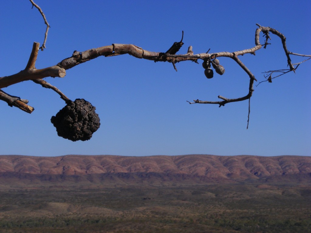
Rained overnight and a bit cold. First step @ 0820. Reached Mullers @ 0950. Two elderly ladies stayed there overnight. Same set up as Post & Rail. Pushed on to Sapling Creek by 1030. Sunny and overcast. Muller Fire Line then benched track along river. Reached Pattersons @ 1230. Lunched and discussed options. Two ladies said information woman had told them they could camp along the track. I mentioned Hirths Landing and they said we could camp there expecting the same facilities as Sapling. We decided to push on to Hirths. Geogeous track to Nelson Road. Sunny. Reached pseudo SA border @ 1715. Emus, wallabies, helicopter dragon flies, LBWs, black cockatoos and echidnas. Red clay and limestone, grass trees and melaleucas. Lis’ noticed tumours on gum leaves. I reached Hirths @ 1745. No toilet or water. Pushed on again to Simsons @ 2000. 32 km day. It seems the entire Geelong Grammar School is camped at Simsons. We had enough room.
Land grab! The South Australian section starts 500 metres EAST of the border.
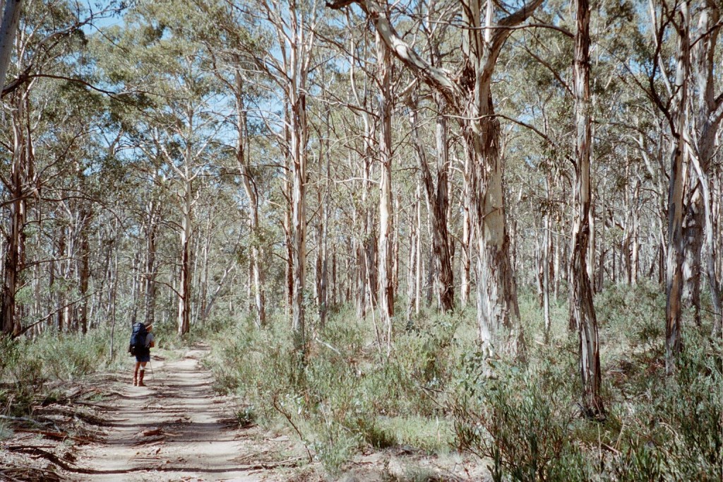
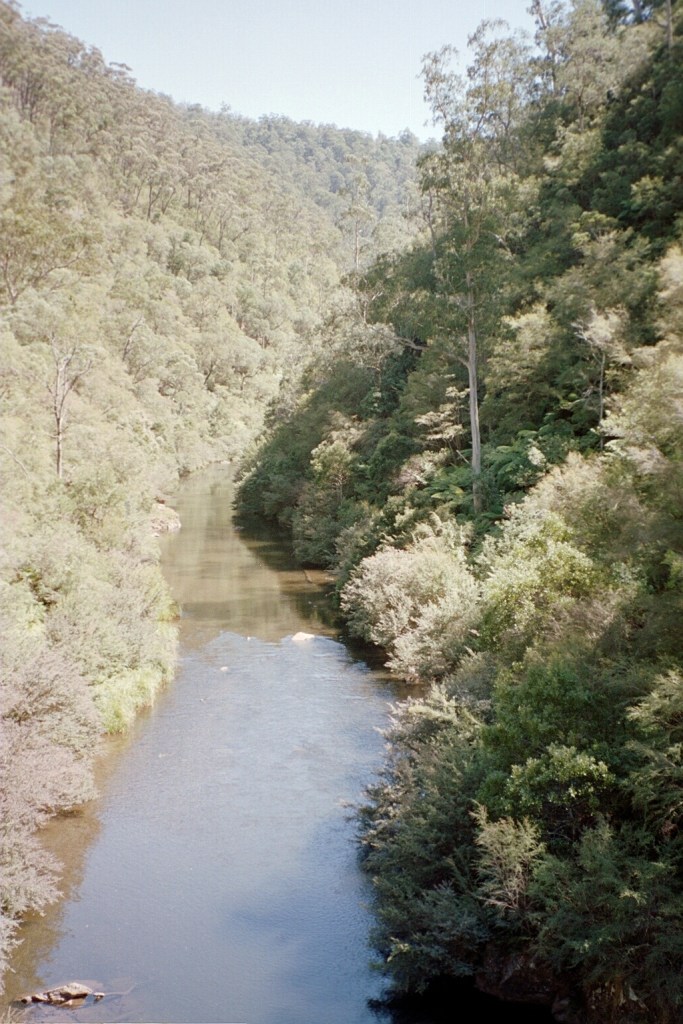
Glenelg River
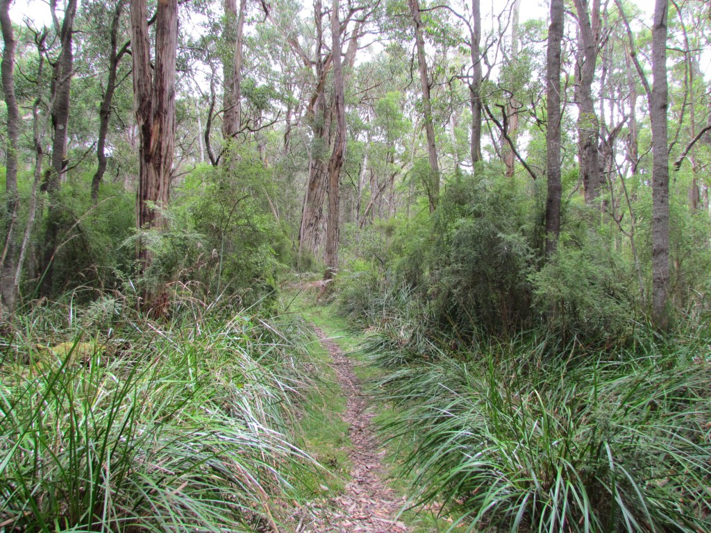
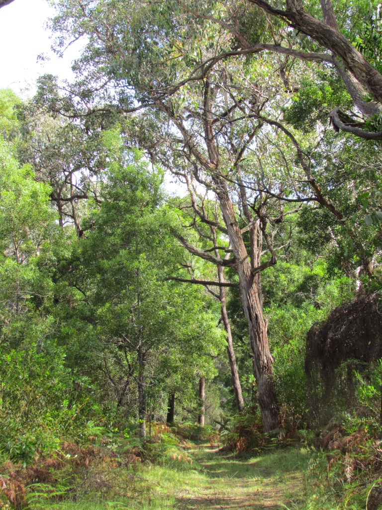
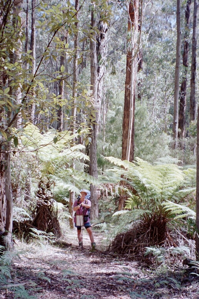
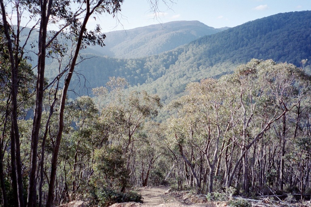
Beautiful stroll
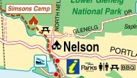
Day 7. Friday, 2nd December, 2011. Simpsons Camp – Nelson.
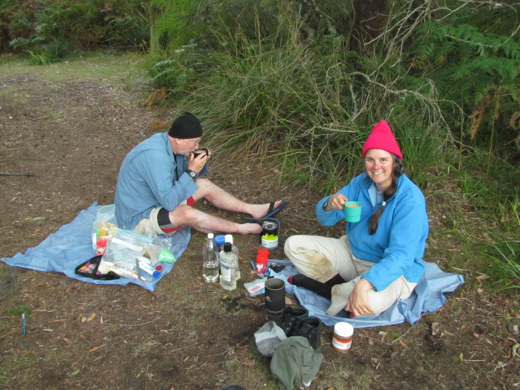
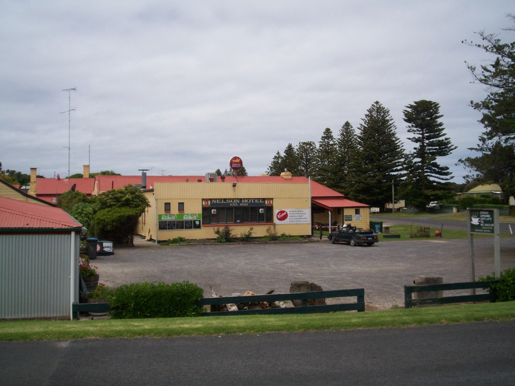
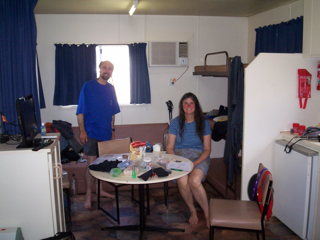
Slept until 0715. Dry night and a leisurely morning. Overcast. Packed up and headed off @ 0915. Arrived Kywong Caravan Park @ 0945. Ensuite donga $80. A shower never felt so good. E.P.S.. Morning tea and a load of washing. Wandered 2 kms in to Nelson and picked up our food drops. Lunch at Nelson Hotel and booked dinner. Then back for a shower and another load of washing. TV on SA time. Back to the hotel for dinner and beers. Yummo.
Breakfast
Nelson
Kywong Caravan Park
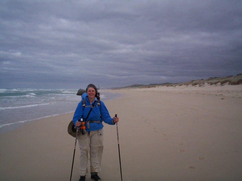
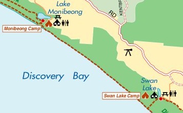
Day 8.Saturday, 3rd December, 2011. Nelson – Lake Monibeong.
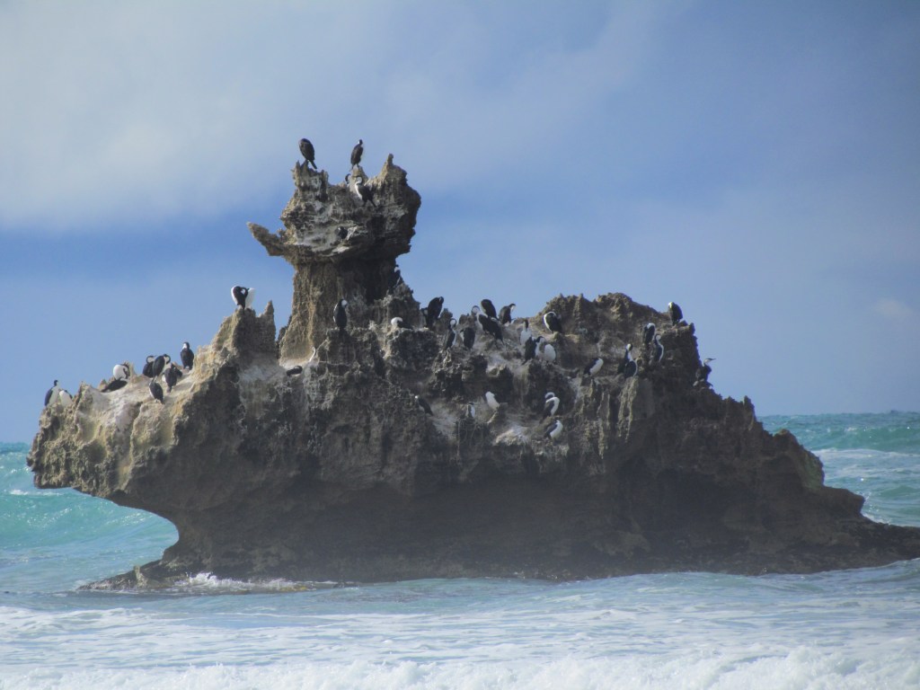
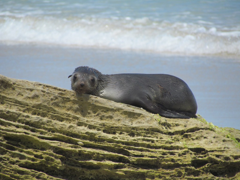
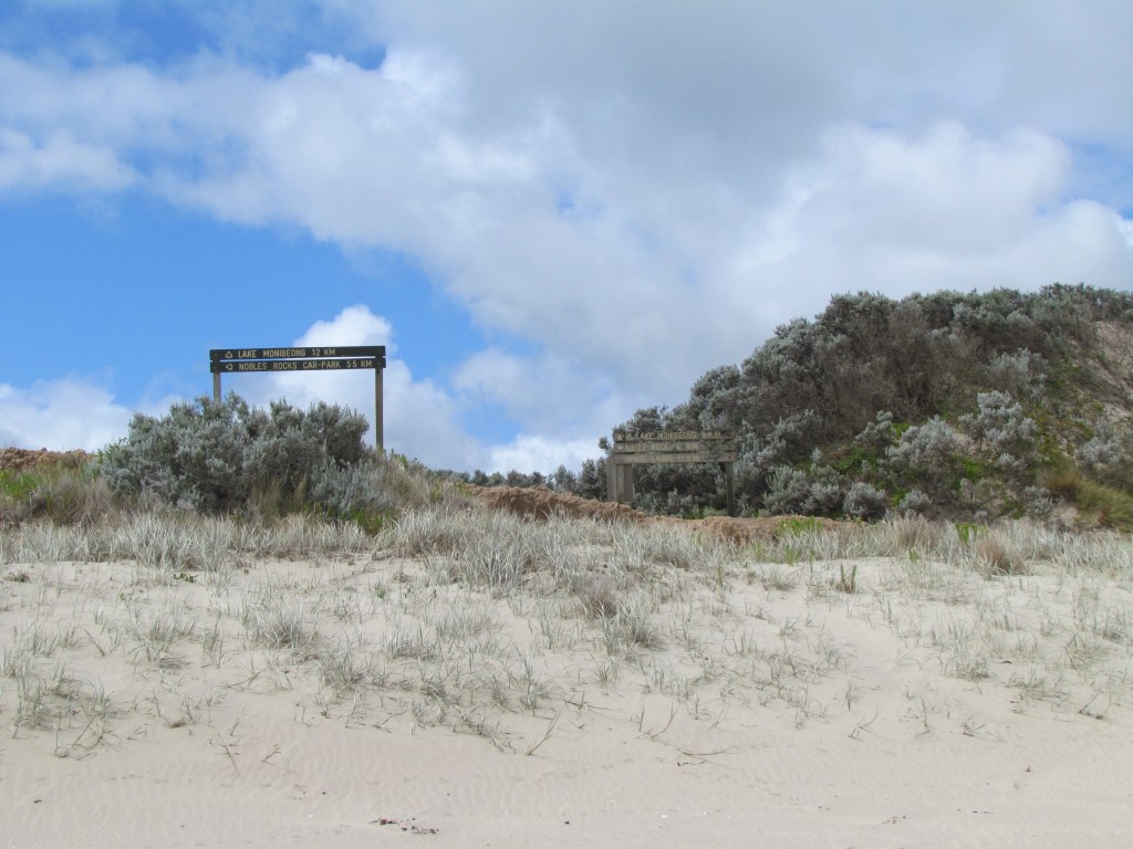
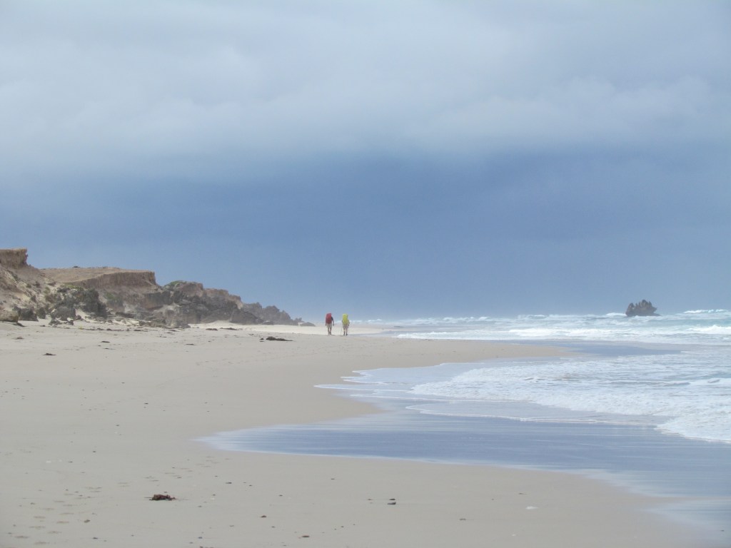
First steps @ 0730. Reached beach @ 0830. Lovely firm sand. Reached White Sands at 1030 and Noble Rocks car park @ 1230 for lunch. Seals, Sand pipers, seagull chicks. Arrived Lake Monibeong @ 1500. Met Chris after trek through sand dunes. Talked about the Appalachian Trail. Whiteblaze.com and 2000 Miles to Maine.
Day 9.Sunday, 4th December, 2011. Lake Monibeong – Swan Lake.
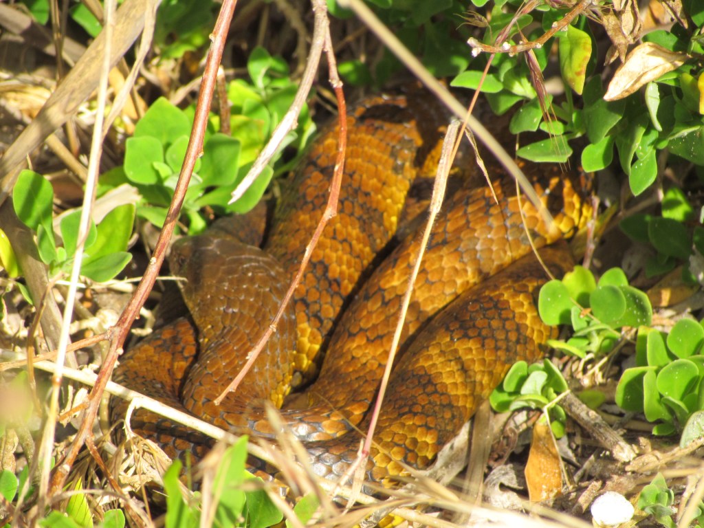
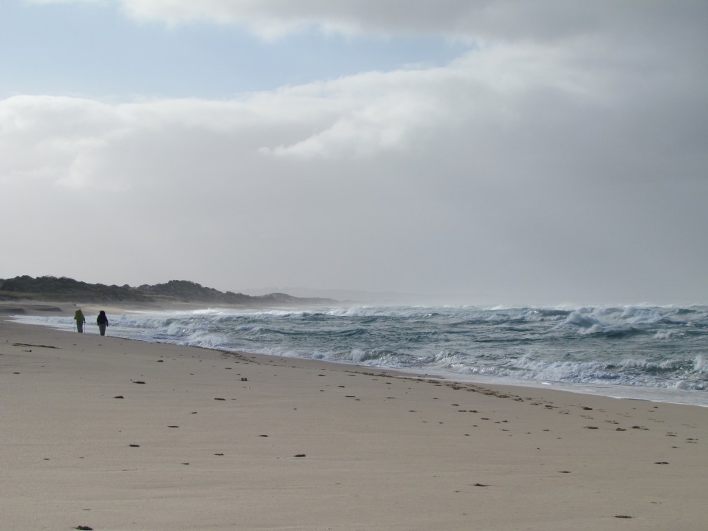
We left Lake Monibeong after a very windy and cold night. Hit beach @ 0815. 13.5 kms to Swan Lake estuary. Cloudy with strong easterly wind. Hard and soft sand. Reached Swan Lake @ 1300 after walking through dunes. Had a leisurely lunch with Chris and discussed hiking and lack of shelters at both Lake Monibeong and Swan Lake. Both accessible via car based campers. Very exposed campsites. Portland Dune Buggy Club camp. Niv had crossroad encounter with them on his way in. Emus on way in. Feral cat amongst scrub. Good bore water from dunes. Still windy and cold after dinner so just went to bed.
Day 10. Monday, 5th December, 2011. Swan lake – The Springs.
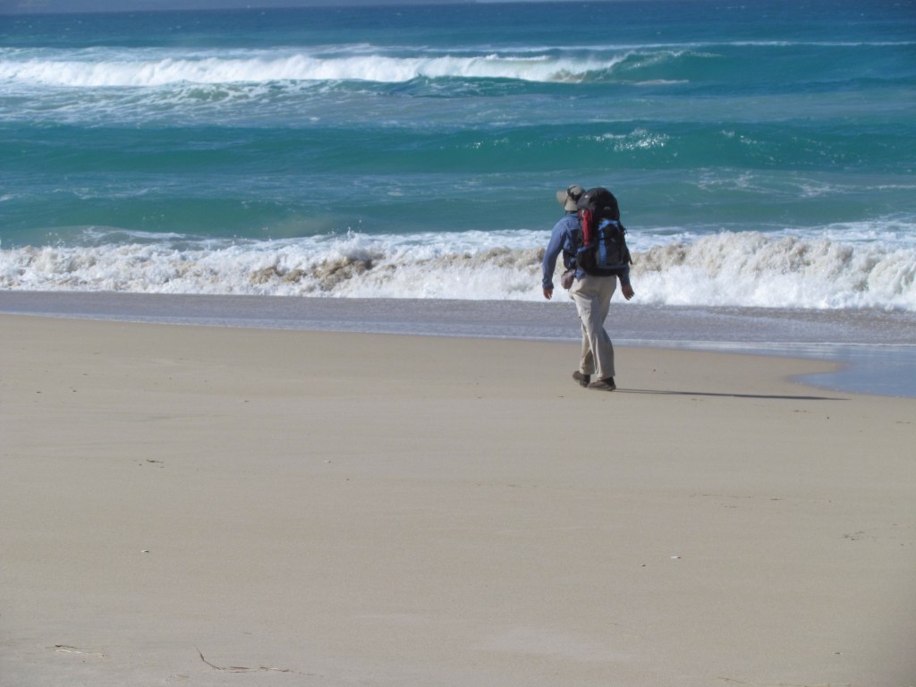
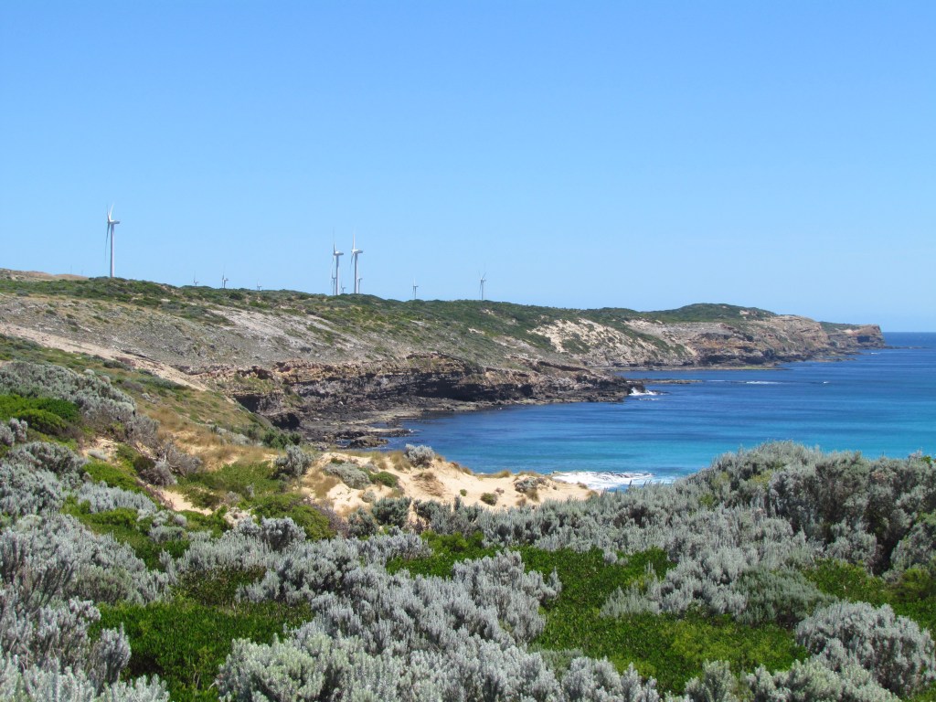
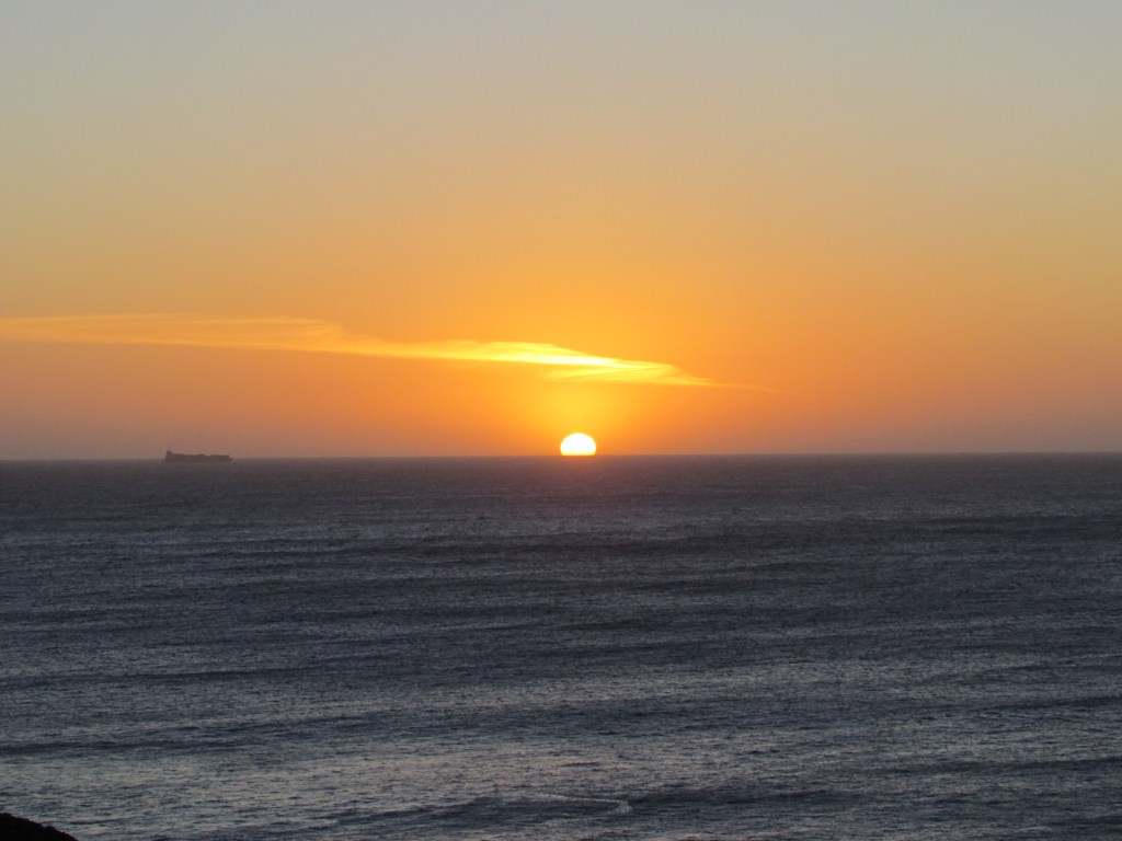
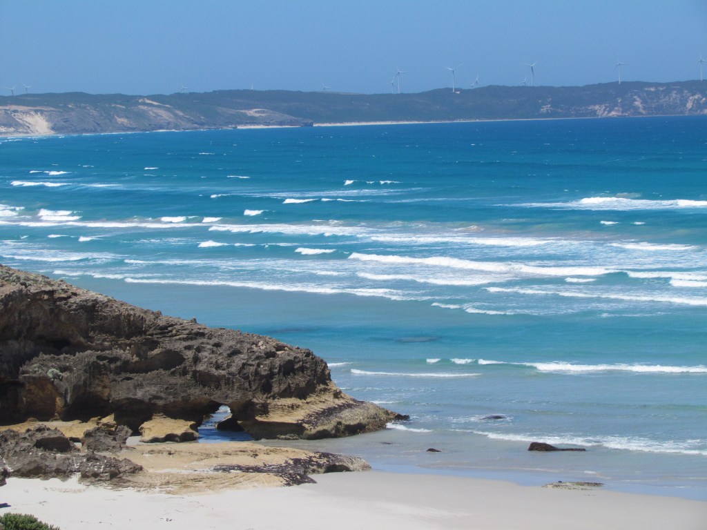
Woke to a clear day before sunrise. First steps @ 0730. On the beach @ 0800. A long haul along it in the sun. We thought we had missed the exit from the beach but eventually found it at the end @ 1230. Reached Bridgewater Lakes @ 1300. Along hot cliff top walk (6.5 kms) from there to The Springs under the wind turbines. Beautiful views across the ocean to the beach. Very hot. Reached camp@ 1600. Very cold wind. Wind turbine just 100 metres from camp. If you listened very carefully you could just hear it. Made tea and read behind shelter next to water tank. Cooked dinner then watched sunset over ocean. Saw green flash. And was nearly run over by a wobblely on way back to camp.
Day 11. Tuesday, 6th December, 2011. The Springs – Trewalla Camp
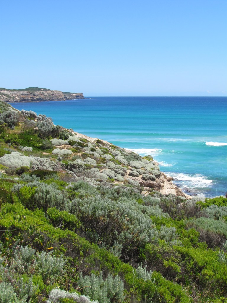
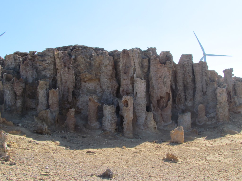
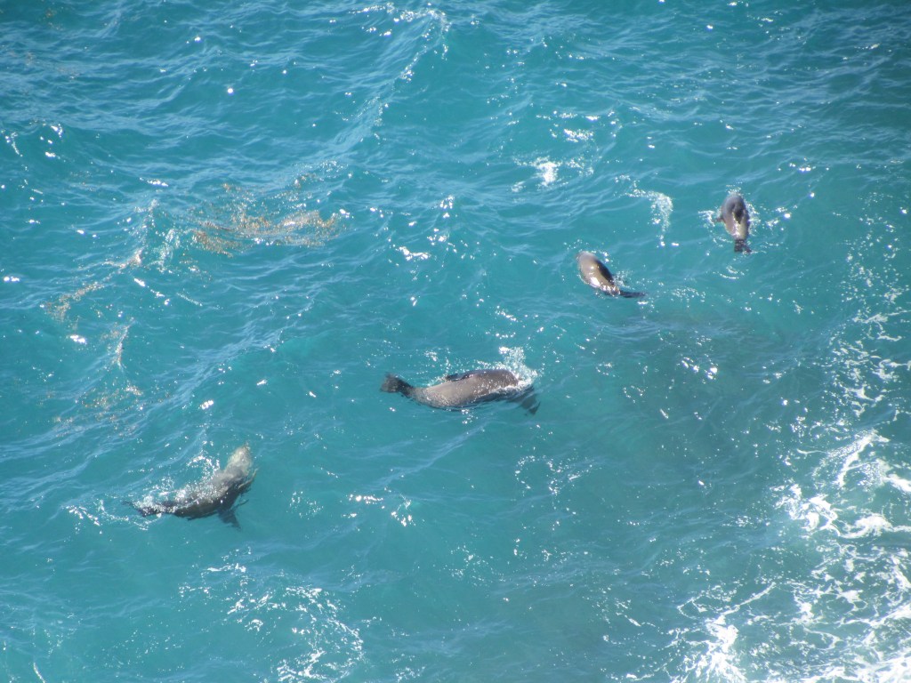
Windy sunny morning. More wind farms. Passed the springs and Petrified Forest which turns out to be vertical solution columns. Reached Cape Bridgewater @ 1000. Overpowering odour from juvenile/old seal colony. Not many seals. Reached Fisherman Cove @ 1130. Surf Club, BBQs, Dutch tourists and a Cafe where we had fish & chips and Niv had an enormous hamburger. Thought about walking the road but the beach looked very nice. Firm and fast. Turned off beach too soon following GSWW markers. We could’ve kept going on the beach to Shellys. Hot heath, top of dunes walk to Trewalla. Not many campsites but sheltered and a shelter.
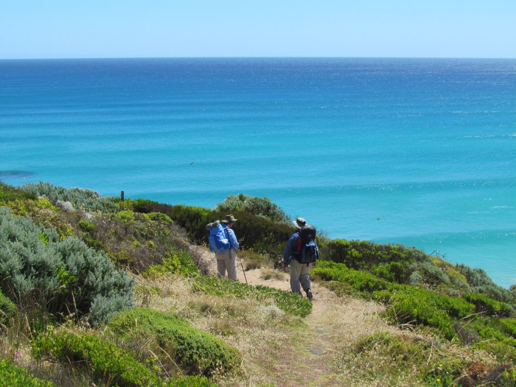
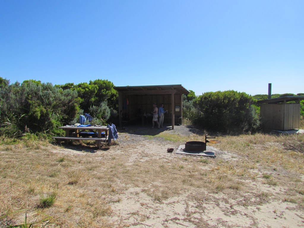
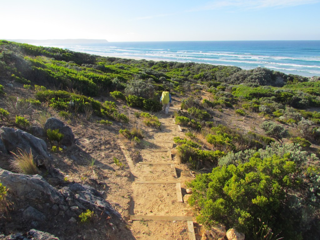
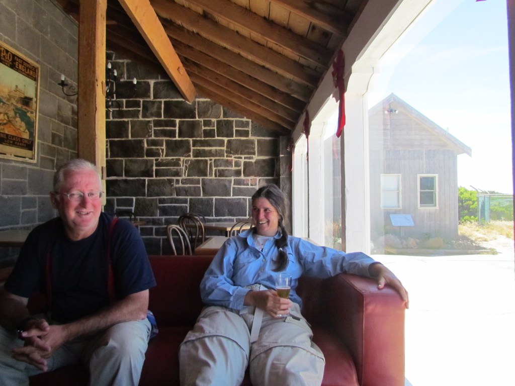
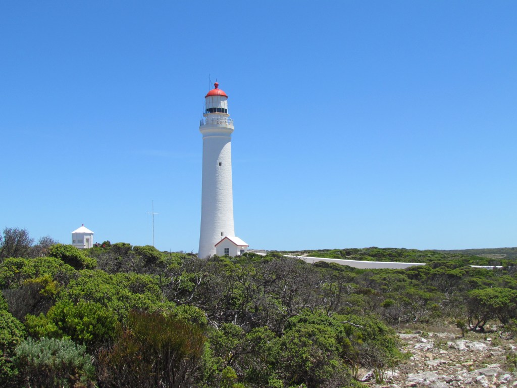
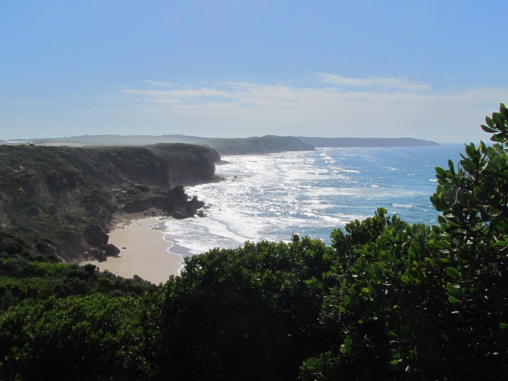
Clear & sunny. Warm night. First steps @ 0745. On beach @ 0800, end of beach @ 0920, right at the end. Marker pointing up to Cape Nelson. Long haul up steps to cliff track. Chris passed us and we said our goodbyes as he was heading to Portland that day. Reached Cape Nelson light @ 1130. Had a coke with Chris. Lis’ and Niv arrived just after Chris left. Beer and baguette lunch. A short 1 km stroll to Mallee Camp. Had reception on Kindle so facebooked Jess and Bec. After a lot of deliberation we decided to forego the smelter and rifle range and head straight for Portland.
The track to Cape Neslon
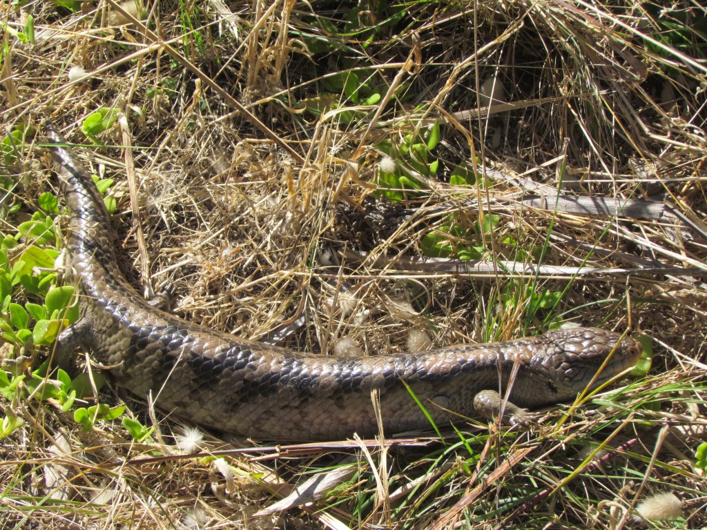
Blue Tongue Lizard
Lunch at Cape Nelson
Cape Nelson Light
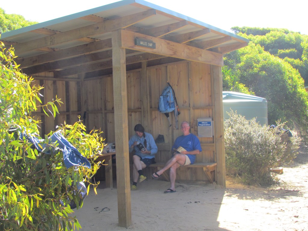
Mallee Camp
Day 13.Thursday, 8th December, 2011. Mallee Camp – Portland
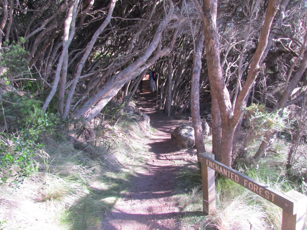
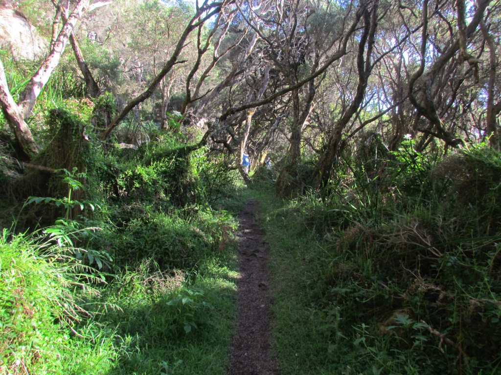
Another warm night. Another clear and sunny day. First steps @ 0800. A lovely ramble along the scenic drive then a beautiful walk through the Enchanted Forest admiring the views along the way. Reached Yellow Rock @ 0900 and continued along the road in to Portland. We were booked in to a cabin at the caravan park by 11. Washing done and a couple of beers.
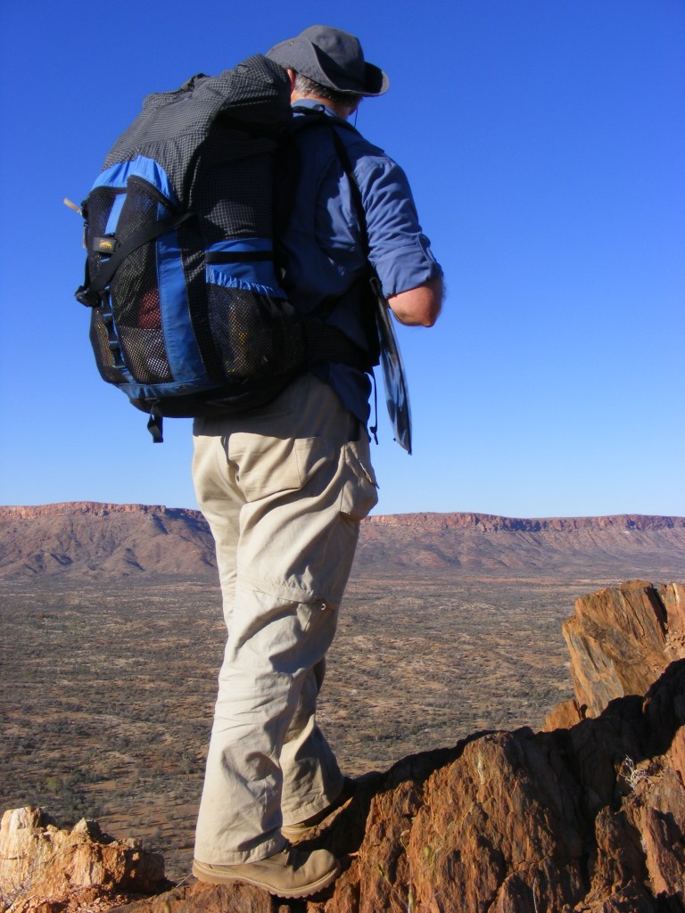
During the start of the Palaeozoic Era, about 550 million years ago, central Australia was covered by shallow seas. Sedimentation and volcanics combined to form a new continental crust and then huge pressures acted upon this sedimentary and volcanic crust forming metamorphics. About 100 million years later massive orogenies, mountain building processes, pushed this crust up in a series of ranges in central Australia. They peaked at a height of over four thousand metres but the minute they reached their apex the process of erosion started to wear them down again till they became what we know today as the MacDonnell Ranges.
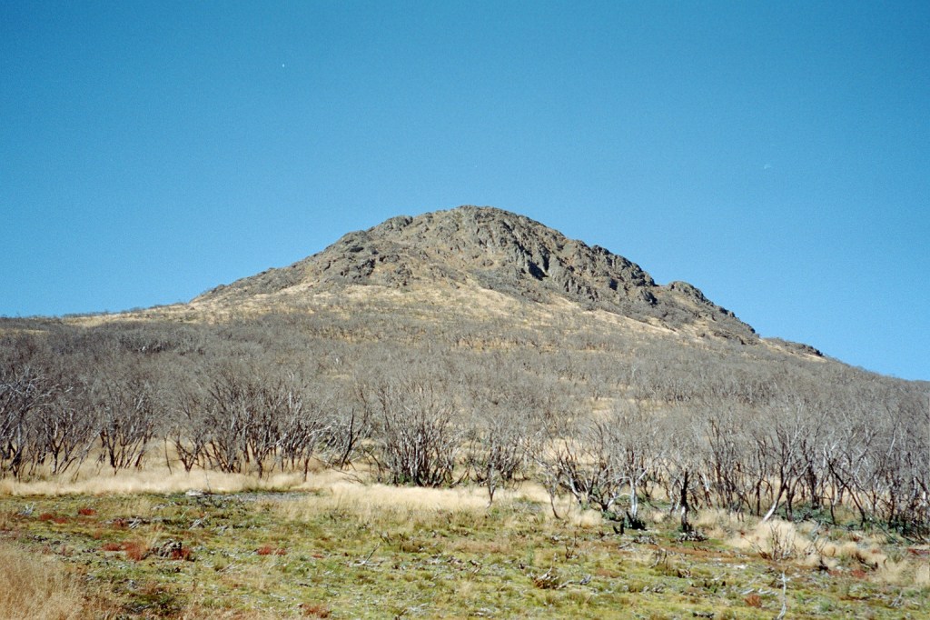
The Heavitree Range
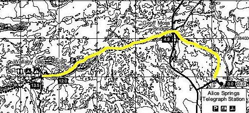
The MacDonnell Ranges are divided in two by the Heavitree Gap in Alice Springs where both the Stuart Highway and the Adelaide – Darwin railway cut through. The ranges to the east are known as the Eastern MacDonnell Ranges but the ones to the west are simply known by the locals as the West Macs. It is important to note that they are plural as they are made up of several distinct mountain ranges all over 1,000 metres and running east west like a series of waves heading from north to south. Some of the ridge lines actually do look like breaking waves. In the West Macs are the Kintore Range, the George Gill Range, the Gardiner Range, the Ehrenberg Range, the James Ranges (a plural range of its own), the Stuart Bluff Range, the Chalet Ridge, the Heavitree Range, the Chewings Range and the Rungutjirba Ridge.
One of the major forces in the erosion process was the Finke River. The Finke was named by John Stuart in 1860 after a William Finke of Adelaide, one of the promoters for Stuart’s expedition. It starts at the conjunction of Ormiston Creek and Davenport Creek near Glen Helen in the Heavitree Range and flows (and I use the term very loosely) for just over six hundred kilometres to the western edge of the Simpson Desert in northern South Australia. It spends decades without a drop of water in it and only flows after great rains. In extreme flood the river pushes through to Lake Eyre in South Australia via the Macumba River.
In the Heavitree Range, the Chalet Ridge and the James Ranges through which the Finke flows (note it flows through at least three mountain ranges) there is clear evidence of deeply incised meanders. Now, because meanders only form on flat plains, the river must have been formed before the ranges were pushed up over 450 million years ago. It was flowing hundreds of millions of years before the Tigris and the Euphrates were even trickles. The Finke River is the oldest river on earth. However, to the local aborigines it is not known as the Finke River. They call it after the great serpent which lives in the West Macs. They call it the Larapinta.
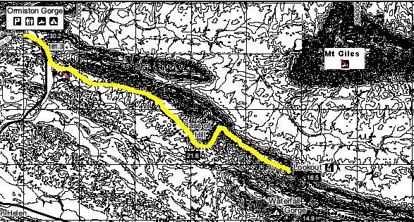
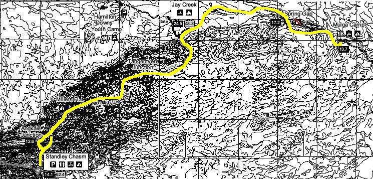
The Larapinta Trail is also named after the great serpent as it was routed to wind up and down the ranges and back and forth across the desert plains of the West Macs. To tell the truth, I hadn’t even heard of the Larapinta until a couple of very good friends, Simon and Ali, moved to Alice Springs so Simon could take up a posting at Pine Gap for a couple of years. When they left Canberra I dutifully promised to visit. We emailed each other spasmodically for about six months when I became aware that there was a long walk west of Alice called the Larapinta Trail and that it was very popular. I looked up everything I could find on it. There is a remarkable amount of information available on the net. There’s even an entire web site administered by the Parks and Wildlife Advisory Council of the Northern Territory devoted to the trail. It is full of track notes, current conditions, who will be on the trail when and other mundane details like where to get water which could be rather handy to know in the desert. It also had twelve maps, one for each section, which I immediately downloaded and printed off. There was also two 1:250 000 scale maps of Alice Springs and Hermansburg which had the trail marked on them but at that scale were about as useful as a map of the London Underground in south-west Tasmania.
There is an information package that I had mailed to me from P&WAC which contained six coloured strip maps. These, along with the section maps I already had, became our maps for the trail. And, then most fortunately, on 6th June 2008, John and Monica Chapman published their excellent guide to the Larapinta. I had it on pre-order and it arrived the day it was published. It was great. It described the walk in both directions and gave us enough information to be able to change our itinerary once we were actually on the ground if necessary. It also really cemented our plan to walk from Red Bank Gorge back to Alice Springs in fourteen days so I put my leave form in. Then I started to hear the horror stories. A friend of Simon’s, Ben, works in Lone Dingo, a camping shop in Alice Springs. He told of hikers crawling bloodied and exhausted in to the shop after cutting short their walk as the trail had destroyed their boots. Well, OK, I added the “crawling bloodied and exhausted” bit but it captures the spirit Ben was trying to convey i.e. don’t take on the Larapinta lightly. A colleague at work said his brother, who had done walks all over the world, had just finished it and he said it was the hardest walk he had ever done even with professional support teams carrying their bedding and food.
We forged on with our planning anyway and pushed the negative vibes to the back of the preparation list. Simon and Ali very, very, very graciously offered to support us by dropping us off at Red Bank, meeting us at two points along the trail to resupply us and putting us up for a couple of days afterwards. So with all the doubts and misgivings packed in with our food and bushwalking baggage, we were right to go.
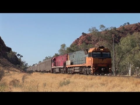
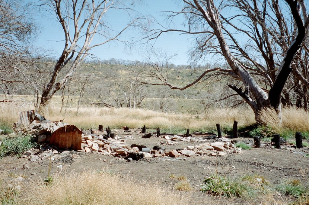
“The Ghan”, Heavitree Gap, Alice Springs, Northern Territory (stock image)
Day 1. Sunday, 6th July 2008. Redbank Gorge.
Lisa dropped Niv and I off at Canberra Airport at a quarter to six on a very cold morning. Our flight to Melbourne was due to depart at twenty to seven. You’d think that at six o’clock on a Sunday morning there’d be no one around but the terminal was packed. Everyone obviously thinks that if you fly early on Sunday morning no one else will either so that’s when everyone decides to fly. We tried to get our boarding passes with adjoining seats for both legs of the flight but I made a complete hash of the self checking service and so we ended up sitting a couple of rows apart. We checked in our bags and went through security. Since we were already dressed for walking, we had to take off our boots, belts and everything in our pockets (compasses, notebooks, pens, etc.) before passing through the scanners holding our boots in one hand and our trousers up with the other. After getting dressed again with two dozen other people all trying to get a place on the two chairs provided to put our boots back on, we had a short wait before QF795 to Melbourne was called. Breakfast was superb. Special K, blue berry muffin, strawberry yoghurt, juice and coffee and I passed the time re reading the track notes for the first couple of days. We soon touched down at Tullamarine where we had to rush to the other end of the terminal to get our connecting flight to Alice at twenty to nine. It’s a rule of flight. The distance to your departure gate becomes greater as your flight time nears.
Unfortunately, I couldn’t get our seating changed for the next leg so we were still a couple of rows apart. While we waited for our flight to be called, I did a quick skim of the maps for the next day. Our flight was called and we soon found our seats. Just before we took off, one of the flight attendants came up the aisle with my map case which I had left in the lounge. It had the entire walk plan in it. I was extremely alarmed when I realised that I hadn’t realised it was missing. I was just so thankful. Anyway, it was only a two hour flight but our seats were aisle seats over the wing so we couldn’t see anything out of the windows nor talk with each other. Since I couldn’t see out the windows, the landing at Alice was a bit of a shock. It was the worst landing I’ve ever experience. We bumped and slew until we came to a stop outside Alice’s terminal and I couldn’t help but wonder what on earth we had landed on. Surely it was a bitumen runway and not some rutted corrugated dirt field. It was a perfectly level bitumen runway so, after we disembarked into a glorious warm and intensely blue day and we made our way in to the terminal, I couldn’t help but stare at Captain Kangaroo and his crew as they made their way through looking totally nonplussed and that sort of landing was perfectly normal to them.
Simon arrived just as we retrieved our bags and we were soon heading in to Alice. Just past the airport we saw our first camel ruminating behind a fence beside the road. It turned out to be the only camel we saw on the entire trip. Soon we passed through the Heavitree Gap and in to Alice Springs itself. The Heavitree Gap, or Ntaripe in the Arrente language, is an important sacred site to the Arrente people and passing through it was avoided until the road and rail link was put through. As the picture shows the Heavitree Gap is the only way through the range for quite some distance. It was a rather long walk round if you wanted to pop in to town from the south for a carton of milk so it was no surprise that they built all the transport links through the gap instead of digging a tunnel through the range or going around some other way.
A gap is a pass cut through a mountain range usually by a river down to the level of the surrounding plains and the MacDonnell Ranges are full of them. The most famous, each for totally different reasons, being Pine and Simpsons Gaps but there are at least two dozen others. The West Macs themselves have more gaps than a South Sydney defensive line up. Several months later, at Simon and Ali’s wedding, all the tables were named after gaps in the West Macs. Nice touch, I thought. Simon took us up to the lookout on Anzac Hill from where we could see the entire town. We even saw the Ghan making its way south to Adelaide. Then it was in to town to get some things for lunch where there was a stark reminder of how hot it gets here. Every car space in the supermarket’s carpark was in the shade of an awning. Simon mentioned that in summer you can drop the temperature by up to five degrees just by stepping in to some shade. We were soon at Simon and Ali’s place which is a very convenient five kilometres west of Alice Springs just off Larapinta Drive. We lunched on beautiful salad sandwiches and then Niv and I each had an episode of exploding pack syndrome as we emptied our bags of everything and repacked our packs ready for walking. Our resupply rations and a few other bits and pieces we packed in to plastic crates which would be brought out to us on the trail. Ali and Simon simply packed their food box, stoves and swags in to their Pajero. This sort of lark was obviously nothing new to them. Niv and I then climbed aboard with our gear and we all headed west along Larapinta Drive in to the West Macs. It’s worth noting that Alice Springs has more swags per square metre than your average suburban shopping mall has Ugg boots. They’re everywhere.
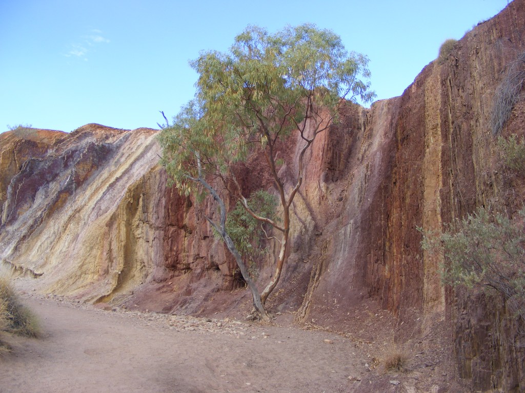
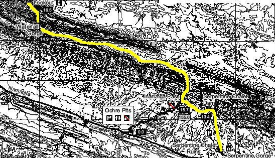
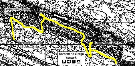
Along the way we stopped at Point Howard lookout and I had my first encounter with spinifex grass which is found everywhere you look. There are a couple of dozen varieties of spinifex and they all hurt. The leaves are needle like and can pierce most clothing and some can even piece soft shoes Unfortunately, I had left my gaiters at home so I had to quickly learn to avoid it whenever I was walking, sitting, setting up my tent or standing still. A bit further on, we turned on to Namatjira Drive then stopped at the turn off to Serpentine Chalet ruins where our first resupply was to be. It had some interactive signage explaining how, back in the 1950s, someone had built a chalet out here as a Mecca for tourists wanting to see if what young Albert painted at Serpentine Gorge actually existed. It did but unfortunately, the resort wasn’t exactly situated in the most picturesque spot. As a matter of fact, it was a five hour walk over some pretty rough terrain to the gorge from the chalet. Something we were to find out about the following Saturday. And there wasn’t any water here so they built a dam further up the valley. Some other enterprising people built another resort further west at an incredibly beautiful water hole called Glen Helen which had magnificent views of the mountains which Albert painted and consequently Serpentine Chalet went bankrupt after only five years. We had a bit of an explore around and double checked our maps to make sure this was in fact where we were to meet up at the end of the week. I had my first inkling that there were to be no soft grassy campsites for us on this trip. The campsites around the chalet ruins were all just red dirt but they were flat. A bit further on were the Ochre Pits, a sacred site where the aboriginals collected different coloured ochres to be used as body paints in ceremonies. We wandered up to a viewing platform to view them. They were beautiful. Soft reds, yellows and browns stripped the cliffs. Unfortunately, a family with teenagers was there and they had descended from the platform and were streaking each other’s faces with ochre. Their parents were on the platform and filming them with a camcorder right next to the sign which promised a $5,000 fine for interfering with the site. I mean, what do you do?! It is one thing to profane something but to record the event is just stupidity.
Ochre Pits
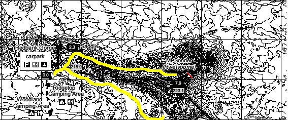
We were soon on our way again and arrived at Red Bank Gorge soon after. There are four distinct sites at Red Bank. There’s the gorge itself, the picnic area, the Ridgetop Camping ground for bushwalkers and the Woodlands Camping ground for car based camping. Our plan was for us to camp at the Ridgetop camping ground and get away first thing in the morning but it was on an exposed ridge top and the bushwalkers already camping there were using rocks to hold their tents down. Also, even though it had a toilet, it was a five hundred metre walk down and across the valley through some pretty rough scrub to the picnic area to get water. The picnic area is the actual start/finish of the Larapinta. It has a shelter, toilets, a water tank and a big “No Camping” sign which was a shame as it was sheltered and had everything else. The Woodlands camping area was down the other side of the ridge top and it too had it all including tables and gas BBQs and stoves so that’s where we decided to spend the night. We drove around it for a while before deciding on a couple of sites. Niv pitched his tent on the site near our table and I wandered across the track to another site to pitch mine. There were heaps of vacant sites all with tables and gas facilities so I couldn’t see any reason not to spread out. Ali and Simon just threw their swags down near their Pajero. It was just on five-thirty and, since sunset was due at six, we decided to get our dinner cooked. Niv and I flashed up our Jetboil stoves and each got a meal out of our pack. This turned out to be a big mistake which we didn’t realise for another three days.
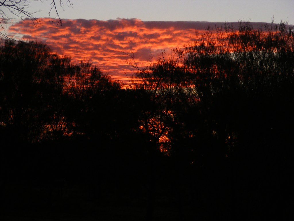
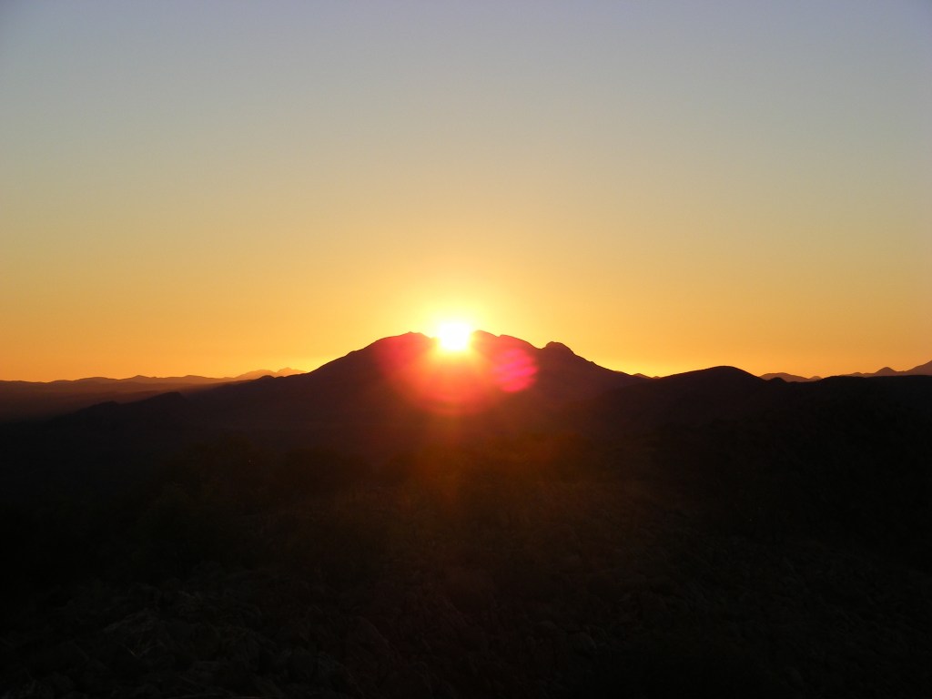
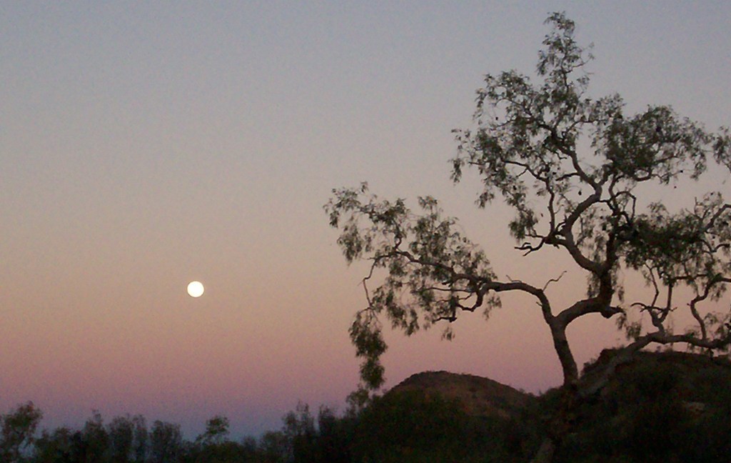
Sunset, Red Bank Gorge
After dinner, we watched a very spectacular sunset with a tiny sliver of a moon following the sun down. After sunset it started to cool down and we were playing a game of yahtzee with our headlamps on when we noticed that the little sliver of a moon was shining so brightly that we had shadows on the table. It was magnificent. Even more magnificent was the night sky above us. It was brilliant. I have never seen such an incredibly bright night sky. We spent the next hour or so watching it. Every now and then we would see a meteor or a satellite pass over head. Eventually it became too cold and we concurred that it was time for bed.
Day 2 Monday, 7th July 2008. Mount Sonder and beyond
Day 1
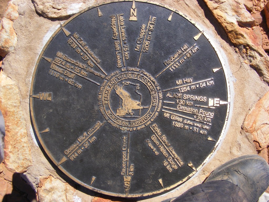
It was a very windy and blustery night which contributed to the usual first night on the ground restlessness. Then it rained very briefly and lightly before clearing to a beautiful and cold dawn at about seven. We packed up and drove over the ridge top to the picnic area for breakfast. It was still quite cold but we made ourselves some tea and breakfasted on muesli. There was already a Trek Larapinta Landcruiser parked there when we arrived and no one else around. By eight Niv and I were keen to start so we waved farewell to Simon and Ali after thanking them profusely. We decided not to visit Red Bank Gorge as we wanted to climb Mt Sonder first and do the gorge afterwards. It would depend how we felt. It was a short stroll down to the Red Bank creek past the water tank. The creek was the first surprise. It was sandy, about twenty metres wide and totally dry. The creeks and rivers only flow very briefly after heavy rain but when they do it is a torrent. We crossed over and made our up to the track junction. According to the guide, it’s eight kilometres to the summit; it climbs eight hundred metres and takes eight hours. We followed the main track down to another creek bed where we unpacked our packs and hid all our equipment except what we would need for Sonder which we promptly repacked. We returned to the junction and started the climb up. There was a very strong wind blowing from the east and it was still very cold. However, the climb kept us warm and about an hour after we started we reached the Mt Sonder Lookout. The lookout had a great view of the mountain, and interpretive sign describing all the geographic features and a warning sign which pretty much stated that if you weren’t sure what you’re doing then here might be a good place to turn back. We were to encounter several of these signs along the trail all the way to Alice. Not long after we passed the sign we encountered the group from Trek Larapinta making their way back down. They were all rugged up and wearing headlamps. They had climbed to the summit to watch the sunrise and warned us of the increasing strength of the wind and the cold further up. We thanked them and continued on. The track was very rocky and we crossed numerous slate shingle sections. It was a long continual climb until we reached the summit cairn at about eleven o’clock. There is a compass rose on top of the cairn with directions and distances to all the major features. Alice Springs and Ormiston Gorge were roughly due east at 130 km and 20 km respectively in a straight line. Mount Ziel and Haas Bluff were to the north-east at 27 km and 62 km. The views were amazing. To stand on top of one mountain and to look down to several other mountain ranges is just spectacular.
Compass Rose, Mount Sonder
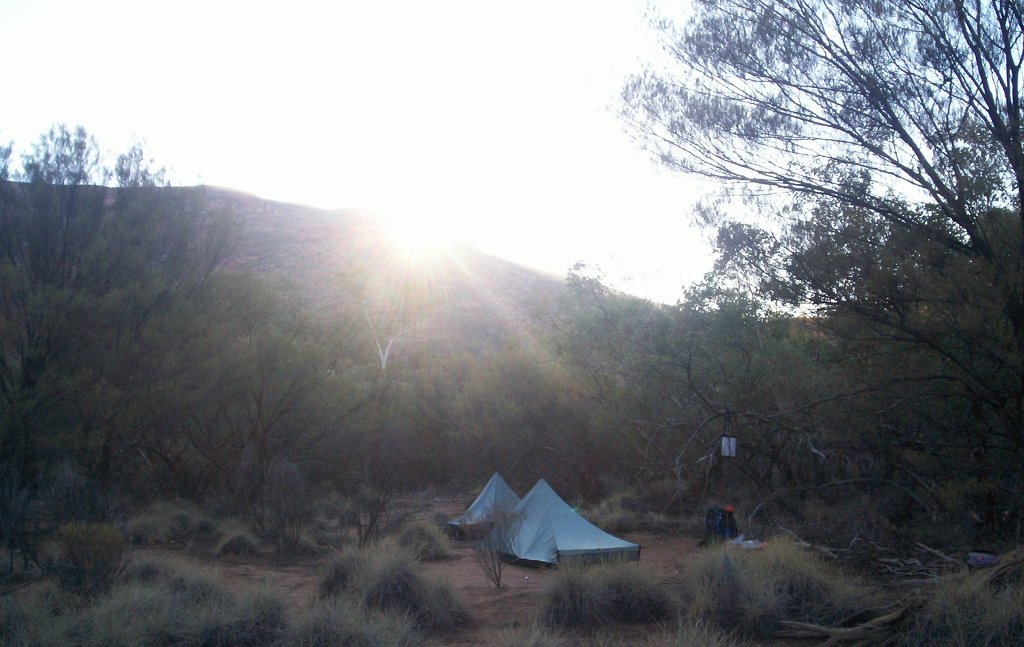
The actual summit of Mt Sonder is only a couple of hundred metres to the east of the cairn but involves a very dangerous descent from the cairn and an equally dangerous ascent to attain it. All the guide books warn against climbing it and we were quite happy to follow their advice. We had a long way to go and really didn’t want to jeopardise the rest of the trip. It was still quite cold so after signing the visitor’s book and taking a hundred odd photos we descended to a sheltered spot on the north side and ate our lunch overlooking the plains and the next line of ranges. The descent was quite fast and we reached the track junction at the bottom by two thirty. We agreed that a night at the bushwalkers’ campsite on Ridgetop would not be very pleasant and since we still had three and a half hours daylight left we decided to push on. I took our water bottles back to the tank at the picnic area and filled them before returning to Niv down at the creek bed where we had stashed our gear. We repacked and brewed up a coffee for afternoon tea. It was really delicious and agreed that this could become a tradition along the track. We were both pretty pleased with ourselves for conquering the highest point on the track relatively easily and early in the afternoon. This gave us a huge boost in confidence and allayed any apprehension we had in our abilities which would last for the rest of the trip. Mt Sonder, or Rwetyopme, and its surrounds are considered sacred so camping and fires are not permitted anywhere on the mountain. The track skirted around the southern base of the mountain and a strict no-camping zone exists for a long way along it. We determined we had to walk about five kilometres to be outside this zone so after we packed up we started off. At every kilometre along the length of the Larapinta Trail are markers telling the distance to or from the next track head. We always knew how far we had travelled and how far to go without all that messing about with map scale and such so we were pretty confident we would know when we were outside the no camping zone. The track is extremely level for most of the way along the mountain’s flank with only the occasional descent and ascent across the numerous dry water courses coming down off it. The huge bulk of Mt Sonder towered over us as we made our way along and we became aware that dry water courses aren’t the only things which come down off the mountain. At one point along we had to negotiate our way across a fairly recent rock slide which was a bit unnerving and we saw further evidence every now and then of some falls. As they say, “Geological time is now.” and sporadically we thought we heard the faint tinkle of a falling stone. It was probably just paranoia after passing the rock slide but it was safer to be wary than not. There were numerous anthills along the side of the track being built over stumps or clumps of spinifex. Unfortunately, level areas clear of spinifex or rocks were not evident at all and I was starting to consider the possibility we would have to push on to Rocky Bar Gap to find any sort of campsite which would involve walking at night. It’s only twelve kilometres from Red Bank Gorge but we only had a couple of hours of daylight left. Looking back, I can see those fears were unfounded as we could have easily followed the track in the dark if we had to. However, just past the six kilometre mark and well away from the mountain’s side, we came across a flat clear dirt area with just enough room amongst the spinifex for both our tents. It was nearly five-thirty and experience has taught us not to pass up a God sent opportunity like this. Niv did a little explore a bit further on where river bed wound through a stand of ghost gums but it was far too rocky. We erected our tents and set up our bedding. Amongst a small stand of white cypresses, a fallen one became our seat for our kitchen. A cup of tea followed by dinner was definitely the order of business. We watched the satellites and meteors pass overhead for quite a while before heading to bed. I read for a while and noticed, after I turned my light off, that the moon seemed much brighter that night, shining through my tent.
Sunrise over Mount Sonder and our camp
Day 3 Tuesday, 8th July 2008. Mount Sonder to Finke River
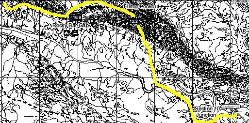
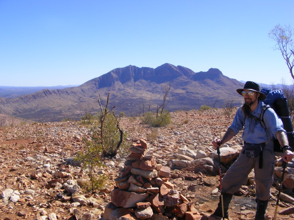
We woke early to a clear cold morning. Our planned itinerary for the day was to Hilltop Lookout but it was now only about ten kilometres away so we decided that we would push on to Davenport Creek which was five kilometres further on. It would mean carrying all our water from Rocky Bar Gap but we had planned on doing that anyway. We breakfasted and packed up. Niv wanted to hang around for a while to get a shot of the sun coming up over Mt Sonder which made me pause and get the maps out. I discovered we were next to the water course which flows between two southerly running ridges and realised we didn’t have as far to go to Rocky Bar Gap as we had thought. It was a lovely stroll along to Rocky Bar Gap and we reached it easily by mid morning. It has plenty of flat campsites and a single water tank which is resupplied by rangers accessing the site via a management track coming in from Namatjira Drive. We filled up everything we could with water and set off for the gap itself which would take us through to the northern side and the long ascent to Hilltop Lookout. The gap was sandy and cool and lined with ghost gums all the way through. On the other side was a vast rocky plain scattered with spinifex and mallee. It was starting to warm up considerably and after about three kilometres of winding through the scrub we started the ascent to Hilltop with ghost gums all across it. They are incredibly hardy trees as the soil was obviously very poor and water nonexistent anywhere near the surface. The track was very rocky and indistinct in places so it took a lot of concentration and sometimes backtracking to keep on the correct route up. This gave us plenty of opportunities to take numerous shots of Mt Sonder. Eventually, we reached the summit cairn, very hot and sweaty. We took several shots of each other with Mt Sonder in the background before moving off to one of the campsites and sheltering from the sun under a very stunted mallee. There were only about six flat clear areas big enough for a tent and they were all very exposed but it is THE place to camp if you want glorious photos of sunset over and sunrise on Mt Sonder. As we were lunching a young man and women wandered up from the other direction with full packs on. They were walking the entire trail from Alice Springs and were heading for Rocky Bar Gap for the night and finishing by doing Sonder the next day. They had spent the previous evening at Finke River and had gone in to Glen Helen for a meal and a beer, an eight kilometre round trip. We told them, apart from Sonder, it was a breeze from here to Redbank and that Rocky Bar Gap was only an hour and a half away. They were very happy to hear this and took several photos before heading off down the track.
Niven and Mount Sonder
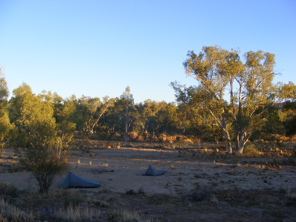
This made us realise that we were also only an hour and a half from Davenport Creek so we got the maps out again and realised it was only nine kilometres to Finke River and we had all afternoon to do it. That being decided we shouldered our packs and headed off along the very rocky track. It was a long, steep and dangerous descent to the plain again and we were very relieved to reach the bottom, hot and sweaty once more. It was however very shady across the plain to Davenport and were saw numerous tracks in the sand. One set were definitely camels so we were eagerly trying to spot one through the scrub. Eventually we came to the Davenport Creek bed. It was enormous. The bed was flat and sandy and about fifty metres wide and three metres deep. The volume of water required to fill it was enormous and it all comes down off Mt Sonder. Davenport Creek was lined with enormous Red River Gums and after a bit of exploration up stream we found a water hole which could be used in an emergency but we still had plenty so we pushed on. It was a very hot afternoon as we crossed the plain towards the Finke River and the Glen Helen turnoff. Early in our planning we had discussed the possibility of spending a night at the resort but decided against it. We reached the turnoff and turned north-east towards the campsite. After crossing the enormous bed of the Finke we climbed up the other side to what is known as the Finke Hilton. There are two of these along the trail, one at the Finke and the other at Jay Creek. They are enormous three sided shelters especially built for walkers. They have two huge sleeping platforms, cupboards for storing gear and food away from the animals, a gas cooker and BBQ, two water tanks and very high tech composting toilets. There is no doubt that the campsites along the Larapinta are more than adequate. This one was however already occupied by a group of four, three Richards and Mary and Kelly. I asked about the third Richard and we were told he was camping on the other side of the Finke. Whilst they did offer to share, we declined and headed back to the Finke as there were no suitable campsites around the shelter. We found a lovely sandy site in the bed and as there were no forecasts for rain for the next few days we pitched our tents and had a cup of tea. As the site was very sandy we had to use rocks to hold our pegs in the ground. We spent some time talking and watching for meteors and satellites. Niv mentioned that camping here was fulfilling one of his life’s goals as the Finke figured prominently in some stories from his childhood. The moon was much brighter that night and the ghost gums in the river bed really shone brightly. They are definitely named correctly. It started to get very cold so we turned in and I soon drifted off after reading for a bit. I was so glad we had packed for the cold of the night. I had a thermal top, satin boxers, beanie, faux silk inner and my Dandelion bag and I was very warm.
The Finke River
Day 4 Wednesday, 9th July 2008. Finke River to Ormiston Gorge
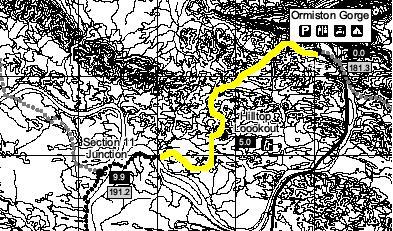
Another cold, clear dawn greeted us as we emerged from our tents to make a cup of tea and prepare breakfast. As we stretched I noticed dog prints all around our tents. Lots of them! And I hadn’t heard a thing all night. Our packs weren’t touched but it made us very careful about storing our gear overnight, either in our tents or hanging up in a convenient tree from then on. It’s only ten kilometres from the Finke River to Ormiston Gorge with a short climb up and down along the way. We were happy to have an easy day and looked forward to hot pies and paddle pops from the kiosk and a hot shower when we got there. The group from the Finke Hilton passed us as we were packing up. Niv wandered off to get some photos and I backtracked to the Hilton to fill our water containers. My three litre water bladder had leaked slightly under the full load the previous day and this was some cause for concern. The thought that my water would be leaking out as we walked to Waterfall Gorge the next day was worrisome as there was no guarantee of water between Ormiston Gorge and Serpentine Chalet Dam. I only filled my one litre PET bottle as that would get me through to Ormiston as I wasn’t anticipating any problems along the way. It was already quite warm by the time we set off and the first three kilometres were relatively flat. Then the climb up to the lookout at the second Hilltop started. They really didn’t sit up all night thinking up the names of these summits did they? It was a fairly easy two kilometre meander up to the summit and when I arrived one of the Richards was still there. He was in his early sixties and was planning on doing the trail in twenty days. It turned out he was an ex high school teacher from Yarralumla, A.C.T. Sometimes this world is way too small. From Hilltop it is a very gentle five kilometre descent to Ormiston Creek and Ormiston Gorge but it was very hot and we were glad to reach the campsite by noon. We found out it was over thirty degrees according to the ranger’s notice board. For the first time I was starting to get an inkling what this must be like in Summer. The bushwalker’s campsite is right beside the trail as you enter the campground from the west. It was packed. The Richards et al had taken up a section and another group had taken up most of the rest. We settled for a few square metres on a soft platform and set up our tents. It also had a nice cleared area under some trees where we set up our kitchen and got lunch under way with the luxury of a cup of tea.
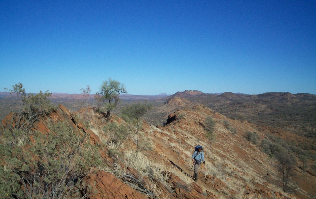
The Larapinta Trail from Hilltop towards Ormiston Gorge
Just as we finished lunch a large party arrived from the east. They were a group of men, all over sixty, from the Sunshine Coast and their leader, Brian, regularly led walks out here. They had come across from Mt Giles to pick up a food drop before heading west to Mt Ziel. We vacated our kitchen area for them to pitch tents and had some great chats with Brian about the area and what great spectaculars were worth visiting off the Larapinta. I could almost see Niv’s cogs starting up to plan another trip out here to do Ziel. One thing Brian did tell us was that we should really consider spending the next night at Giles Lookout. There was no water but it had good campsites as well as splendid views back to Sonder and the sunsets/sunrises were well worth it. It sounded like a pretty good idea to us so we adjusted our plan accordingly. Then the conversation turned to our Tarp Tents. Quite a few of the party were checking them out and they nearly fell over when we told them they only weigh seven hundred grams. Brian’s party settled down to their lunch and we packed up and set off to explore the bazaars and fleshpots of Ormiston Gorge. A banana paddle pop from the kiosk was top of the list. We wandered across to the main campsite and found about two hundred Flinders University geology students camped there and laying siege to the car park, toilets and overflowing rubbish bins. They were on a bit of a field trip apparently. A bit further on was the hot showers and flushing toilets and then we reached the kiosk. Apparently it had been closed for about six months and was unlikely to open that afternoon to sell us neither pie nor paddle pop. Disappointed with territory capitalism (not to mention the paddle pop yearning unfulfilled.), we ambled back to our campsite and got our gear together to wash some clothes and wallow in the hot showers. It was great. After showering I wandered back to where the kiosk wasn’t profiting and read the notice board. This is where the weather reports are posted and pamphlets on Ormiston’s charms and other information can be gleaned. One point of interest was that this evening there was to be a power point presentation by one of the rangers on the West Macs’ habitats and inhabitants called just that. The camp fees for Ormiston are six dollars each per night and for that you get a campsite, water, rubbish bins, toilets, hot showers and now a night at the flicks. Luxury! It was just as we were preparing to cook dinner that the mistake we both independently made on Sunday evening became evident. We had planned on four dinners before resupply. Monday, Tuesday, Wednesday, Thursday and resupply on Friday at Serpentine Chalet Ruins. No matter how many times we added things up we were both still short one dinner. Luckily we both had an extra emergency ration with us. I decide to have mine then and leave my tuna for the following evening while watching the sunset from Giles Lookout. My emergency ration was pasta, peas and corn cooked in a pea and ham soup so it wasn’t too shabby at all. It grew dark quickly and started to get cold as we finished dinner. We rugged up with everything we had and wandered down to the camp’s amphitheatre. It is a large covered concrete area surrounded by a low concrete wall, well lit with a screen and power point projector already set up. There we discovered all of the bushwalking community in attendance plus a few interlopers from the caravan area on folding chairs. Obviously, Flinders University didn’t include the presentation in the geology curriculum as they were all having various parties at their site which we passed on the way. We all took seats on the concrete wall surrounding the presentation area and behind the caravaners. Unfortunately, the seating was rather hard and cold but Ranger Kelly soon arrived and gave a great presentation on the three main habitats (mountains, deserts and rivers) and the inhabitants therein. One of the denizens she mentioned is a huge monitor (three metres plus!) called a Perentie (varanus giganteus). It’s the fourth largest lizard in the world and not the sort of thing you want to meet. It’s apparently not very bright and scavenges and eats anything and everything including bones which explained
the lack of dead animals I hadn’t seen so far. She then casually mentioned that it tries to eat anything it comes across, things like feet sticking out of a tent and such like. She also spoke expansively about Ormiston Pound which was on the other side of the gorge. One of the caravaners asked the question, “What is a pound?” to which Brian immediately replied, “About twelve shillings!” This, of course, went over the heads of the majority there but it got a few grins. It was absolutely freezing by the time the presentation finished and we shivered our way back to the campsite. A hot chocolate was definitely in order to warm us up before we climbed in to our tents and warmed our sleeping bags before sleep.
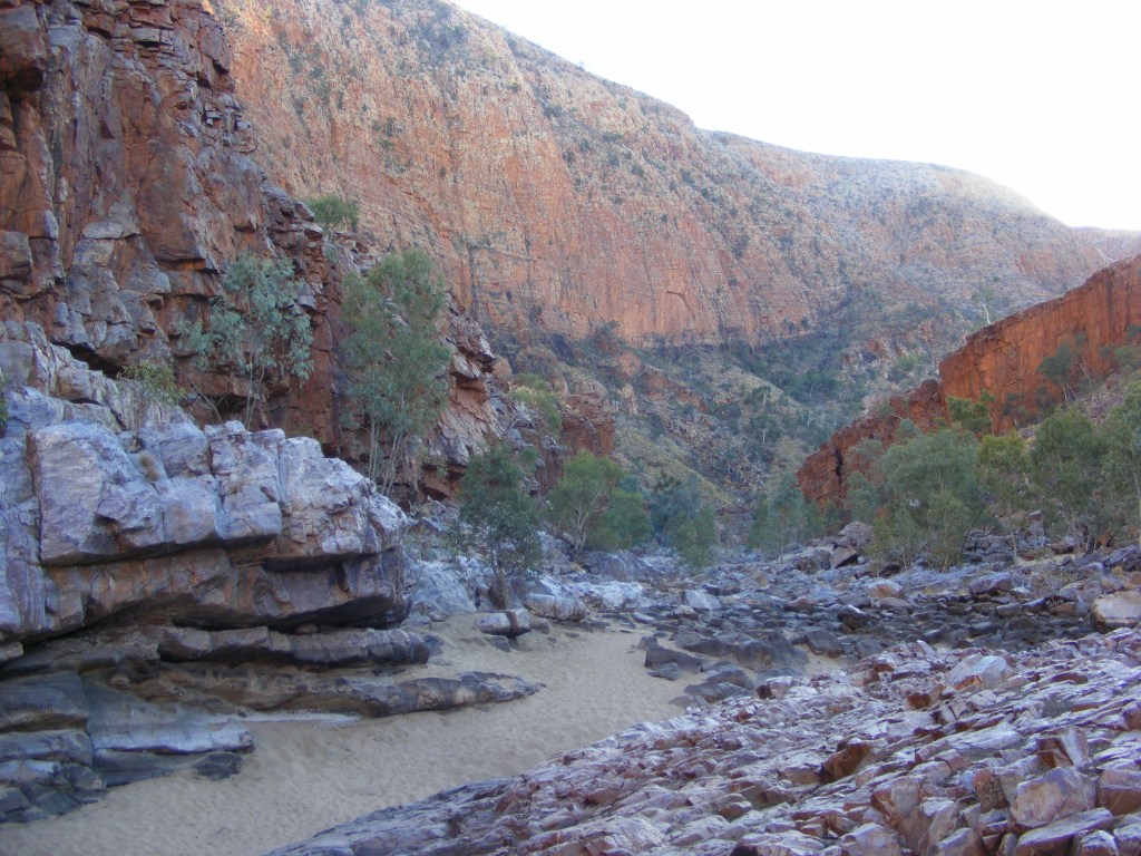
Ormiston Gorge
Day 5 Thursday, 10th July 2008. Ormiston Gorge to Giles Lookout
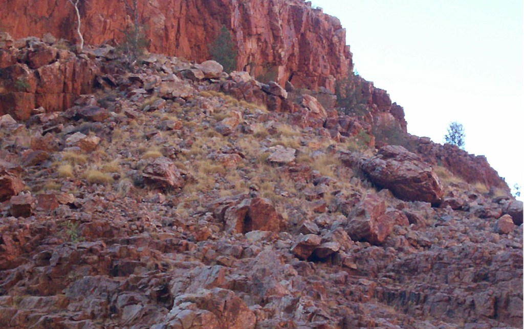
Brian and the Sunshine Coast boys were up at six o’clock and consequently so were we. It was a very cold and clear night out. There was a bit of light hearted banter about my alleged snoring keeping the dingoes away, and me pointing out that, firstly, I never heard any snoring when I woke up and secondly, if, if mind, I was snoring it didn’t keep then away the previous night, did it? So we packed up, bid each other a genuinely fond farewell and wandered down to the picnic area to get a hot brew going, had breakfast and sat back to watch the dawn light up the red gorge. Gorgeous? Definitely! We loaded up all our water containers to see us through the next thirty hours. There would not be any water until we reached Serpentine Chalet Dam the following afternoon. I had my three litre water bladder, a four litre wine cask bladder which also doubled as an extra pillow and a one litre PET bottle, all full. Eight kilograms of water which effectively doubled my pack load. And every drop worth the effort. Ormiston Gorge is one of the thirteen designated checkpoints on the Larapinta. At each one is a log book for signing in and out and a map of the trail showing where you are on it as well as information on the track conditions either way. We logged our intentions, dropped our packs and headed for the gorge to try and find the rock wallabies which famously inhabit it. Ranger Kelly had recited a story the previous evening about a python taking a rock wallaby there then having to lie by the waterhole to digest it for a couple of days. Apparently this was upsetting a lot of the tourists so they bundled it up and transported it up to the Ormiston Creek bed where it finished its digestion then made its way back to the gorge. As you can see by the photo below, rock wallabies aren’t the easiest of animals to spot. However, once you do, you know what to look for and then they seem to pop up everywhere. A lone heron was basking by the severely depleted waterhole when we arrived but Monty (as all pythons are known) was no where to be seen. Looking at the water marks on the cliff face opposite showed the water level to be down by about five metres. We were to discover all of the waterholes along the trail were well down. They had water but I would only drink it if we didn’t have a choice and only then after loading it up with puritabs. There’s a fair bit of irony being in the desert during a drought.
Rock Wallaby, Ormiston Gorge. It’s sitting on the big boulder in the lower centre
A couple of hundred more photos (“What did people do before digital?” I hear you ask. Well, they just took a chance that Aunt Mavis didn’t ruin the shot, basically.) and we were back at the track head where we shouldered our packs and headed off to follow the dry Ormiston Creek upstream before the track turned off and started meandering through the foothills of the Heavitree Range. It was a very pleasant eight kilometres with a few ups and downs before we arrived at the locale known as Base of Hill. It had warmed up considerably by now and I stripped down to shorts and a tshirt in preparation for the three-hundred metre climb ahead. This was one of the steepest climbs along the trail from the west but we were fairly mentally prepared for it. All you can do is put one foot slightly higher than the other over and over again until there’s no more up. And that’s exactly what we did. Even with the heaviest load we would ever carry on the trail it was done by lunchtime. We sat in the shade of a lone white cypress, drank about a litre each and ate lunch. There is always a great sense of achievement felt after such a climb. The trail east to Giles Lookout was very rocky, indistinct and occasionally followed a very thin ridge way. After about three kilometres of this the top of the range opened up and we were soon at a very sheltered campsite to the side of the track. There was enough space for about six tents in three separate locations all joined by rock lined pathways. Sparse shade was provided by white cypress and mallee. Unfortunately, as I was setting up I discovered my water bladder had leaked again and I lost about two litres. I had plenty left but it was a worry.
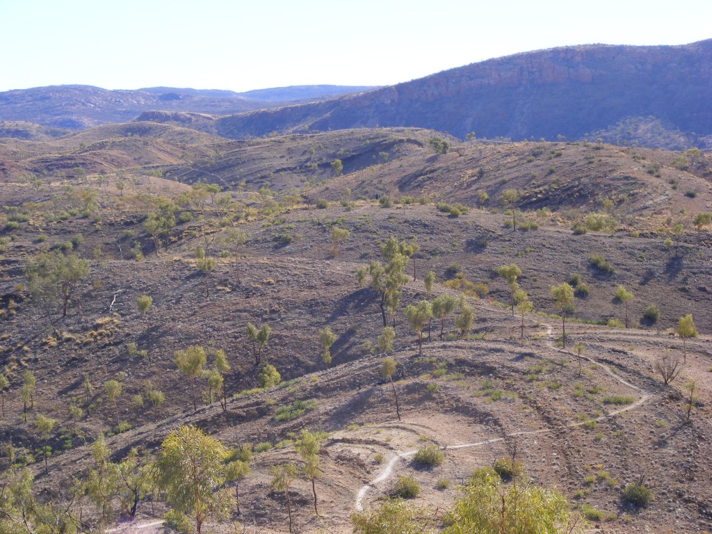
We spent the remainder of the afternoon chatting, reading and staring from a vantage point to the north across the great expanse of Ormiston Pound and the huge bulks of Mt Giles to the north and Mt Sonder to the south and, further south, Mt Ziel. The walls of Ormiston Pound made it clear that this was once a vast and deep part of the inland sea. The plain below was coated an olive green by Mallee and Ghost Gums and the lines of the creeks and rivers were vividly marked by the bright green of the River Red Gums and the white of their sandy beds. I couldn’t help but wonder what it must have been like for Giles and his party coming through here not knowing what was ahead and seeing vast expanses like this filled with nothing and always the constant worry about water. We waited for the promised glorious sunset and we weren’t disappointed. We must have sat at our vantage point and watched the changing colours for about an hour before we conceded that it was now too dark and cold to stay there any longer. A late dinner under a much brighter moon then an early bed followed as we had decided to get up at six o’clock again, pack up and breakfast watching the sunrise from Giles Lookout.
Sunset over Mount Sonder from Giles Lookout
Day 6 Friday, 11th July 2008. Giles Lookout to Serpentine Chalet ruins
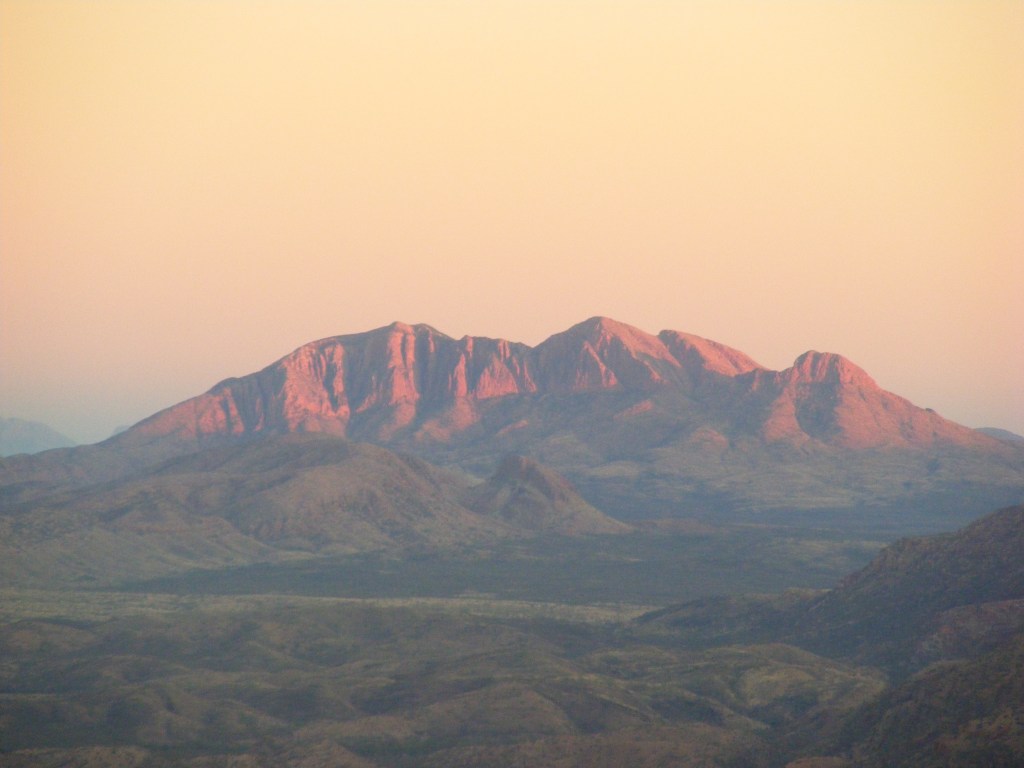
Sunrise on Mount Sonder
The moon had long since set by six o’clock but it was still cold and very clear. We quickly packed up and hurried along the track using headlamps. It was only a kilometre to Giles Lookout but we knew we were racing the sun and we just made it. A bright purple glow to the east was just fading as the dawn brightened. We had our first cup of tea while we switched our view from east to west and back again as we tried to take in as much as possible. Mt Sonder glowed bright red as the sun reached it then the walls of Ormiston Pound lit up. There is no doubt that the Larapinta just presents one magnificent vista after another. So, breakfast and the dawn show completed we started the long steep descent to the creek bed three hundred metres below. The track was indistinct at the beginning and we knew it zigzagged most of the way down so we were very relieved to find that the track markers were more frequent than previously. We reached the bottom and headed up stream looking for the conjunction indicating the turnoff to Waterfall Gorge. It had started warming up by this stage and, as I had only two litres of water left to get me through the day, I was eager to really move along. We soon reached the junction and made our way up to the waterfalls. Well, the waterless falls anyway. Still, they would make a lovely series of babbling cascades when the water did flow. There was one small pool of stagnant water near the tent site marked on the map. I would have had to be completely out of water before I’d even consider taking it from there. It was a short climb up from there to a broad open valley which climbed up to a saddle about three kilometres away. Sheer cliffs lined the edges of the valley and this intensified the heat and the light which seemed abnormally bright. By the time we reached the saddle, I was feeling its effects. Luckily a breeze was blowing up the valley on the other side so I dropped my pack and made an umbrella out of my hat and one of my trek poles before having a large drink. We rested for a while and admired the view. It was another four kilometres down this valley to Pioneer Creek then up the other side to the turnoff to Inarlanga Pass. We reached the entrance to the pass and stopped for a very late lunch under some shade in the creek bed which headed in to the pass.
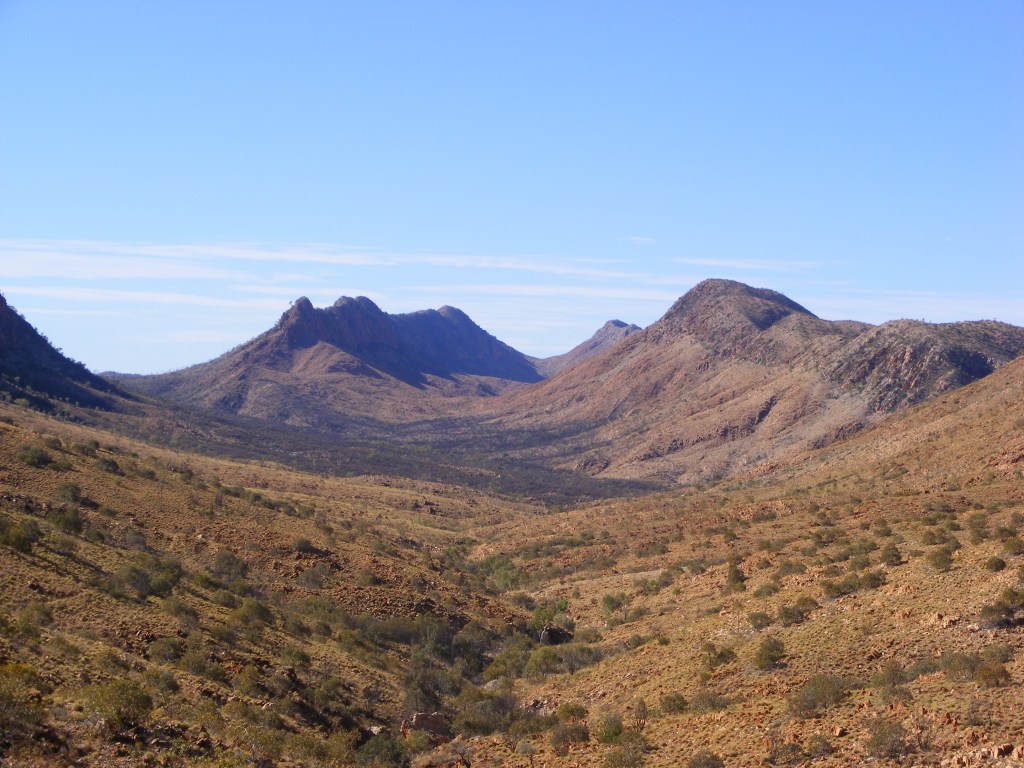
The view heading for Pioneer Creek and Inarlanga Pass
I was out of water by this stage but it was only a kilometre through the pass then two further kilometres to the track head at Serpentine Chalet Dam. The pass is a very sacred place as it is the border between two of the aboriginal tribes and it has a definite surreal feel to it after the openness and heat of the preceding valleys. It was very cool and dim as we clambered across, around and, once, under the boulders under the high cliffs on either side. There were dozens of Cycads growing amongst the rocks. We had a lot of difficulty spotting the markers which indicated the route through. At one stage I completely lost the route and was looking around everywhere for a marker when a raven perched on top of the right hand cliff cawed loudly. I looked up at it and there high up but below the bird was a marker. We climbed up to it and the raven flew across the canyon to the cliff on the opposite side. We watched its flight and it perched high up but directly above another marker. Now, I’m not usually given to irrational flights of fancy but I did say, “Thank you” to the bird. We were soon out of the maze and standing at a track junction. Four kilometres to the west were the Ochre Cliffs and two kilometres east was the Serpentine Chalet Dam track head. It was a very pleasant stroll to the track head but I was about beat when we arrived. I was hot, sweaty, slightly sun burnt and extremely thirsty. It was time for a big drink of water followed by an all over wash and a shave at the water tanks. I felt way better when I was done. Niv went for a wander up to the dam itself while I had a rest under the shade of a stand of white cypress. When he got back I was feeling way better so we headed off to the Serpentine Chalet Ruins to rendezvous with Simon and Ali. Along the way we passed a group from World Expeditions. They were doing the trail in style. They had transport for all their gear, cooked breakfasts and dinners and were only walking the “best” sections of the trail. The one they were scheduled to do the next day was from Serpentine Gorge back to here. One group was a young family from Canberra and we promised to greet them as we passed as we were heading to Serpentine Gorge ourselves. Niv and I continued on towards the ruins but we were unsure of the exact meeting spot. We settled for a spot near the ruins and did our bible study for the day before Simon and Ali drove up. We did a quick recce of possible campsites before settling on one close to Larapinta Drive. We soon had the site set up and Simon proceeded to make the most delicious stir fried chicken, veggies and noodles preceded by drinks and nibbles. Some people do the track tough and some don’t. We told them of our adventures over dinner but we didn’t linger too long out of bed once it was dark. One of the rules of the West Macs are that, yes, you are allowed to have a fire in designated fireplaces but, no, you’re not allowed to gather wood so if you want a fire you have to bring your own. There are only so many satellites and shooting stars to look for so when I had gathered my self imposed quota, one of each, it was time for sleep.
Day 7 Saturday, 12th July 2008. Serpentine Chalet ruins to Gap Creek
Saturday dawned clear and cold once more and Simon and Ali managed to outdo dinner the previous evening by cooking up a huge breakfast. As we were stuffing ourselves silly, the World Expeditions bus went past and we waved. Breakfast over, we waddled back to our tents and packed up. Simon unloaded our resupply crates and we very, very, very carefully checked our rations for the next four days. I also decided to offload some gear. My dining shelter was obviously superfluous out here. I also left my woolen shirt as it was hot during the day and my thermal top, bushwalking shirt and wisp-wind shirt would be adequate since we were always going to bed not too long after sunset. My water bladder was still leaking so it went in to the crate. Ali had a two litre PET bottle in their esky, full and frozen, which became my main container. So, even though I gained two and a half kilos of rations, I also lost about a kilo of gear. ☺ Deluges of thank yous were given as we waved goodbye to Simon and Ali after they dropped us all the way back about a kilometre from Serpentine Chalet Dam. The party was over and it was time to get back to business. We ambled through open woodland along the base of the Heavitree Range for about four kilometres until the track turned and started the three hundred metre climb to Counts Point. This part of the Heavitree really shows it was once the bed of a sea. There are slabs of sedimentary rock which are rippled just like the floor of a shallow sea. Also shells and rounded pebbles protruded from the eroded rock walls. Another very pleasant surprise was that stone staircases had been built on the steeper sections which made the going much easier. They really did a great job putting the track work in. It had heated up considerably by the time we reached the track junction at the top of the range. To the west was a one kilometre walk to Counts Point and to the east, a five kilometre walk to the end of the ridge before the track descended to Serpentine gorge. Twin white cypresses provided shade and a sign at the intersection provided somewhere to drop packs and hang my map case. The World Expeditioners came along just as we started to head for Counts Point so we joined them and chatted along the way. The view from Counts was fantastic to the north across the desert plain. We returned to our packs. Niv decided to take some more photos so I ambled off across the stony ridgeline. It was a very easy and pleasant stroll to the end of the ridge and I completely switch off for a while. Along the way two wedge-tail eagles rose up out of the valley to the north on some thermals and hovered about three metres above me, checking me out. They swooped off and did two more sorties over me before they headed west, probably to check out Niv and I went back to my mindless reveries. After about four kilometres I came to the end of the ridge line and decided this was as good a place as any for lunch. I found some shade under a lone cypress next to the track, moved a couple of rocks to make a seat and dug in to my pack for my water. As I was drinking I decided to check my maps. That was when the horrible fact dawned on me that I didn’t have my map case with me. I looked around but it was definitely not there. I had left them hanging on the sign five kilometres back. I had just about resigned myself to an extra ten kilometre round trip when Niv strolled up. Thankfully, he had them with him. Lunch completed, we descended the three hundred metres to the plains below and after a kilometre through the scrub we came to the Serpentine Gorge carpark. There was a toilet, a water tank and a couple of picnic tables. The bushwalkers camp was a further two hundred metres across the creek. Of all the camps along the Larapinta, this was the least impressive. The ground was rock hard and most of the sites were sloping. There was a tank fed from a larger tank up the hill, a tin shed for storing food caches and lots of poles with melted power points on them sticking out of the ground. This was obviously a burnt out caravan camping site which had just been reclassified as a bushwalkers camp. It was pretty uninviting. We filled up our water and decided to head for Serpentine Gorge to see if anything better was offering further along. We soon reached a T intersection. Straight ahead was Serpentine Gorge and to the east was the Larapinta Trail to Ellery Creek. A quick read of the track notes told us that it was only about three kilometres to Gap Creek from the turnoff. We decided to try and find a campsite there but first we had to check out Serpentine Gorge. We hid our packs off the track and set out for the gorge. We soon reached the waterhole which effectively blocked the entrance in to the gorge but it was a very beautiful place. The steep red walls on either side framed the crimson gorge beyond. We took numerous photos before debating whether to take the zig-zag path which leads to a lookout far above. Unfortunately it was late in the afternoon and even though we only had to do three kilometres we didn’t know if we would find a campsite when we got there. We walked back to the junction. The Larapinta meandered once more below the Heavitree range. It took us under an hour to get to Gap Creek and there were no suitable campsites at all along the way. An unnamed gap to the north in the Heavitree gives Gap Creek its name. We scouted around for about half an hour until we found a suitable spot amongst the spinifex, rocks and the ghost gums. It was just up from the main creek bed but was obviously a secondary bed during flooding. There were a few dingo prints and large monitor prints going in to and out of the rocky, sandy bed. We pitched camp and had a cup of tea while we watched the sunset light up the range above the gap. We had a late dinner by headlamp then set about ensuring out gear would not be disturbed by any night time visitors. The night time cold had set in but I needed a toilet break before bed. I went for a walk up out of our campsite and discovered that the air temperature rose by about five degrees. All the cold air obviously settles in to the depressions created by the water courses. I casually mentioned this to Niv before turning in. It turned out to be the coldest night on the trail.
Wedgetail Eagle above Counts Point
Day 8 Sunday, 13th July 2008. Gap Creek to Rocky Gully
I was very cold when I left my sleeping bag that morning to answer another call of nature. We decided to push on to Rocky Gully that day. It would mean a twenty four kilometre day but we had done much longer days before. The only thing we were unsure of was water availability at Ellery Creek, ten kilometres along. There was permanent water in the gap there and there had been some mention of tanks being installed but nothing definite. We decided to walk our own walks that day so I packed up and started off. The track was becoming more and more rocky. It was very rough in some places and the dolomite bed rock started to become more prominent. It seemed to take for ever to reach Trig Point along the trail. There are great views there and the trig point itself is a forty four gallon drum hoisted up a metal pole. From Trig Point the trail deteriorated further. It started following a line of very rocky hills. The first one was a steep climb followed by a steep descent and the possibility of twisting an ankle on the stony path was very real. Small ridges of dolomite lined the path way and crossed over necessitating me lifting my feet higher than normal to cross them. I could easily understand how the trail destroyed boots. After the third of these steep and rocky hills, each one taking about twenty minutes to walk, I decided at the base of the fourth to leave the trail. I set off in to the spinifex and contoured around the hill. Five minutes later I was back on the trail on the other side. I repeated this maneuver for the next hill and it was far easier. I soon crossed a stile which marks the border between the West MacDonnell National Park and the Roulpmaulpma Aboriginal Land Trust of which Ellery Creek is a part of. Consequently camping is banned everywhere except at the bushwalkers camp at Ellery Creek. For the first time in a couple of days I started meeting other people walking the trail coming from the other direction. They were all only walking sections but we passed on information about what was ahead to each other. One party had spent the night at Ellery Creek and they confirmed that the tanks were installed at Ellery and were full. They also mentioned that the water in their billy had frozen overnight. I knew it had been cold but, even so, that was a bit of a surprise. It had warmed up considerably by the time I reached Ellery Creek. There was a brand new toilet block there with the promised water tanks on each side. I filled up and had a wash. The dirt carpark was full of tourist busses and four wheel drives and the bushwalkers camp was right in the middle of the main loop leading in and out of the carpark. It was incredibly dusty and I was glad we weren’t spending the night there. I waited around in the camp for Niv but after about half an hour, I checked in and out of the track head and started the long haul up to the saddle which would take me across the Heavitree range back in to the West MacDonnell National Park and down to the plains on the northern side.
Ellery Creek
Crossing Alice Valley to Rocky Gully. The Chewings Range in the background
It was about three kilometres to the saddle but it was a two hundred metre climb. I stopped at the top and decided that this was lunch and as good a place as any to wait for Niv. Unbeknownst to me, we had just missed each other at Ellery Creek. Niv had gone down to the waterhole to take some photos and had decided to lunch there. I must admit I was starting to get a bit worried but I decided to press on after lunch. It was another long descent to the plain known as Alice Valley. As I reached the bottom I looked back to the saddle and saw Niv coming over it. Much relieved, I pushed on. It was soon very hot crossing Alice Valley. Just past a management track I came to a stream bed and there clearly in the sand were the bare foot prints of three people heading west. This was the first sign I had seen of aboriginals out here. A bit further on piles of brumby dung started peppering the track. It started being hard work due to the heat and I was getting tired because of the long day. I soon reached a large stream bed which is marked as a campsite on the maps and guide book. There was a very inviting patch of shade with a sandy hollow and I decided to rest here for a while. After half an hour I was feeling much better. It was only about six kilometres to Rocky Gully from there so I pushed on. About half way to Rocky Gully I overtook three young men who were carrying very large packs and really doing it hard. The packs were huge. I said hello and about an hour later I descended from the plain to Rocky Gully. That stretch of the trail is definitely not the most picturesque and I really didn’t enjoy it at all. It was very rough going and hot. I walked through the comparative cool of the gully to the bushwalkers campsite at the other end passing one small and one large campsite on the way. The bushwalkers campsite was hot and without shade. The ground was also rock hard. Another group had set up camp a bit further on in the stream bed which flowed through the gully. They were quite an elderly lot and had spread out quite a bit. I tried engaging them in conversation but all I got was monosyllabic replies. None of them looked particularly happy. I returned to the bushwalkers’ campsite. There were two water tanks there and the management track I had crossed after lunch came right in to the campsite. If I had known this I would have seriously considered following it as it was much shorter and easier to walk along. I filled my water bottles and returned to the gully, planning on setting up at the larger of the two campsites there but when I returned the three young men I had passed earlier were already there. I stayed and chatted with them for a while. One of them was in the navy and based at HMAS Albatross near Nowra. I asked him about his huge pack and he told me he had borrowed it from the army parachute training school there. The he told me the pack on its own, without anything in it, weighs seven kilograms. Definitely not light weight bushwalkers. I casually mentioned that my pack, without food and water, was only seven and a half kilos. I retreated further up the gully to the other site when Niv came down the track. It took a while to organise enough space for our two tents in the small site but some tetris like maneuverings did it. We set up and got the first cuppa of the evening under way. I told him about the three guys and their packs and he was just as flabbergasted as I was. We were both pretty beat from the heat and the long day so it was a very early night even for us.
Day 9. Monday, 14th July 2008. Rocky Gully to Hugh Gorge
We had both been looking forward to a much easier day today. It was only sixteen kilometres to Hugh Gorge and the going was mostly flat with one downhill section of about one hundred metres. A doddle in fact and it was. We were really looking forward to hiking through the desert and there were a couple of major sights along the way. One was Ghost Gum Flat and the other was Hugh’s View. We had a late start and the elderly group camped in the stream bed passed us as we were having breakfast. They looked less happy than they had the previous day. We finished up and headed for the water tanks to fill up before heading off. On the way back we again stopped and chatted to the heavy weights. They had started at Ellery Creek and were only going as far as Simpsons Gap. We wished them well and returned to our camp to pack up. The three of them passed us as we were just finishing up and started the climb up the track out of the gully. We followed about ten minutes later. It was a steep pitch but once we crested the rise it was fine. We soon caught up with the three young men and they were already moving slowly. It was going to be a long day for them. It was very easy going for us and after seven very easy and delightful desert kilometres we descended down and across to Ghost Gum Flat. The walk that morning was exactly how I envisaged the desert to be. Red, red soil, dry water courses, sparse vegetation and relatively easy on the boots and consequently our feet. The track was a sheer joy, meandering through the scrub with only a very slight rise now and then. Ghost Gum Flat is distinguished by a huge Ghost Gum and a picnic platform under one of the Ironwoods there. It has a very nice campsite but no water. We saw some brumby bones along the way which indicated that the perenties were not in this area. I must admit to being a bit paranoid about things sticking out of the tent at night so this was a bit of a relief. We lunched on the picnic platform. It was only about three very relaxing kilometres from Ghost Gum Flat to Hugh’s View which was very distinguished by a sign with a pair of decidedly ruined boots stuck on either end.
Ghost Gum Flat
Hugh View
We sat and admired the view. Hugh Gorge was a brilliant red under the sun as was the Chewings Range which it cuts through. However, the last three kilometres to Hugh Gorge seemed to take forever. It was the same easy and lovely desert we were walking through but we were keen to get there. After every little bend or rise on the trail we expected to be there. Eventually we reached a set of wheel ruts which led us to a campsite with a Toyota Landcruiser ute parked there. The Landcruiser camp was a bit of a mess with gear laying everywhere and a small fire scar filled with flecks of alfoil. We met the owner later on up in the gorge and he told us he was support for a group hiking through from Ellery. He said he was leaving the next morning. A bit further on was the water tank and track registration shelter. The float high above the tank indicated that it was full. According to the sign next to the registration log, the bushwalkers’ camp was a bit further on. We ambled down to the dry Hugh River and followed it upstream. Unfortunately, the group who was at Rocky Gully the previous day had spread right out again and taken all the good sites. We eventually found the only site left which was right up at the entrance to the gorge and only about two metres up from the river bed which had a lovely waterhole full of water. We set up camp and spent some time watching a willy-wagtail dance around the waterhole. Even though it had been a relatively easy day, we had been on the track for eight days without a break. We really needed a rest day but we were scheduled to meet up with Simon the following evening at Birthday Waterhole to replenish our rations. Also, there was the minor detail that he was bringing pizza and beer for that night’s dinner. Not something to be missed. Our planned route from Hugh Gorge to Birthday Waterhole was via Rocky Saddle and Fringe Lilly Creek campsite, a total of sixteen kilometres but both the Chapmans’ guide and the Larapinta Trail strip maps rated it as “Very Hard”. I remembered the management track we crossed the previous day and widened my scrutiny outside the Larapinta. Sure enough, a management track which serviced the tanks at Hugh Gorge and Birthday Waterhole ran in from Namatjira Drive. It was only fourteen kilometres via that track to Birthday Waterhole and flat, much as we had experienced today. That was our rest day planned. We did have some mourning about missing an obviously very scenic part of the trail but the reality was that we weren’t up to it and it would have made it a long and hard day with the real possibility that we might not make it before dark. That was a risk we didn’t need to take. So, how to fill the rest of the afternoon? Well, there was this rather large gorge to explore so after a cuppa we set off. Soon enough we met the owner of the Landcruiser returning and after a short chat, went our respective ways. We only planned to go as far as we felt like but, as with all larks like this, we constantly just wanted to see what was around the next bend. It was a beautiful gorge with the occasional full billabong. However, there was flood debris high up in the branches of the gums and some of it was very large. When the river came down from the Chewings Range, it didn’t muck about. The going was extremely rough and tough also. We had to back track a couple of times to get back on the trail even with the Larapinta markers there to guide us. After about two hours of very slow exploration, the shadows started rolling across the gorge and a half moon started rising in the east. We estimated that we had reached Pocket Valley which was only about two kilometres from the gorge entrance. Boy, we were glad we didn’t have to carry our packs through here tomorrow. The return journey seemed twice as fast and we were soon back at camp preparing dinner. We talked about the three young men who we hadn’t seen yet and how rough the going was through the gorge. As luck would have, it was just then that they appeared looking very tired. We told them of our plans for the morrow and advised them to do likewise but they were adamant about continuing. They were heading for the campsite at Hugh Gorge Junction about four kilometres in to the gorge.
We told them how rough the gorge was and to reconsider but to no avail. We wished them well as they headed off again. Just on dusk a flock of Major Mitchell Cockatoos flew in to our little waterhole and the trees surrounding it. The moon was well and truly up by the time the sun set completely and the gorge was lit up brilliantly and as a consequence all the shadows seemed much darker. We admired the view for a while before the cold sent us to bed. I read for a while and dozed off.
Day 10. Tuesday, 15th July 2008. Hugh Gorge to Birthday Waterhole
Have you ever seen that Looney Tunes cartoon called “Father’s Day” with the three bears? It has a six hundred kilo baby bear in a nappy, a real mid-western momma bear in a cotton dress and a floral hat and a little grumpy pappa bear. The baby bear has set ten godzillion alarm clocks to go off around pappa bear’s bed because it’s Father’s Day. The alarms go off and baby bear starts jumping up and down with excitement and saying, “Oh. Goody, goody, goody. The great day has arrived, the great day has arrived!” Well, that’s pretty much how we felt that Tuesday morning. We had only a fourteen kilometre stroll over flat terrain with the magnificent mountain back drop of the Chewings Range. The short walk meant we could spend the afternoon relaxing, doing some washing and giving ourselves a sponge down. Oh, and did I mention that night we were getting pizza and beer? Simon was going to do the world’s longest pizza run for us from Alice. Have I mentioned that we sure owe him big time? So, we had a bit of a relaxing morning. The elderly group, who were still not happy, left first to head up Hugh Gorge passed us. Many of them commented on our tents and, once more, they nearly fell over when we told them they were only seven hundred grams. We also wanted to wait until the Landcruiser man left as we didn’t want a dust bath as he passed us on the track. Eventually we heard his diesel start up and idle for about ten minutes before he drove off. We finished packing and wandered back to the water tank to fill up for our journey.
Heading for Birthday Waterhole
Birthday Waterhole Camp
It was a really delightful stroll to the Birthday Waterhole turnoff. We took the opportunity along the way to make a few detours straight through the desert just to get the feel of it. We discovered brumby tracks and dung heaps, an old weather recorder and a high ropes challenge course in the middle of no where. It did however get rather hot so we were keen to get to the waterhole and have lunch. Not surprisingly, the waterhole was dry as was the river which flowed down from Brinkley Bluff in the Chewings Range. We set up camp at the end of a long sandy patch beside a ridgeline which separated us from the river bed. After lunch, we went across to the water tanks on the other side and washed ourselves as well as our clothes. We strung out washing up on a line behind our tents and went to explore upstream. The only thing of any note along the river bed was a huge river level recorder set way up on the bank. We climbed up to it and circled back to our camp where we spent the afternoon reading and just generally lazing around in whatever shade was available. Late in the afternoon we heard voices from over the river and wandered over to see who it was. It was the three heavyweights. They looked exhausted and I bet they were. Carrying those huge packs up and over Rocky Saddle in the heat would have just about done me in. But they were young and healthy and still smiling. We chatted for a while as they cooked up a huge dinner. At about six o’clock with dusk well and truly set in Simon rolled up in his Pajero with one of his colleagues, Aaron, who decided that doing a one hundred kilometre pizza run and a night out on the Larapinta sounded pretty sweet. After introductions we sat back in some chairs Simon brought and enjoyed our much anticipated pizzas and beer. It was delicious. However, it soon grew cold and, as much as we would have liked to sit around drinking beer, it just wasn’t comfortable. Aaron pitched his tent, Simon just threw his swag down next to the Pajero and we retired to our much loved tarp tents. Did I mention that we owe Simon big time?
Day 11. Wednesday, 16th July 2008. Birthday Waterhole to Standley Chasm
Well, we had our rest day and it was now time to do the big one. It’s only seventeen kilometres to Standley Chasm from Birthday Waterhole but there’s this little thing called Brinkley Bluff in the way which has, at times, an almost vertical six hundred metre climb from Stuarts Pass. Happy, happy, joy, joy. Not! Let me tell you, cold Hawaiian pizza for breakfast is certainly one of life’s treats. After licking the oil off the pizza boxes we set about restocking our rations for the remaining five days. (We didn’t really lick the oil off but we felt like it as the pizza really tasted that good.) Simon and Aaron had to get back to work so we were breakfasted, rationed, packed and were on the track by eight. The first part of the track followed a very sandy river bed before leaving it and heading for Mint Bush Spring. Mint Bush Spring is one of the only sources of water for animals around. Unfortunately the water is very brackish and there is a lot of dung trampled in to the ground around it. A very dead scrub cow was decomposing quite happily near the spring so we passed on tasting the water and continued on. Over a slight ridge and we were back in the river valley and heading for Stuarts Pass. There were brumby tracks in the sandy soil of the track and after a while we caught a glimpse of three brumbies up ahead. They must have got wind of us before we saw them as they were already trotting away before we could get our cameras out. The next two kilometres to Stuarts Pass were spent moving as silently as we could through the scrub hoping to catch up to the brumbies and get some shots but we never saw them again. As we reached Stuarts Pass, we met a party of four who had spent the night on Brinkley Bluff. They mentioned that the night was very cold up there and the campsites were very exposed. We started the long climb up. The first three hundred metres of the climb was over two kilometres to a saddle before dropping a hundred metres to Rocky Cleft. It wasn’t bad at all. However, the last three hundred metre gain in altitude to the summit was only over one kilometre and it was very steep but, again, it was only a matter of putting one foot in front of the other over and over again. The track zigged and zagged all the way up and at the end of each zig or zag was a short vertical climb up on to the next section of the track. I tend to switch off during these climbs and only concentrate on where my foot is going next so it was a bit of a surprise when the track levelled out and we breasted the last rise to the cairn on the summit. Needless to say we were again very pleased with ourselves. Nine days on the track had conditioned us physically and our mental preparation came from all the experience we had of climbing big mountains in the past. And it’s the mental preparation which makes the climbs easy. Once you accept that it’s going to be a long hard slog you just get on with it.
Brinkley Bluff. We climbed from the right hand side
Niv on the summit of Brinkley Bluff
The views from the summit were absolutely spectacular. (Ho-hum, more spectacular. When will this torture ever cease?) We dutifully signed the visitors’ book and settled back to take it all in and enjoy lunch. The decision to walk from west to east had been full of doubts as most guides are for walking from east to west but there have been several times along our route when we were really glad we were heading east. The first was climbing Mt Sonder. Knowing we had already done the highest peak was a real confidence booster for the rest of the trail. The climb down from Hilltop Lookout on the second day was also something we were glad we didn’t climb up as was the climb down to Waterfall Gorge. Now we had another reason to be glad we were heading east. From the summit of Brinkley Bluff the Larapinta follows the very narrow and rocky ridge of the Chewings Range gradually downhill to Reveal Saddle, four kilometres away. It was very hot, very hard on our feet and very hard going as we criss-crossed the ridge line at least a dozen times. Oh, and bear this in mind, we were going downhill. We passed a couple climbing up with big packs. They didn’t look at all happy and they didn’t even acknowledge our hellos as we passed. They were definitely not having fun. From Reveal Saddle it’s a long six kilometre descent to Standley Chasm and we were very tired by this stage but Standley Chasm has a kiosk. The promise of a banana paddle pop once more motivated us on. Somehow, just before the bitumen Niv and I got separated when Niv stopped to change the batteries in his camera. I waited around for a while sitting on a wooden sign which pointed to a nature walk. After about thirty minutes I headed for Standley Chasm. The area is owned and run by an aboriginal trust and it closes at five o’clock. It was just on four thirty when I reached the bitumen road heading up to the car park and the kiosk, five hundred metres away. Quite a few cars and 4WDs were heading down as I walked in to the car park. When I arrived, Niv came out of the kiosk and said that he had already paid for our entry and camping fees. There was already a tent set up in the grass picnic area. Wait a minute! Grass? Yep, grass. It was luxury. OK there wasn’t a lot of it but there was more than enough for us to set up our tents on. We set up and headed back to the kiosk where two very efficient girls were packing up for the night. I know it’s a real pain to have customers coming in two minutes before closing so we were really apologetic about turning up when we did. They didn’t seem fazed at all and very happily sold us banana paddle pops, cokes and a sausage roll each at half price because she said they would be thrown out anyway. The kiosk area had the kiosk, a gift shop with post cards, akubras and didgeridoos and a large verandah with tables, chairs and a large open fire burning. We retired to a table right next to the roaring fire and enjoyed our bounty. The pangs of banana paddle pop withdrawal eased and we relaxed. While we were there we perused the blackboard menu and seriously thought about having fish and chips for breakfast but we didn’t know what time they would be opening and we wanted to get going early to check out the chasm itself. The picnic area had wood BBQs with the wood supplied so we got a fire going while we cooked our dinner. We sat at a picnic table near our tents and chatted until it got dark. Just before bed, I wandered over to the very garish toilet block and had a really good wash. It felt so good to slip in to my sleeping bag being clean. (ish.)
Banana Paddle pops
Standley Chasm mural
Day 12. Thursday, 17th July 2008. Standley Chasm to Mulga Camp
We were up early, breakfasted and packed long before the kiosk opened. We headed up in to the chasm and dropped our packs at the Larapinta Trail track junction before setting off to explore the chasm. It was narrow, huge and went a long way. After an hour’s exploration we returned to our packs and started the long two kilometre haul up to Gastrolobium Saddle. There were stone stairs for the initial climb before we dropped slightly down to Angkale Junction which we discovered could be reached via a tight squeeze out of Standley Chasm. If we had carried our packs through the chasm we could have avoided the long climb. There was a large sign on a log which read, “Alice Springs – 60 km. From this point the Larapinta Trail is intended for experienced and prepared walkers only. If you are a casual walker visiting Standley Chasm TURN BACK NOW!” We continue to climb up to Gastrolobium Saddle without the stairs and soon reached the top. Gastrolobium is a very poisonous plant which grows there after fires apparently. It was four kilometres from there down Cycad Creek to Millers Flat and it was very rough going. The trail was well signposted but the track left a lot to be desired. It was narrow between high walls. At one point we had to climb down five metres via a dry waterfall as this was the only way to go. Cycad Creek certainly lived up to its name with the big ferns growing everywhere. About one kilometre before Millers Flat we came to a spring. It was very brackish and uninviting. Millers Flat was a bit of a nice change from the hard going of Cycad Creek. For a start, it was flat. Funny ‘bout that. Anyway, it was also very open and had some shade which we happily made use of for morning tea. We decided to push on to Mulga Camp that night as the Alice Springs markets were on the upcoming Sunday and we felt like we had the chance to make Alice by Saturday. From Millers Flat there are two routes, the high route which would take an extra hour and a half or the alternative low route as it is known in the guides. They both came out at a place called Tangentyere Junction about four kilometres away with or without the four hundred metre climb. Not much of a decision there if we wanted to push on to Mulga for the night. The low route followed the now wide but plaited bed of Cycad Creek. It was fairly easy going and we soon reached the junction. Three kilometres later we reached Fish Hole. It is a beautiful spot and very sacred. It was full of water but unfortunately surrounded by churned up sand and several hundred cubic metres of dung.
Never give up
Standley Chasm
Standley Chasm
Standley Chasm
This is the only water source for the brumbies and scrub cattle between the little soak at Millers Flat and Spring Gap, eight kilometres away. Camping is prohibited anywhere near the water hole and the only permissible route to Jay Creek camp is to follow the bed of Jay Creek itself. Another no brainer as the surrounding terrain was very steep with thick scrub. The one kilometre stroll to the Jay Creek Hilton and lunch was fairly easy but the heat had once more set in for the day. That and the light reflected harshly off the white sand of Jay Creek. The Jay Creek Hilton is an exact replica of the one back at Finke River. We made full use of the facilities and I started by pouring two litres of water over myself and then drinking another two litres. A bit of a dehydration headache had begun to set in along Jay Creek but all that water sorted it out. Lunch was a very leisurely affair spread out on the sleeping platforms. We finished and set out once more in the heat to walk the six relatively flat kilometres to Spring Gap. Not long after Jay Creek I switched off and just enjoyed the walk. I reached Spring Gap far ahead of Niv. It too was a lovely waterhole but again there was the churned up sand and dung. A dingo skeleton added to the ambience. I only gave it a cursory glance as I passed it. I switched off again which was a big mistake as it led to what could have been the end of the walk or even the end of me. The Larapinta had lulled me in to a real nonchalance about any dangers and it decided to remind me just where I was in a big way. I walked up a small crest and there, not five metres away, was the most dangerous thing I have ever encountered on a bushwalk. It was a full grown scrub bull. It was huge, muscularly, had about a one metre spread of horns and it was staring right at me. I was at a total loss as to what to do. I quickly scanned around for a suitable tree but they were all stunted sapling size scrubby things. I thought about doing a Harold but I knew there was no way I would get more than a metre before it was on me. I undid my waist belt and sternum strap in preparation for a fling and flight which I also knew I didn’t have a hope in winning. I was just hoping my pack would keep it occupied long enough for me to think of something else. Anything else really! We just stood there staring at each other for about two minutes. I calmed down a bit and, for some reason, I got my camera out and took a quick snapshot. It snorted at me and some ping of lunacy made me raise my trek poles above my head, whistle and go, “Yar! Yar!”, á la Rawhide. It stared at me in a rather dumbfounded way and I thought that I had just made a really big mistake but it just turned and started trotting off along the trail in the direction I had to go. After my heartbeat and blood pressure had dropped to about marathon rates, I cautiously followed along but I kept my straps unbuckled. I caught a glimpse of it way ahead in the scrub off the trail just before the trail crossed the small stream bed of Rocky Creek and headed up to the ridge above Mulga Camp. I later learnt that I was extremely lucky. It was obviously not part of a herd as there can only be one bull. If there had been any cows around that would have meant they were his and, as a way of protecting them, I would have been turned in to mince pretty pronto.
Jay Creek Hilton
Moonrise over Arenge Bluff
The short climb up to the ridge line was like walking through a park. There was no ground cover and all the trees were white cypresses scattered about. At the ridge line the trail crossed a management track and headed down to Mulga Camp. There were great views of Arenge Bluff from there and when Niv came through he got some spectacular shots of the full moon rising over it. Mulga Camp was set amongst a stand of large mulga trees which had some very welcome shade. It has a toilet, water tanks, picnic tables and a definite park feel to it. I set up my tent on a nice flat site and got a cuppa on while waiting for Niv. He wasn’t far behind. I told him about the bull and he said he had heard the yelling back at Spring Gap when he stopped to take a photo of the dingo. As you do. It had been another long day at just under twenty five kilometres and much harder than we anticipated with the long, difficult haul down Cycad Creek and the hot trudge through sand to Jay Creek so we spent what was left of the day just sitting in the shade and enjoying the water. Just on dusk as we were cooking dinner a young couple came in to camp from the east with very sensible sized packs. They were planning on walking the entire trail and were scheduled to be in Standley Chasm the next evening as a whole bunch of their friends were turning up on Saturday morning for a breakfast birthday party. We advised on an early start as the trail ahead for them was pretty tough. They thanked us for the advice and got on with setting up their camp and having dinner. By the time we had cleaned up twilight had gone and the full moon had lit everything up as if it was day light. It was brilliant. My quota of satellites and shooting stars was not going to be filled that night so I thankfully just turned in and fell asleep almost at once. I awoke once during the night and thought it was day due to the brightness of the moon shining through the tent but I checked the time and instantly fell back asleep.
Day 13. Friday, 18th July 2008. Mulga Camp to Wallaby Gap
The young couple told us not to miss Bond Gap as it was extremely lovely so after breakfast we packed and headed off after wishing them well. Six rather easy kilometres later we were contouring around Arenge Bluff and soon reached Bond Gap. All the big climbs were behind us now and we had started the relatively flat and easy stretch along the ridge lines of the Chewings Range and the Rungutjira and Euro Ridges to Alice. That and eleven day’s conditioning meant we were really moving fast. Bond Gap was beautiful with lots of water, green grass and water reeds growing everywhere. It was obviously well patronised by the native animals but there was no sign of neither brumbies nor scrub bulls. We took some photos and started the flat and easy eight kilometre trek to Simpsons Gap. About two hours later, just before the Standley Chasm bushwalkers’ campsite, a ranger was taking readings from an optical walkers’ meter. I had seen one just up from Rocky Creek the previous day but wasn’t in the right frame of mind to register what it was. I complemented him on the standard of the Larapinta and what a great walk it is. He told me they were all pretty proud of it. And with good reason I might add. It was hot and the air full of diesel fumes when we arrived at the car park. We lunched in the shade of the Larapinta registration shelter and filled our water bottles. Quite a few people ride up here on mountain bikes from Alice as it is only seventeen kilometres down the road. We briefly toyed with the idea of just walking down to Ali and Simon’s but it was only a fleeting muse. We had a trail to finish. I texted Simon and asked us if he was happy to pick us up the following day instead of the Sunday as we had planned. I didn’t get a reply until that evening as he doesn’t have any mobile coverage at Pine Gap. Can you believe that? The most sophisticated communications facility in the southern hemisphere doesn’t have mobile coverage. Anyway, we left our packs at the shelter and headed in to the gap to check it out. I must admit it is pretty awesome. It has to be the biggest gap. Huge cliffs rose up either side and it’s along way through to the other side. We seemed to be the only ones there as we walked past the “No Swimming” sign near the drop down to the sandy bed of the gap. That all changed about fifteen minutes later when we were at the waterhole at the northern end. About a dozen tour busses must have pulled in after we started in as suddenly hordes of camera wielding tourists poured in behind us and started setting up tripods and arranging group shots. We beat a hasty retreat.
Bond Gap
Simpsons Gap
No kidding.
Wallaby Gap is only ten kilometres via Hat Hill and the eastern section of Rungutjira Ridge. It was a fairly easy climb up Hat Hill as the trail circled right around it and climbed gradually from the south instead of going straight up to the saddle via the north side. As we contoured along the southern cliffs of the ridge a large group of aboriginal children with some adults were walking to Simpsons Gap from the east. They were spread out for about two kilometres. The adults were all young youth workers. I chatted briefly to one of them and discovered that all the children were from settlements throughout the territory. They were spending their winter holidays at Hamilton Downs Youth Camp which is north-west of Jay Creek off the Tanami Road. We dropped down off the ridge way and had a very easy six kilometre stroll through the desert to Wallaby Gap. There were bloodwoods and ironwoods as well as mulga scattered throughout the plain. We bypassed Fairy Spring and Scorpion Pool as we had been told they were dry and we soon reached Wallaby Gap camp. It had a nice shelter, a gas stove, a water tank, a toilet and picnic platforms. This was to be our final camp site on the trail. Unfortunately, it was also a disgusting pig sty. There were shopping bags, half eaten rolls, cakes, orange peel and half eaten oranges and glad wrapping lying everywhere. The group we had passed had obviously lunched there and just thrown what they didn’t want where ever. I even found about two dollars in change under one of the platforms as we set about cleaning it up as best we could. However, there was no way we could have carried all that rubbish out so we left it in bags next to the toilet. It was rather disheartening and, although I wasn’t angry, I certainly lost any sympathy for the children. How they could leave such a beautiful place in such a mess is beyond me. And the adults had obviously done nothing about it. “Leave nothing but footprints, take nothing but photos and kill nothing but time” has always been the bushwalkers’ philosophy so this was close to sacrilege to me. Wallaby Gap camp looked a whole lot better and we decided not to let the incident put a damper on our last night on the trail. It really is a beautiful place so after setting up our tents, we just sat on one of the platforms drinking tea and enjoyed a magnificent sunset. We decided to forgo exploring the gap until the following morning and set about preparing dinner. Another huge bonus now revealed itself. As the sunset lit up the west, a full moon rose in the east bathing the dusk in a very surreal light. It was a great way to spend our last evening out. Just after dusk we heard voices coming down the trail from the east. They were a group of four girls who were hiking the Larapinta as their end of high school treat. They had started at Alice Springs Telegraph Station that morning. They didn’t bother putting up tents but just laid a tarp on the ground and their bags on top. Needless to say, headlamps were totally unnecessary in our tents that night. The full moon was so bright.
Day 14. Saturday, 19th July 2008. Wallaby Gap to Alice Springs Telegraph Station
It was still shining brightly when we got up. Dawn was lighting up the sky as we sat on a small knoll above the camp with our cameras waiting to get a shot of the full moon setting as the sunrise lit up the ranges. We weren’t disappointed. It was probably one of the most spectacular sunrises I have ever seen. Packed and breakfasted, we wandered down to Wallaby Gap and then back to start the last thirteen kilometres to Alice Springs Telegraph Station. The first part of the trail involved a short one kilometre pinch up to Euro Ridge. Oh, by the way, the ridge is named after the wallaby like marsupials which inhabit the area and not after the continental currency so we spent the next three kilometres trying to spot them and not to fall off the crest of the ridge line which the track followed a bit too closely sometimes. It was a fair drop down to the valley floor below, about two hundred metres actually. Alice could easily be seen in the distance and I texted Simon with an ETA of noon. He said they’d be there. We soon dropped down off the ridge and the trail undulated for the next three kilometres through the desert plain until we reached the Alice Springs to Darwin rail line on top of a small saddle. It was hot again and the tracks shone like twin mirrors. Declining the invite to put my ear to one of the tracks to listen for a train we settled for taking shots of each other beside the “LOOK FOR TRAINS” sign. Two kilometres later we crested a small rise and there was the Stuart Highway crossing over a ravine cut by the Charles River via the Geoff Moss Bridge. Geoff Moss’s claim to fame is that he’s the father of Ian Moss, Cold Chisel’s lead guitarist. Seriously! Oh, and apparently he was also the Northern Territory’s minister for public works. Thundering down the highway heading for Alice was a magnificent three-trailer, cattle, road-train. It made an incredible site crossing the bridge. As a matter of fact it almost stretched the length of the bridge. I marvelled at the sight before kicking myself I hadn’t got my camera out to capture it. We crossed under the bridge and wandered along a section of the old highway before cutting through the scrub again to meet up with the Adelaide to Darwin telegraph line. Surprisingly most of the metal poles and the wire are still there. Even more surprisingly was the fact that most of the ceramic insulators hadn’t been shot off. We were about five hundred metres before the cemetery at the telegraph station when my phone rang. It was Simon and we were running late so we picked up the pace. We soon reached the cemetery and stopped to read the headstones protected behind a stone wall topped with glass. One of the headstones had a rather eerie inscription: SHOULD THE STURDY STATION CHILDREN PULL THE BUSH FLOWERS ON MY GRAVE I MAY CHANCE TO HEAR THEM ROMPING OVERHEAD. Now, I don’t know about you but I bet there were a few sleepless nights after some telegraphist’s children were out gathering wild flowers for their mothers when they stopped by chance to read the inscription after their mothers called them in for supper. One hundred metres on, Simon and Ali formed a guard of honour on each side of the track and did a Mexican wave as we officially finished, what was to me, the best walk I have ever done. Guess what? Alice Springs Telegraph Station has a kiosk and, guess what? They didn’t have any banana paddle pops so we had to settle for rainbow ones which taste like banana anyway.
Friday, 25th March 2004. Kiandra – Witses Hut. 13 kms.
7 pm. We picked up our food cache at Kiandra and wandered all the way to Witses. We got here at about 4 pm. It was a nice walk along the Manga fire trail. It took us across the Wild Horse Plain and the Monaro Range Range down to Tantangarra Creek. I was going to ring home when we got to Kiandra but there were a couple of Telstra technicians working on the phone so we had to wait until they finished before I could phone. I got the answering machine. It was an easy walk into Kiandra. The grass had been cut all the way and we saw our first emu near Selwytn. Unfortunately, there is no water here. We went for a stroll for about 500 metres out on to the Blanket Plain but all the creeks we passed were dry. So Niv has taken our water containers back to Tantangarra Creek to fill them. It’s about a K and a half back to there. Unfortunately, the bursitis in my right knee has flared up big time. It’s very sore at the moment. I’m hoping that it will clear up. I think it’s because I spent a lot of time yesterday afternoon sitting cross legged shaving, having cups of tea and cooking dinner. I’m pretty sure that’s what has set it off as it’s not the pounding along the track because I’ve been doing that for weeks now. From here we’re going to Millers Hut tomorrow which is only 17 Ks away so, hopefully, we’ll be there for lunch. We also cross the Murrumbidgee and I doubt if there’s a shortage of water there. Then to Bill Jones Hut, Oldfields Hut and up to Murray’s Saddle and maybe even to Bimberi. That’ll depend on my knee. Then to Cotter House and the Orroral Valley. Hopefully we’ll be in Orroral on Monday night. We seem to be going very fast now but I think we’re going to slow down somewhat because of my knee.
Witses Hut
Saturday, 26th March 2004. Witses Hut – Millers Hut. 16 kms.
We had a good day. We left Witses and crossed Blanket Plain, up and over the divide and down to the Murrumbidgee River where there’s a ford and a very interesting foot bridge. It’s the remains of the original bridge with only one log crossing over now. We set out cross country above the Murrumbidgee and saw our first AAWT markers for a while. We descended down to the Murrumbidgee again and then followed a gully up to a saddle. Then down to Dairymans Creek. From there we headed northish until we reached the old Rules Point to Currango telegraph line which we followed until it veered off to the Port Phillip fire trail. We stayed on the original bearing until we found some wheel ruts which we followed down to Millers Hut. Millers Hut is quite lovely. The High Country bushwalking club who looks after it have done a wonderful job. It’s a bit plain on the outside, just corrugated iron but the inside is very nice. Unfortunately, my knee got worse and worse yesterday especially on the cross country bit. I’ve got it strapped up well and truly so I hope it will get me through the day. I had a rough night last night. Every time I rolled over or stretched or bent my leg I’d wake up with the pain. While we were cooking tea last night, three people came along on horses and we chatted for a while. They’re camped over at Ghost Gully which we’ll go past today before turning off on to the Mosquito Creek fire trail. We’ll follow it over Blue Water Holes Saddle and down on to the Coolamon Plains. We’ll make a decision there depending on how I’m feeling whether to stop at Blue Water Holes or push on to Oldfields. Today was the first day we’ve woken up with frost on the tent. It’s a beautiful Autumn day.
Rules Point to Currango telegraph line
Millers Hut
Inside Millers Hut
Niven crossing the Murrumbidgee River
Sunday, 27th March 2004. Millers Hut – Oldfields Hut. 38 kms.
We’ve just crossed into the Australian Capital Territory. Two states down and just the territory to go. Yesterday was a long hard day for me. We did 38 Ks from Millers Hut to Oldfields Hut. We checked out Hainsworth Hut on the Mosquito Creek fire trail. There’s a group of brumby runners encamped at Oldfields. They’ve got a contract from the A.C.T. government to trap any brumbies before they cross into the A.C.T. There’s some A.C.T. Parks rangers with them. They’ve set traps on the other side of Mount Murray using salt for bait. We saw several brumbies last night. They were crossing the flats below Oldfields on the Goodradigbee and we saw a mob today on the climb up to here at Dunnes Flat. Daylight savings finished this morning. My knee is very bad. It seems to be getting worse. I literally hobbled up to here. It was incredibly stiff this morning and it took a long time to warm up so I could move it freely with less pain. It has swollen up quite a bit around the strapping. Niv’s gone for a trot up to the summit of Bimberi.
Mosquito Creek fire trail
Hainsworth Hut
Morning at Oldfields Hut
Oldfields Hut
Crossing in to the A.C.T.
Monday, 28th March 2004. Oldfields Hut – Eighty Acres.28 kms.
After Murrays Gap we just strolled down the fire trail to the Yaouk fire trail and on to Cotter Hut. It’s all burnt out all the way through but the track is clear. We didn’t see any more brumbies. We had lunch at Cotter Hut and then just followed the road to Eighty Acres. We got here at about 6 pm. It was the first decent camp site after Cotter Hut. Mind you, I wouldn’t want to camp at Cotter Hut unless it was an emergency. There’s water there but it’s mainly sloping dusty ground. There’s water here. This is a very nice campsite. It’s overgrown with long grass so obviously the kangaroos haven’t returned after the fires. It got very cold last night and this morning there’s a real mackerel sky. We woke up at 6 am and the sun shone in. That’s the first time that’s happened on the trip. Today, we’re off to Orroral Valley then the Link Road up to Honeysuckle Creek. It’s only 18 Ks.
This has got to be my favourite campground. Toilets, water, a huge picnic shelter with tables and only 19 Ks to go. Yesterday we strolled into Orroral Valley and saw our first big mobs of kangaroos. Lots of mobs. It’s burnt out around the edges of the valley but the valley is untouched. It was a very easy climb up the Link Road and then down to Honeysuckle Creek. We got there at about 1:00 pm. We had lunch then set up camp and drank several cups of tea as water isn’t a problem. There’s no way my knee could handle the climb down to Tharwa from Mount Tennant so we’re going via the road.
Orroral Valley
Honeysuckle Creek picnic shelter
Honeysuckle Creek camp
Mount Tennant
Wednesday, 30th March 2004. Honeysuckle Creek – Namadgi Visitos Centre, Tharwa. 19 kms.
Now that was a long bitumen bash. We wandered down the Apollo Road to the Tharwa Road and up it to here. Four hours, 19 Ks. Not bad. At one stage a calf was ahead of us along the road then it was joined by a couple of sheep. No matter what we tried, we couldn’t get passed them until the verges on the road widened enough for them to hide in the bush from us. This little game went on.for about 5 Ks.
Sunday, 21st March 2004. Thredbo – Whites River. 37 kms.
10.30 am. We’ve had a nice stroll along the raised walkway this morning. We got the Kosciuszko Express up to Eagles Nest at 9 am and wandered off. The last couple of days at Thredbo were real rest and recuperation. We got to Thredbo at 1.30 pm on Friday to find the YHA hostel shut. So we dropped our packs there and went for a wander around the village. Niv had a chicken shwarma and I had a pepper pie for lunch. We got back to the hostel at 3.30 pm just as it opened. We checked in, had a shower, washed everything then organised our food from our cache we had left there. We had our packs ready to go by the time it was time to go out for dinner. Pizza and beer. The next day our families came down and had lunch with us. It was fantastic seeing everyone. We had ham and salad rolls. After lunch we had a wander around the village and I showed my Lisa, Bec and Jess through the youth hostel and then they went home. Last night we cooked up a big dinner in the kitchen. Lots of vegies and fish fingers. From here we’re going to go up and drop our packs at the Lakes Walk turnoff and then up to the summit of Kosciuszko for morning tea and then along the Lakes Walk to Carruthers and across to Twynam for the night. The weather is a lot diferent than what we’ve been used to. It’s cold and the clouds keep moving in and away again. Typical main range weather. There’s a lovely view down the valley to Lake Cootaptamba.
The Lakes Walk
Mount Anton
Whites River hut
Mount Tate west ridge
The Rolling Grounds
Monday, 22nd March 2004. Whites River – Grey Mare. 19 kms.
9 am. It was a very long day yesterday. After we left Rawsons Pass we did the obligatory pilgrimage to the summit of Mount Kosciuszko (The highest mountain in Australia not Australia’s highest mountain.) and then strolled along to Carruthers Peak for lunch. From there it was Twynam, Anton, Main Bluff, up Mt Tate, Consett Stevens Pass, up and across the Rolling Grounds and by that time it starting to get dark. We’d run out of daytight. There was a very cold wind up the top so we decided to press on to Whites River and we veered off at the Granite Tors and came down in to the Whites River Corridor. The sun had set by that time. Niv led by torchlight and we came out of the scrub on to the West Aqueduct track. We followed it up to the main road and got to Whites River Hut at about 9:30 pm. So after setting up and having tea we got to bed at about 11 pm. We had a bit of a sleep in this morning. We’re heading straight across to Grey Mare’s today morning. I’m looking forward to a relaxing afternoon there doing some washing and getting it dry before it gets dark. From here it’s up to Schlink Pass, on to the Schlink Hilton, down the Valentines fire trail to Valentine’s Hut and then the Valentine’s Falls track to Grey Mare. I’d just like to scope out the track for when Jess does this route next holidays. It’s very burnt out around here. The fire came within metres of the hut. All the mountains towards Gungarten are burnt. It was all burnt across the main range, the feld marks and across the Rolling Grounds. Noon. A very quick stroll in to Valentines this morning. The road was clear all the way then the Valentines fire trail has been bulldozed obviously in response to the fires. It’s still burnt out all the way through here. There’s a brochure here outlining what is closed within the park. A few things of significance. The Rolling Grounds from Dicky Cooper Bogong to the Main Range has been closed. There was nothing from where we came from indicating this. The Valentines Falls Track is also closed as is Jugungal. So we’ll be taking the normal route via the Geehi River. It’s a gorgeous day. I’m just waiting here for Niv and then we’ll have lunch and get to Grey Mare in time to do the washing.
Traction engine used at the old Grey Mare mine
Niven in Grey Mare hut
Peter in Grey Mare hut
Tuesday, 23rd March 2004. Grey Mare – Mackeys Hut. 25 kms.
8 pm. I got to Grey Mare at 2.45 pm yesterday after an hour and three-quarters stroll from Valentines. The track has been bulldozed all the way and it looks like it continues. Today we’re heading for Mackey’s. It’s about 25 Ks from here. Past Mount Jagungal and the site of O’Keefe’s Hut, which was a shame to lose but we hope to have lunch there. Grey Mare hut is definitely one of my favourites. After I got here yesterday I went up to the mine and had a wash and washed my shirt, pants and socks and hung them out to dry. We had an early dinner and an early night in the hut. 11.45 am. There’s not a lot left of O’Keefe’s. The fire must have taken it out very swiftly. From the track you can see all the way to Tabletop and it’s all burnt along the way. They certainly built the hut in a lovely place. It’s a lovely site and is still a great campsite. The toilet’s still standing which is a bonus at any campsite. There’s a lot of thick grass to plough through to get to the creek. I’m just going to hang around here until Niv gets here and then we’ll have lunch and push on to Mackey’s. One thing about the site is that the hut’s footprint makes it seem a lot smaller than I remember the hut being. After walking around for a while you can make out where the bedroom, the main room and the bathroom come woodshed was. The hearth of the fireplace is actually quite big. The bulldozer tracks keep going which makes life easy if a little dusty.
Mount Jagungal
O’Keefes Hut ruins
Mackeys Hut
Wednesday, 24th March 2004. Mackeys Hut – Nine Mile Diggings. 31 kms.
10 am. I left Mackey’s Hut this morning right on eight. I think it’s the first time I’ve actually been on schedule. It only took me 2 hours to get here. Another lovely day on the track. I got to Mackey’s yesterday at 1.15 pm and had lunch. We went down to the river afterwards, had a bit of a wash then relaxed for the rest of the afternoon. During the evening we thought we heard cows mooing and it turns out we did. Just crossing the plains here I’ve seen two herds of black cattle. They’ve obviously either been dropped or driven into the national park. We had a big discussion last night about our plans. We thought that, since we’re ahead of schedule, we’ll stay ahead of schedule. We’re going to push through to Nine Mile Diggings today and that should get us home by next Thursday. 1 pm. I’ve had a very nice stroll through to here, Tabletop Mountain. I got to the Tollbar Road at 11 am, the Tabletop fire trail at 11.15 am and passed the Happy Jacks turnoff 10 minutes after that. I’m just having lunch. Unfortunately, it is burnt out all the way through here. The damage is unbelievable. It’s going to be interesting to see what the campsite at Nine Mile is like.
Happy Jacks Plain
Tabletop Mountain from Happy Jacks Plain
Eucumbene Dam
Nine Mile Diggings camp
Thursday 25th March 2004. Nine Mile Diggings – Kiandra 13 kms.
9 am. We’re on our way to Selwyn and and the ghost town of Kiandra. We left Nine Mile this morning at 8.20 am. It’s a beautiful morning. There was a slight red tinge to the dawn which was a bit of a worry. I got to Nine Mile Diggings yesterday at 2.30 pm. The track all the way from the Four Mile Trail has been mown so they must be preparing for the ski season. There wasn’t a lot of water at Nine Mile so we just had to decant water from our bottles into our bucket before filtering it.
The Australian Alps Walking Track essentially follows the crest of the alpine range from southern Victoria through to the Australian Capital Territory. On the way it crosses all the highest mountain regions from the Baw Baw Plateau, the Mt Howitt area, the Bogong High Plains, the Cobberras then across Kosciuszko National Park, into the Namadgi National Park near Canberra then finally to Tharwa, A.C.T. It is a pure wilderness walk with only two towns, Mount Hotham and Thredbo along the way.
Niven and I had talked about doing this for a few years. We both had Long Service leave due so we set dates for late Summer/early Autumn to minimise the likelihood of encountering snow. We spent the Australia Day weekend putting out five food drops at Rumpff Saddle, Mount Hotham, Taylors Crossing, Thredbo and Kiandra. How much food did we need for our planned six weeks? Well, I had…
Pasta, 4 kgs.
Cup’o’soup, 13 packets
Tuna, 18 cans which I dehydrated
Dried vegies, 10 sachets
Muesli bars, 11 packets
Crackers, 6 packets
Cheese, 6 blocks
Peanut butter, 2 x 500 gm. jars
Tea, 100 tea bags (Earl Grey and Lemon Ginger)
Two fruits, 3 cans (food drop treat)
Irish stew, 3 cans (food drop treat)
Fruit cake, 3 x 1 kgs.
Methylated spirits, 3 lts.
Zip loc bags, 3 packets
Hand sanitiser, 6 x 50 ml. bottles
Toilet paper, 7 rolls (you do NOT want to run out.)
We fully intended to have rest days and eat up big in Mount Hotham and Thredbo. Some some friends dropped us off at Walhalla on 24th February and left us so we had no choice but to walk home.
Stage 1. Walhalla – Rumpff Saddle
Tuesday 24th February 2004. Walhalla, Victoria.
We’re not really sure where the official start of the track is so we’ll have several official starts. The first one will be here at the station then we’ll hike to the rotunda and then up to North Gardens. We had a very pleasant morning wandering about town.The hike up to the cricket ground is a nice stroll. We came back down and had a chat to Rhonda and Norm Aquilina at the General Store. We’re going to go for a tour of the mine this afternoon which should be interesting. We were going to spend the night at North Gardens. We walked up with our packs, dumped them in the BBQ shelter and then went and did the tour of the Long Tunnel Extended Mine. It was very good. We went deep, well, a couple of hundred metres, into the ground to the big machinery chamber. We checked out what was happening at the General Store, which wasn’t a lot, and then walked back to the gardens along the tramway. Unfortunately, it looks like there’s a bunch of lads moving in here for the night so we’re just going to grab our packs and go back to along the tramway to find somewhere quieter to camp.
Walhalla Station
North Gardens
Walhalla
Niven at our campsite in Walhalla on the old tramway above the General Store
Wednesday, 25th February 2004. Walhalla – O’Sheas Mill. 16 kms.
Niven and I have reached the iron bridge across the Thompson and the Baw Baw National Park. It has been a very pleasant stroll this morning. The tramway is just flat, easy walking. Well cleared and lovely. Lots of tree ferns and huge trees. It’s a lovely day to walk up the Thompson River valley. From here, we are going to continue up the valley, following the track until we get to Fingerboard Spur where we start the climb up to the Thompson Road where there is supposed to be a water point. It’s about 2 Ks from there to O’Sheas Mill. The bridge is quite substantial. It’s about 20 metres above the river, built in 1900 and all the original ironwork is still intact. It was built by engineers from the Victorian Railways. It’s easy 50 metres across the expanse and it is extremely convenient, that’s for sure. We arrived at O’Sheas at about three o’clock after quite a good first day’s walking. The climb up from the Thompson River wasn’t too bad at all. There were a few surprises. One of the was that one of the curves marked on the map didn’t exist which meant that we just kept on the track, straight, which led up to the main climb up Fingerboard Spur to the Thompson Road where we had lunch. From there we just followed the track down to the site of O’Sheas Mill. It’s a very nice campsite. It has a toilet, a picnic table and a very nice flowing creek. There’s a bit of a weir which forms a very nice pond. We had a bit of a wash and washed our clothing and hung everything out to dry. We sat round, had a cup of tea and a bit of cake. It’s still a very clear day. A few clouds forming but nothing really serious. Tomorrow we’re off to Mt Erica. We worked it out to be about a twelve-hundred metres climb from here. That should be OK as it’s over thirteen kilometres. According to Siseman (our guide book), after the first initial climb, the track comes to an open road which will make things a lot easier.
The Walhalla Tramway
Thompson River Bridge
Thompson River
On the descent to O’Sheas Mill
Thursday, 26th February 2004. O’Sheas Mill – Talbots Hut Site. 13 kms.
10.20 am. We left O’Sheas Mill this morning at about eight-thirty. We’ve had quite a good morning. We got up and got going. Packed up our still wet washing and pegged it to the back of our packs. We’ve climbed about four hundred and fifty metres so far. It’s a long steady climb up the Firebreak Track. The climb was quite good. Very steady and quite arduous. We’ve covered about four and a half kilometres so far today. Fingerboard Spur, yesterday, gave us a indication what it’s to be like but we’ve made the realisation that all we have to do is put one foot in front of the other and we’ll eventually get there. It’s a lovely track. About two metres wide, covered in lots of leaf litter and with lots of tree ferns. It goes through a huge mountain ash forest. We passed a couple of stumps before who’s trees were taken by timber-getters but they had to climb up about two metres before they started cutting as indicated by the platform marks up the stump. The Mt Erica Road is just a gravel road that goes up to the Mt Erica Picnic Area about three kilometres from here. Another beautiful day. Very sunny and very bright. One of the blessings so far was that we walked up the hill under the forest and not out in the sun. I’ve got my pack leaning up against an Alpine Track marker, drying my socks and singlet. From here, it’s up to Mt Erica Picnic area, then Mushroom Rocks, up Mt Erica itself and then to Talbot Hut for the night. 1.00 pm. It’s only about four Ks from here to Mt Erica and another K past that to Talbot Hut or, rather, Talbot Hut site where we hope to spend the night. A very pleasant stroll up to here. The first two Ks after morning tea were uphill but then it flattened out nicely to a pleasant stroll through the forest. There are lots of huge mountain ash and huge silver wattles. These wattles are enormously tall. There’s one right here that must be forty metres tall. Apparently, the lead beater possums eat them or rather their flowers. I had a good lunch. Standard lunch is about six water crackers, about forty grams of peanut butter and about forty grams of cheese. That adds up to about 1500 kilo-joules. I added that up from all the information on the sides of the packets. It’s still a sunny, bright day though a few clouds seem to be moving in. 4.30 pm. We climbed a total today of 1260 metres from O’Sheas Mill up Firebreak Track then up to the Mt Erica Picnic Area. Then to Mushroom Rocks. Mushroom Rocks to Mt Erica and then just down to here, Talbots Hut site. It was probably one of the toughest climbs that I have done in a very long, long time. The total distance we travelled was only about 13 kilometres so we climbed one hundred metres every kilometre and that’s not counting the ups and downs. Towards the end I was starting to seriously feel it. We stopped about a hundred metres from the summit and had a long break. It was amazing. After the break, we just strolled up to the summit. Talbots Hut Site is not bad at all. All that’s left is a chimney and a very impressive one at that. It’s a concrete rendered chimney and it’s not going anywhere in a hurry. There’s nothing else here. There’s a nice creek down behind it. We got a bucket of water which we’ll filter later. We’ve just put three puritabs in it. We just got the tent out to dry and our washing and my shirt is also hanging out to dry. It’s still quite a lovely day. You can certainly tell the difference in the altitude. There are wispy clouds above us and you certainly appreciate it when the sun comes out and shines on you. The vegetation has changed dramatically. There are no silver wattles or mountain ashes up here. We’re surrounded by a snowgum/black sally forest.
Rover Chalet, Mushroom Rocks, Baw Baw National Park
Talbots Hut site
Friday, 27th February 2004. Talbots Hut Site Stronachs Camp. 22 kms.
10:00 am. We’re about 6 kilometres from Talbots Hut Site. We’ve been walking across the Baw Baw Plateau and it’s a very, very nice walk. The track is an undulating, winding footpad come bridle trail passing through high plateau heathland and tall black sallies and what we think are myrtles. Although the myrtle forest is supposed to be a bit further on. We’re making very good time. It’s another gorgeous day. It’s a real pleasure to be walking amongst the shade from the forest. There are yellow “Alpine Track” markers pretty well all the way marking the route so it’s very easy navigating or at least knowing we’re still on the right track. It is about six Ks from here to Mt St. Gwinear which we hope to make by lunch time. From there to Mt Whitelaw and then down to Stronacks Bushwalkers Camp which is about a K from Stronacks Camp itself. 11:00am. We’re at the junction which takes us to St Gwinear or on to Mt Whitelaw. There’s a signpost. St Gwinear is 1 kilometre, St. Gwinear Carpark is 4 kilometres and Baw Baw Villiage is 5 kilometres. We estimate that it’s only a K or so from here to St. Phillack. 1 pm. Whitelaws Hut has a very similar chimney construction to the one at Talbot’s. A very interesting little stroll. We’re going to rename the Baw Baw Plateatt as the Baw Baw Undulations. There’s nothing flat about it whatsoever. It’s a winding up and down track all the way. It’s a good track, very easy to follow. It’s very scratchy on the legs though. The heath is very close. It’s still a lovely day and it’s good to be here for lunch. 4 pm. A signpost read, “Mt Whitelaw, 3 kilometres. Stronachs Camp, 4 kilometres. ” The track is very overgrown. The Upper Yarra Track, that is. It doesn’t look like it gets used very often. The sign itself is kinda buried in the Baw Baw Berries. The Upper Yarra Walking track heads downfrom here to the Newlands Road, 3 kilometres from here. It’s been very pleasant walking through the forest. Unfortunately my legs are a bit scratched up at the moment because of the heath. 6:30 pm. We crossed the Baw Baw Plateau in one day. It’s been a very long 22 kilometres. We got down off the plateau to the designated bushwalkers campsite and decided not. It would have meant a 200 metre scrub bash to water and it was only a very tiny site anyway. So we hiked the extra kilometre down to Stronachs Camp and when we got to the Thompson River Road, there were a couple of guys beside the road fixing a tyre on their Toyota Hilux and I think they were blocking the entrance to Stronachs Camp so we just said G’day and strolled past. About 200 metres down the road, I’m thinking, “No. This isn’t right. ” So I had a look at the map and decided that, yes, it was back there. We turned around and came back, filled up our water and came back here to this nice campsite beside the road. We’re down amongst the mountain ash again. They’re very tall so we probably won’t get the sun in the morning. The sun is just starting to set now. It’s only half past six and we can just see the sun through the trees. We’ve only got fifteen or twenty minutes before it’s below the horizon.
Whitelaws Hut site
Stronachs Camp
Baw Baw Berries
Baw Baw Track
Saturday, 28th February 2004. Stronachs Camp – Red Jacket. 25 kms.
9 am. We’re 2 kilometres from Stronachs Camp after a very pleasant stroll through the forest. We got up at a quarter to seven this morning. We packed up, had breakfast and got going. We were away by twenty past eight which was probably the best so far. It did take us fifty minutes to do the 2 Ks through the forest. The track is very well maintained although it twists and turns everywhere. There has obviously been a work crew through recently as all the logs are sawn and the blackberries cut back. It was Friday night last night. I forgot it was Friday. A couple of cars turned up long after we’d gone to bed. Lots of doors slamming, loud talking and loud music. Obviously a couple of groups walking across the Baw Baw Plateau. There was one car up near the gate this morning. It’s another gorgeous day. Blue skies with the sun shining through the mountain ash. The Upper Thompson Road is just a dirt track really. It doesn’t get a lot of use by the looks of it. It’s about 500 metres from here down to Trig Point Track. We’ll followed that down to the Thompson River Valley. From there it’s going to be up the other side and that’s going to be a long climb. Noon. We had a fairly good morning and made good time. We climbed up to the trig on Trig Track. It had a sphere on top of it. We went down from the trig to Park Road. Unfortunately it’s very steep and on the way down I had a nasty tumble and took a bit of skin off my arm. We got to the Jordon Divide Road and followed it past Easton Dam and then to the turn off down to the Thompson River. This is actually Thompson Camp and it’s where we are having lunch before we try and find the foot pad up to Mt Easton. 4.15 pm. Now THAT was the toughest climb I’ve done in a very, very long time. We had lunch down on the Thompson River at 540 metres and we’re on the summit at 992 metres. What was not mentioned anywhere is the false summit of Little Easton which is about 50 metres lower than the real summit but there’s then a 100 metre descent before climbing back up to the real summit. Note to self I am never going hiking ever again without my hiking poles. They are lifesavers. From here it’s 8 kilometres to Red Jacket and that’s going, to be this afternoon’s entertainment. Hopefully, mainly on fire trails which should speed things up. It’s still a lovely day but there is a bit of a breeze blowing which may portend a change in the weather but we’ll see. 6.20 pm. We came off Mt Easton and I made a slight geographical error. We came down, hit the fire trail and automatically turned east. According to Siseman we’re supposed to follow the fire trail off Easton and down and then turn east onto the Casper Fire trail. Unfortunately, we turned east when we reached the fire trail instead of following it down. So we were just wandering along thinking how well this is going and about 2 Ks later it came to a dead end. So we got Siseman out and reread the notes. This time properly. We turned around and walked back. We followed the Casper fire trail north-west until it hit the Easton Road, turned east and followed it until we reached another junction where the AAWT signpost had been knocked over. So we picked it up and pointed it back to where we had come from and continued on. So far we’ve seen one Alpine Track marker and two AAWT markers so we’re definitely on the right track. However, it is twenty past six and we have quite a way to go to get to Red Jacket. Red Jacket is the only place we can camp as we’re in the Thompson River catchment. So it’s going to be o long walk into night by the looks of it.
Red Jacket camp
Sunday 29th February 2004. Red Jacket – Black River. 22 kms.
9 am. We had a very long day yesterday. We crossed the Jordon at twenty past eight last night and got into camp. We set up camp, got some water, purified it, cooked tea and went to bed. Just as we finished cooking tea it started to rain. It rained on and off all night. It was still raining when I woke up at five to seven. At half past seven it stopped raining and cleared up to another gorgeous day Today the track goes up Victor Spur. It’s about a six hundred metre climb. Before we do that though, we are going to have a look at Red Jacket and see what’s left of the town. 9.15 am. There are about three very distinct graves we can see in the Red Jacket cemetery. The biggest one here is a family plot. The inscription reads, “In loving memory of Michael O.’Keefe Senior who departed this life 21st April 1894 aged 67 years. Also his daughter Bridget who departed this life on 11th February 1867 aged 2 weeks and his son Timothy who died on 10th November 1896 aged 25 years. Also his dear wife Anne who departed this life on 12th June 1913 aged 76 years. RIP. ” The next headstone is, ” in Remembrance of Mary Jolley who died 7th October 1904 aged 77 years and of her sons, Nathaniel who died 13th August 1888 aged 28 years, David who died 1st January 1880 aged 12 years. “ 1 pm. We got to the Walhalla Matlock Road at twelve thirty and just cruised along from there. It was a bit of a long haul up the side of Mt Victor to the Walhalla Matlock Road. It took all morning but that’s the way it goes. From here, we follow the road until we get to Champion Spur Road and drop down to Black River. That’s about 14 Ks from here. The weather keeps closing in on us and then clearing up. We had a few spots of rain earlier on. We got our pack covers and jackets on in time for it to clear. It’s now nice and sunny.
Descent to Black River, Champion Spur fire trail
Black River campsite
Monday, 1st March 2004. Black River Rumpff Saddle. 15 kms.
9.30 am. It’s Autumn and it feels like it too. We’re at the camping spot on Black River and that’s all it is. A spot. We had an interesting afternoon yesterday. We followed the Champion Spur track along as best we could. Unfortunately, or rather fortunately, we missed the turnoff for the AAWT and kept going which turned out to be very fortuitous. We followed the fire trail straight down to the Black River and across to this nice camping spot. Siseman describes a scrub bash for the last kilometre down the river to here and looking at the terrain along the river it’s not something that I’d like to experience. It’s very narrow. We’re in a deep gorge and there are thick blackberries and stinging nettles all the way along. We had a good night but it’s very chilly this morning. We’ve got a five hundred metre climb this morning up to Mt Shillinglaw and from there we hit the Jamison Road which will take us up to our food cache near Mt Skene. So 15 Ks all up starting with a nice heart starter of 500 metres. 10 am. If I’ve ever done one impossible thing after breakfast, that was it. I just climbed 500 metres in an hour and a half non stop and I still feel great. So I think my conditioning is starting to kick in. The track is very good for the first part where it is an overgrown fire trail but then it deteriorates rapidly. From that point it’s a matter of following the signs. There are cut logs, the occasional ribbon around a tree and very occasionally and Alpine Track marker. I’m at the top of the unnamed hill that Siseman mentions. There’s a little cairn of rocks here and the track veers off to the north east. Unfortunately it’s going to drop one hundred metres which is a bit of a shame considering all the effort I put in to get here. It’s an absolutely beautiful day with not a cloud to be seen. It’s nice and warm up here. This unnamed hill has got huge trees on it. I’m just going to fix up the cairn a bit, have a bit of a break until Niven gets here and then we’ll take off.
Gums on Mt Shillinglaw
Barkley River Jeep Track near Mt Skene and Rumpff Saddle
Sunday, 14th March 2004. Besford Track – Mount Misery Road. 28 kms.
8 am. We’re at our campsite on the Beresford Road. After a sleep in yesterday morning we got away at 11.30. We sorted all our food out and returned the cache. Washed some clothes and dried them. Dried the tent out properly and repacked everything from scratch. We scrub bashed through a paddock at the start after we crossed the bridge at Taylors Crossing and eventually cut north to the dirt road in to the Alpine National Park. We passed a few paddocks, an eagle hanging on a fence, a dog hanging on a fence. They’re big at hanging whatever they shoot on fences around here. We followed the road until we got to the turn off to Morass Creek which was a steady climb up to a peak and then we followed a very rough foot pad which contoured all the way down to Morass Creek. It took us most of the afternoon to get down to Morass Creek. Again we didn’t have lunch until 4 pm. Then we had a very heavy scrub bash up the other side until we broke out into the open. We followed a very steady ridge line until we got to the Corryong Road. We followed the Corryong Road for a couple of Ks down to Stoney Creek where we filled up all our water bottles and from there to the turn off on the Beresford Road. We climbed for the rest of the day up the Beresford Road. All the way to here. We gained 400 metres. It’s all burnt out unfortunately. Last night we just kept walking and walking, trying to find a halfway decent campsite but we didn’t find any. It got to the point at about 8 last night that we decided to climb to the next ridge and just set up camp. So we got to the top of that ridge where one of the gates marked on the map was and from there we turned off up to the top of a knoll and set up camp amongst all the burnt out timber. It wasn’t great but it had to do. Another beautiful morning on the track. Today we’re heading for Johnny’s Top and then Buenba Creek. Before we leave we’re going to get all the maps out and look at the big picture.
Beresford Road camp
Monday, 15th March 2004. Mount Misery Road – Stoney Creek. 24 kms.
8.30 am. We’re about to start walking up the Limestone Road to the Alpine National Park. We left our campsite yesterday morning after consulting our maps and decided to have a day ambling and rambling along country roads instead of going up Johnnys Top and Buenba Creek. So we came down the Deep Creek fire trail, filled our water bottles at Deep Creek before moving into the farming areas along Morass Creek. It was a very nice little stroll. It started to get very warm at one stage. We got passed by a logging truck and a couple of four wheel drives and then as we were walking down the road a huge branch fell out of a tree about 10 metres in front of us just after I had pointed out to Niv that a car was coming towards us. So we cleared the branch off the road and the ute pulled in. It was a couple of people just having a look around the place and they offered us a lift to the Beluka Gap. So we got a lift all the way to the Beluka Gap and started wandering down the Limestone Road. We had lunch near some cattle yards and continued on to here. We set up camp up from the bridge over Morass Creek. We got here at about 3.30 pm, went down to the creek for a good wash and then came back, cooked up dinner and went to bed. It’s a very foggy morning. It’s either fog or very low cloud. It’s rather cold and the landscape is still very burnt out. Yesterday we saw our first kangaroos of the trip which is a good sign as it means they’re starting to move back into the area after the fires. It’s about 17 Ks along the Limestone Road to a bridge and a hut inside the Alpine National Park. From there, it’s only a hop, skip and a jump to the Cobberras and then on to Cowombat Flat which is 24 Ks past the hut.
Mount Leinster
Misery Road camp
Tuesday, 16th March 2004. Stoney Creek – Cowombat Flat. 17 kms.
8 am. We camped last night on the upper reaches of Stoney Creek at a very nice place. We’re back in real alpine country now. Yesterday we left our campsite down on Morass Creek and walked the 12 Ks to the border of the Alpine National Park on a very well used but good dirt road. It was very easy walking. There was only one turn off which went to the Bunamba Mine which was a very good road indeed. Bitumen in fact. We passed another row of dead dogs hanging on a fence and just as we got to the watershed on the saddle, a ranger came by. He was full of information about the place. The whole area had been burnt out as had the hut we were heading to. He did, also, offer us a lift to Cowombat Flat as that was where he was going. We declined as this was one section that we wanted to walk. And I’m very glad that we did. We wandered down to the site of the hut and I kept thinking that we had made the wrong decision but after lunch on Limestone Creek, we wandered the 8 Ks to the Cowombat fire trail and then 2 Ks down to here and it was a lovely stroll. All up it was a 27 K day. It hadn’t started out to be that but that’s how it went. It’s only about 16 Ks from here to Cowombat Flat so, at the rate we’re going, we should be there by afternoon tea time.
Limestone Road
Cowombat fire trail
Stoney Creek camp
Cowombat Flat camp
Wednesday, 17th March 2004. Cowombat Flat – Tin Mines. 18 kms.
8.30 am. Yesterday we strolled down from Stoney Creek, which was dry all the way. It was a very easy stroll down. We got here in time for lunch at 1.30 pm. Cowombat Flat is very overgrown with grass. It must’ve been a real mown alpine meadow before the fires came through. The fires drove all the kangaroos and brumbies out so there’s nothing to keep the grass down now. It’s still lovely now though. We did our obligatory photo shoot with one foot on either side of the Murray River, straddling the NSW/Victorian border. Cowombat Flat is near where the Murray starts and the Murray makes up the majority of the NSW/Victorian border all the way to S.A. Forest Trig is just over there so this is the other end of the straight part of the border, the other being Cape Howe. I can’t remember when I stood on Cape Howe last. Yes, I can, it was on the Wilderness Coast walk. Anyway, it’s another beautiful day. There was a lot of smoke in the air yesterday and there’s still a bit about today. The wreck of a DC-3 is still here which made a forced landing here in 1954 after an engine failure . There’s only bits of the wings though. Today starts with a short climb of about 3 Ks up to Snow Gum fire trail and from there back to the Cowombat fire trail and down to Tin Mines where Carters Hut is and where we’re going to spend the evening. It’s only about 18 Ks so that should be this morning’s exercise.
Niven straddling N.S.W. and Victoria
Wreckage from a DC 3 forced landing
Peter straddling N.S.W. and Victoria
Tin Mines hut
Thursday, 18th March 2004. Tin Mines – Cascade Hut. 19 kms.
8.30 am. We had a good day yesterday walking in from Cowombat Flat. It didn’t start out that well. The fire trail disappeared under all the regrowth just after we started off and we spent a bit of time trying to find it before just following a ridge line up till we rejoined the fire trail about a K from the top. We followed the Snowgum fire trail up and down and back to the Cowombat fire trail. We just ambled after lunch. I got here at 3.00 pm and Niv wandered in at about 3.30 pm. We really cruised along the track. Switched off and just strolled. Very pleasant walking. Anyway, after I got here I went down to the river and had a wash, washed my clothes and brought water back to the hut. Niv had the tent hut by then so we brought the table out of the hut and had a very civilised afternoon tea. There are no brumbies around. There’s plenty of sign. Dung up on the track and a full skeleton down near the Indgeegoodbee river. There’s also a huge lump of pink rose quartz down there. We cooked up tea then had a lovely fire inside the hut. We had a few cups of tea and just chatted. We got to bed at about 9.00 pm. Today, it’s on to Cascade Hut which is all of 17 Ks away with a 200 metre climb along the way. The weather is very cloudy with the smell of smoke in the air still. It’s been smoky since Taylors Crossing. We got a bit concerned last night as it got very smoky at one stage.
Cascade Hut
Along the Cascade fire trail
An Ent along the way
Cascade Hut
Friday, 19th March 2004. Cascade Hut – Thredbo. 14 kms.
10.30 am. I’m on the Alpine Way at Dead Horse Gap. Back on the bitumen. It took me 2 1/2 hours to walk here from Cascade Hut. A very nice stroll. Our walk from Tin Mine to Cascade yesterday was a very pleasant stroll. We left at 9.00 am and arrived at Cascade Hut at 1 pm for lunch. It was quite overcast in the morning then it cleared to a lovely day. I washed my shirt and shorts again in the Ingeegoodbee River and managed to fall in. We spent the afternoon lounging around and had afternoon tea. Niv cooked up mashed potatoes with peas, cheese and pepper. Then it was time for dinner. We had another lovely fire and drank hot chocolate after dinner. It got very cold last night. It was the first time I had my beanie on in bed. We woke this morning to clear skies. The first time we’ve woken to clear skies for the entire trip. We watched the sun come up. From here it’s a 6 K stroll down a track on the other side of the road to Thredbo. The Thredbo River Track according to the sign. We’ve booked into the hostel. So it’ll be clean clothes, showers and having lunch and going out for dinner.